
Speak now


I’m Sorry. I didn’t get that.
Antiquity
Ap Chau & Kat O: explore islands’ Hakka and fishermen culture that has changed little over past decades

Written by South China Morning Post ( Morning Studio )
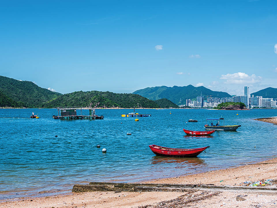
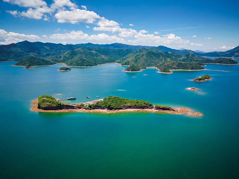
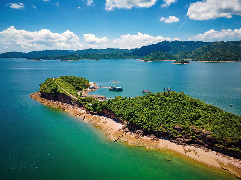
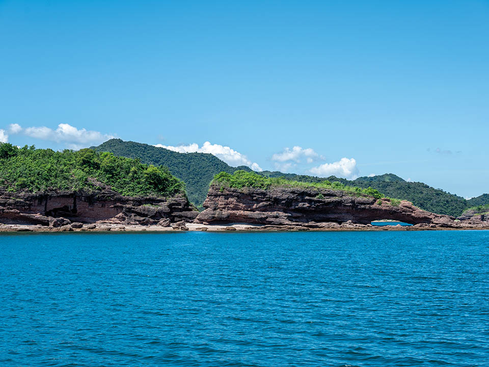
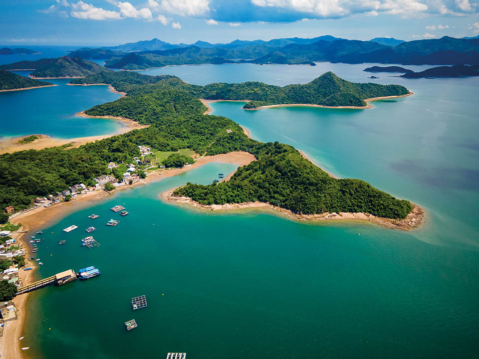
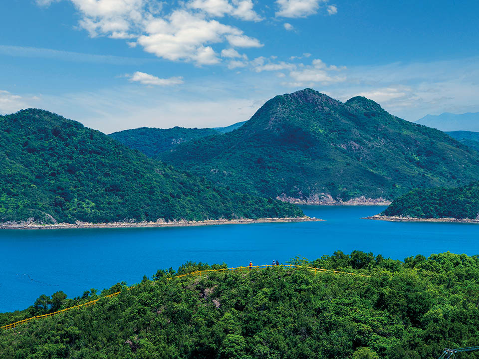
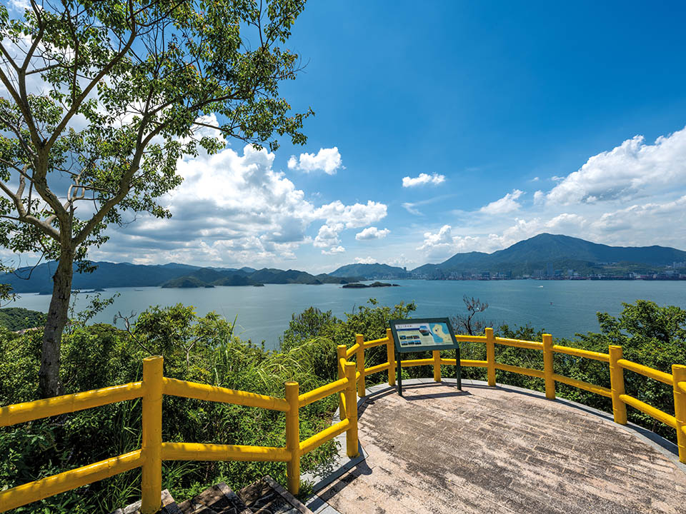
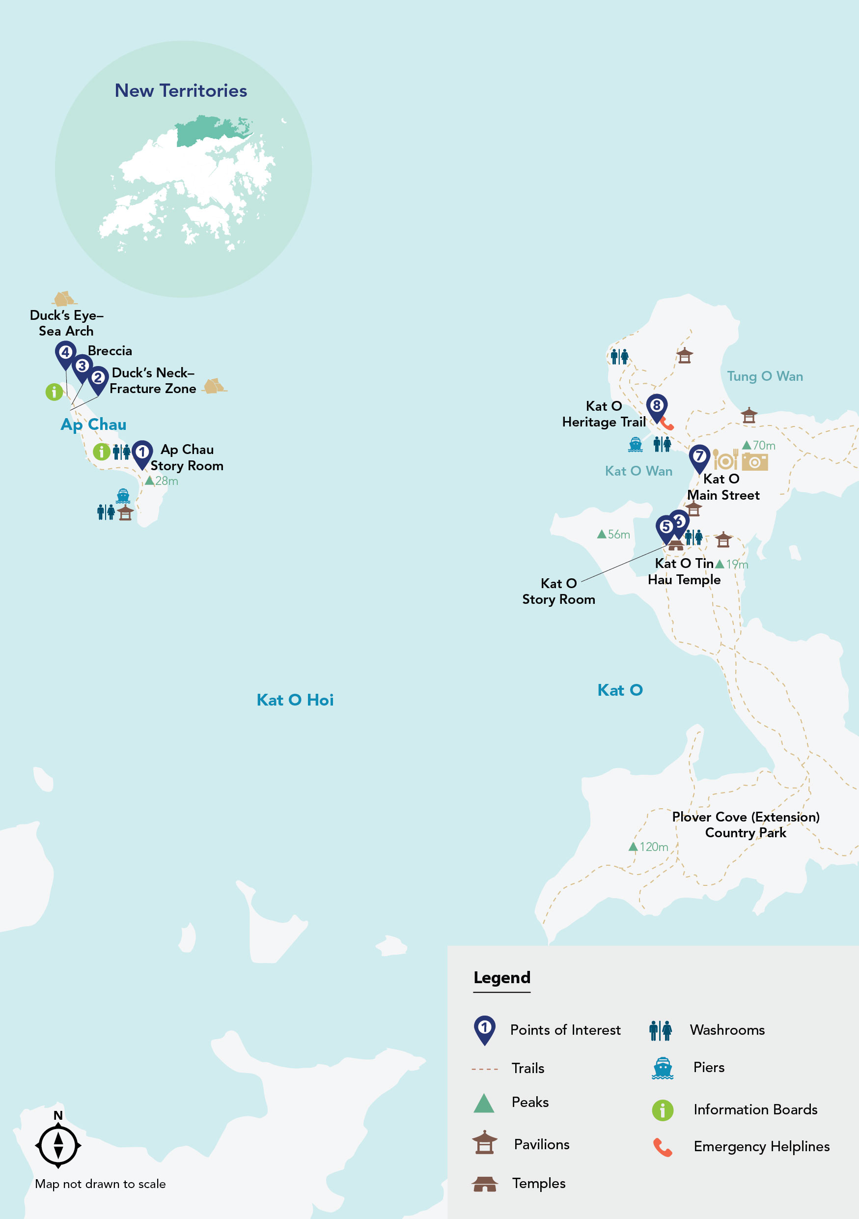
The tiny island of Ap Chau and its larger neighbour, Kat O, located in Double Haven, have changed little in decades. They form part of the Hong Kong UNESCO Global Geopark. Visitors can relax as they learn about the history, culture and lives of the islands’ fisherfolk. Explore Ap Chau — best known for its spectacular, Instagram-friendly ochre-coloured rock formations, including one shaped like a duck’s head with a sea arch forming its ‘eye’ — and take an enticing hike across Kat O, offering spectacular hilltop views of Double Haven — one of Hong Kong’s most beautiful stretches of ocean.

Refuel
Ap Chau has a few informal pop-up stores offering snacks and drinks, but their availability is unpredictable. Although Kat O has several village stores, many of them are open only at weekends and on public holidays.
-
Ap Chau Story Room
Start your visit to Ap Chau at Ap Chau Story Room, which details the 0.04 sq km area’s distinctive geology, and culture and heritage of the boat people, who still live there on what is Hong Kong’s smallest inhabited island. In the late 1920s, fisherfolk from Kat O and other nearby island villages began to moor their boats there and build homes. At their peak, they numbered more than 1,000, but most left in the 1970s. The island is named Ap Chau, or ‘Duck Island’ in Cantonese, on account of the curved shape of its rocky landmass, which resembles the body and — thanks to sea and rain erosion — separate head of a prone duck.
Get me there
-
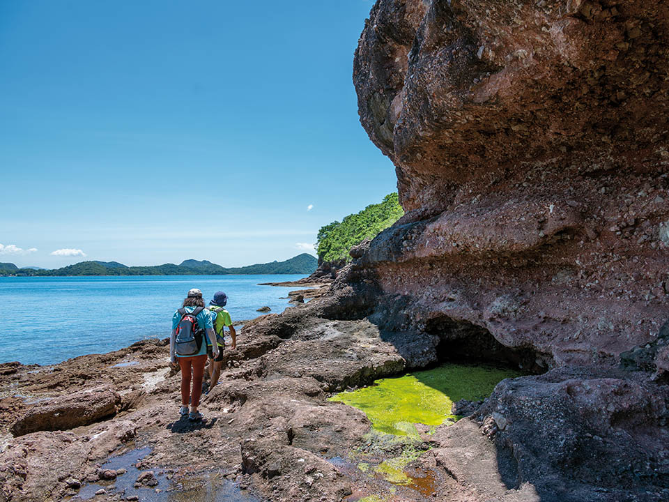
Duck’s Neck - Fracture Zone
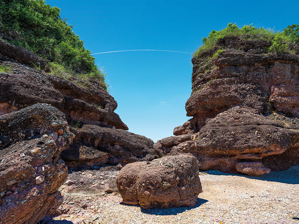
As you take a short, leisurely stroll along the island’s shoreline you will notice the distinctive ochre sedimentary rock, namely breccia. The gap in the hill created by sea erosion, next to the separate ‘duck’s neck and head’ rock formation, is the perfect place to closely examine the distinctive texture and layers of the ochre-coloured rock.
Get me there
-
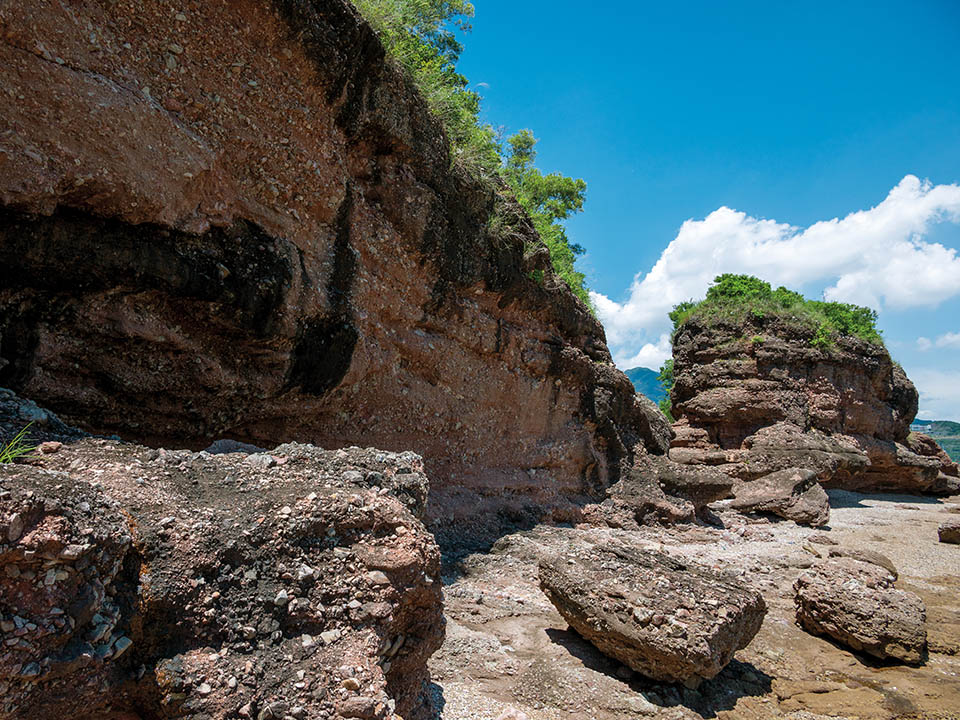
Breccia
The rock formations on Ap Chau include gravelly, coarse-grained rock fragments, which gets its distinctive brownish-red colour from oxidised iron deposits. The island offers a variety of eye-catching natural rocky coastal features where outcrops are exposed and easily accessible to visitors.
Get me there
-
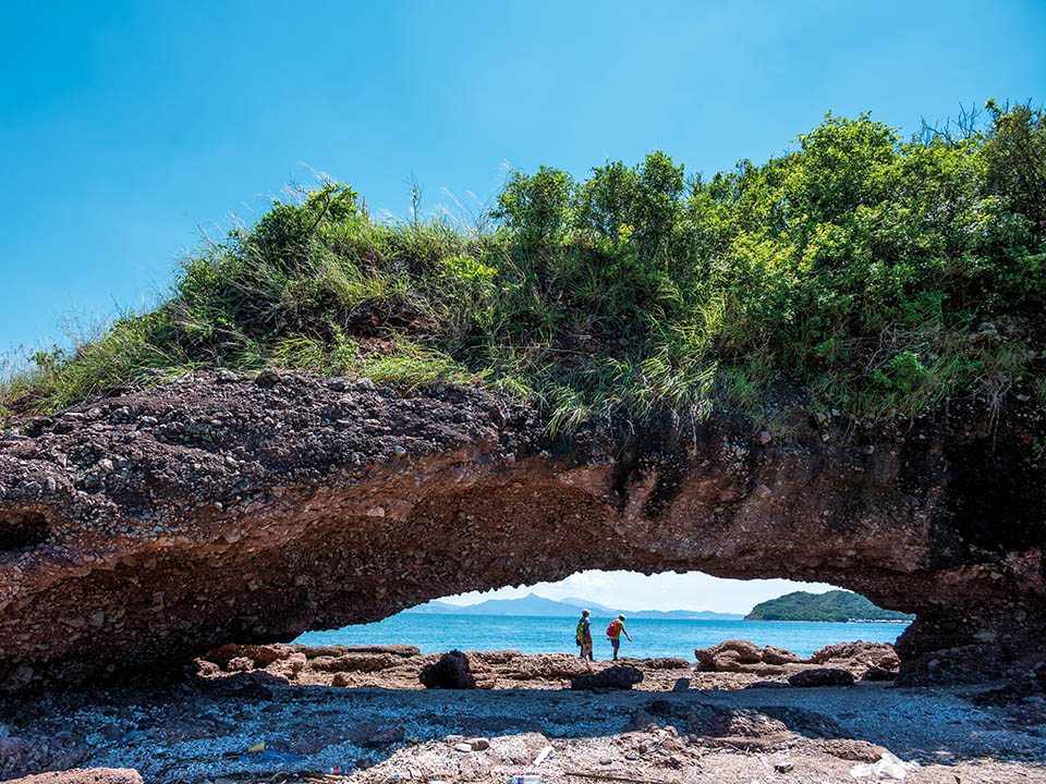
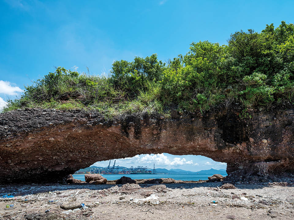
Duck’s Eye - Sea Arch
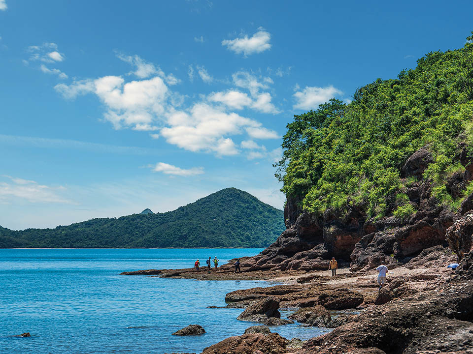
The ‘duck’s eye’ in the duck’s head — a wide, head-height rocky sea arch formed by the relentless erosion of the sea — lies on the northwestern tip of the island. It is one of the most popular spots on the island among visitors, and offers numerous great photo opportunities for Instagram buffs. The left ‘eye’ looks out across the sea at Mirs Bay and, further north, to the high-rise development of sprawling Shenzhen.
Get me there
-
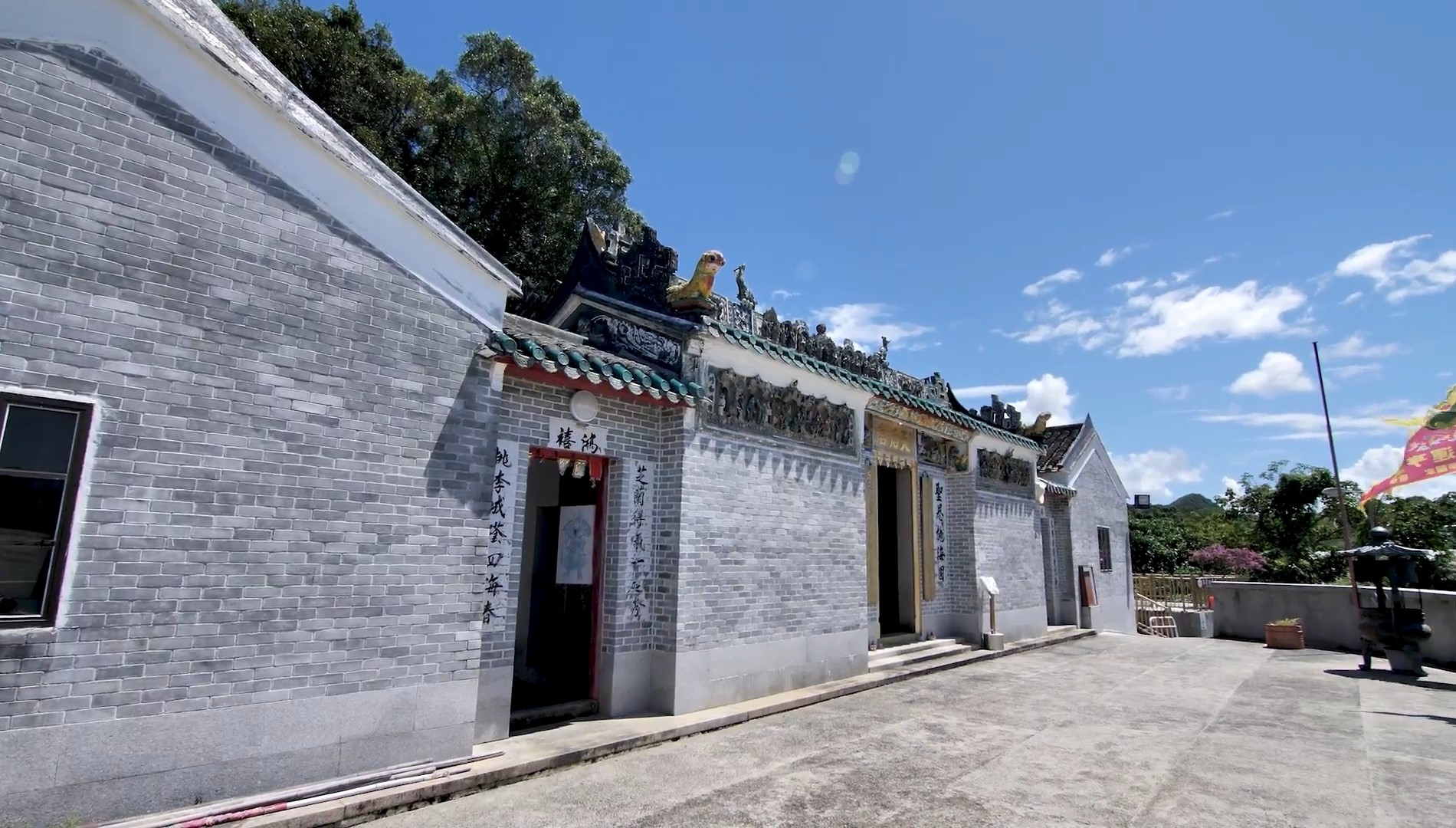
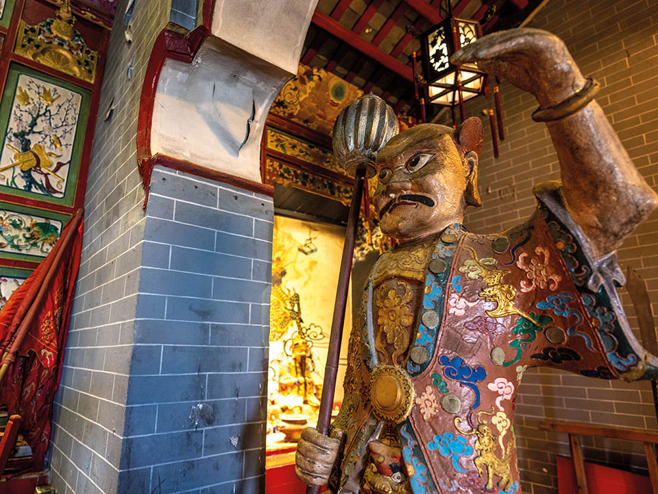
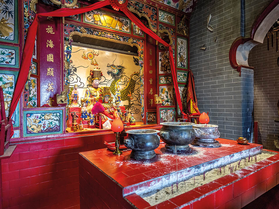
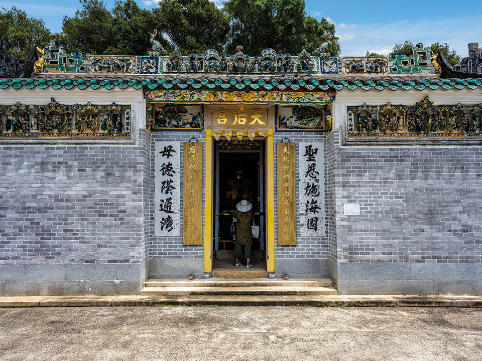
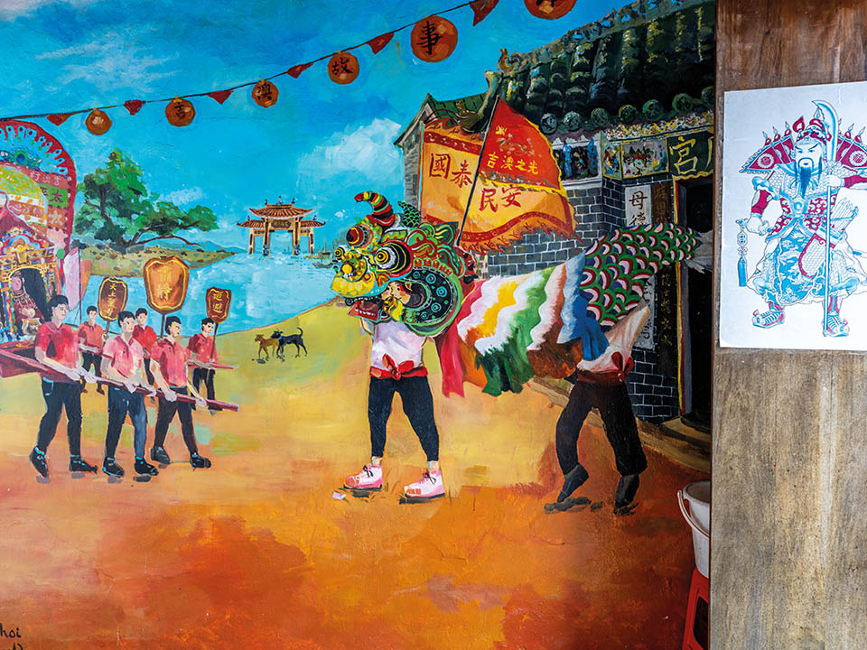
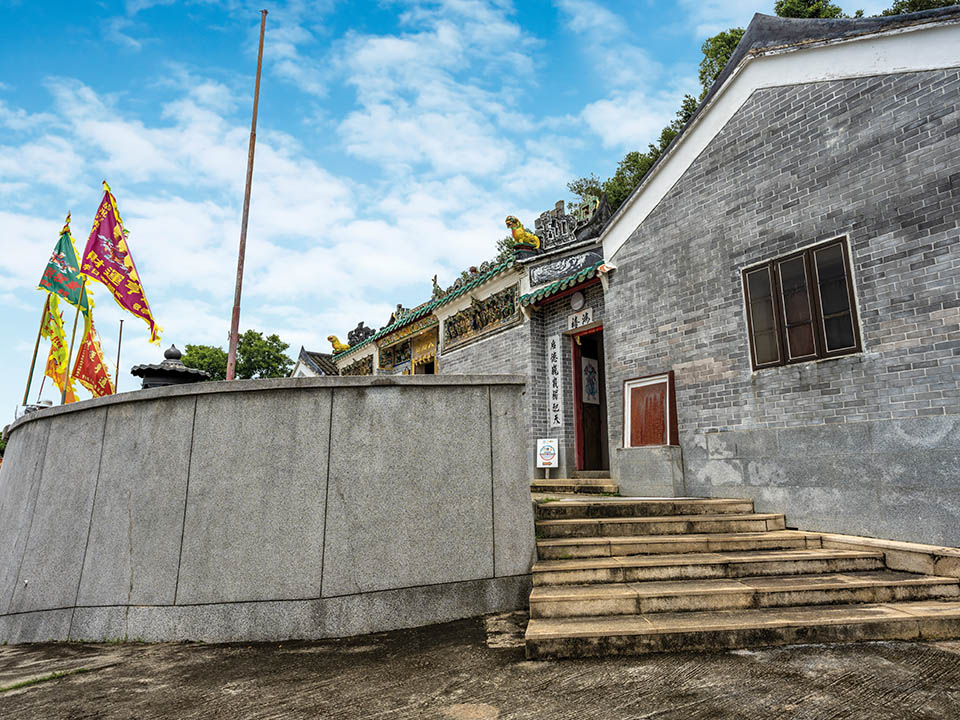
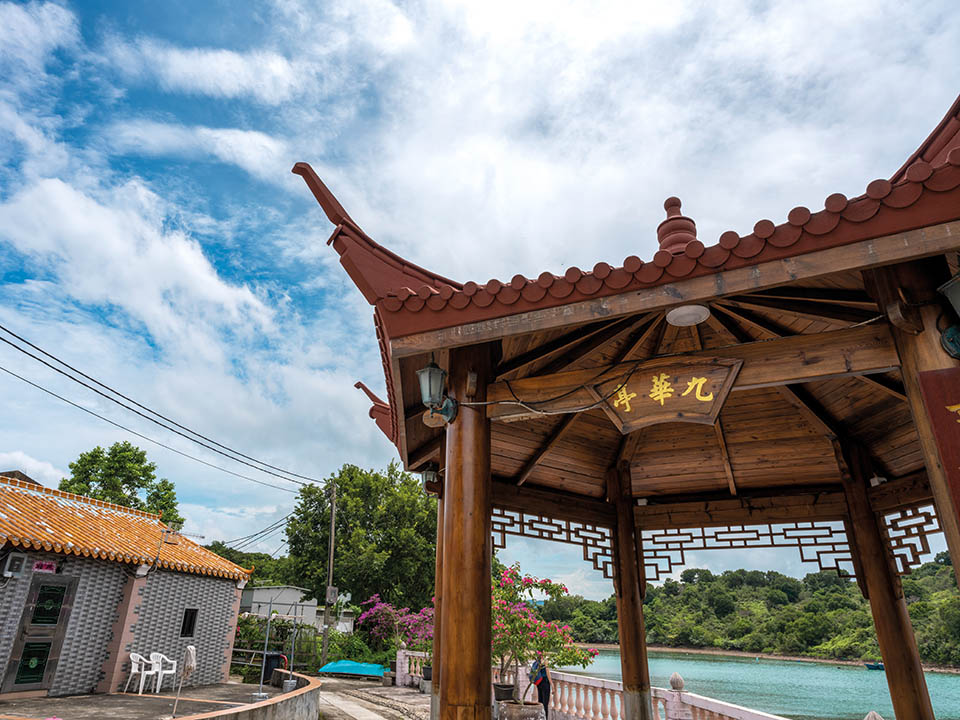
Kat O Tin Hau Temple
Kat O — known as ‘Crooked Island’ because of its twisted shape which created ideal sheltered bays — has long been a popular site for mooring fishing boats, hence its Cantonese name, meaning ‘Lucky Bay’. Its historic connection with fishing explains the presence of its well-preserved Tin Hau Temple, built in 1763 near the island’s northwest shoreline to honour Tin Hau, the ‘Goddess of the Sea’, who protects sailors and fishermen. Its outer walls and roof area feature many brightly coloured ceramic tiles and intricately designed figurines.
Get me there
-
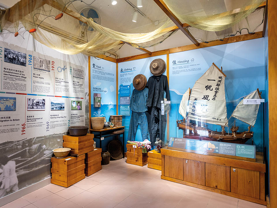
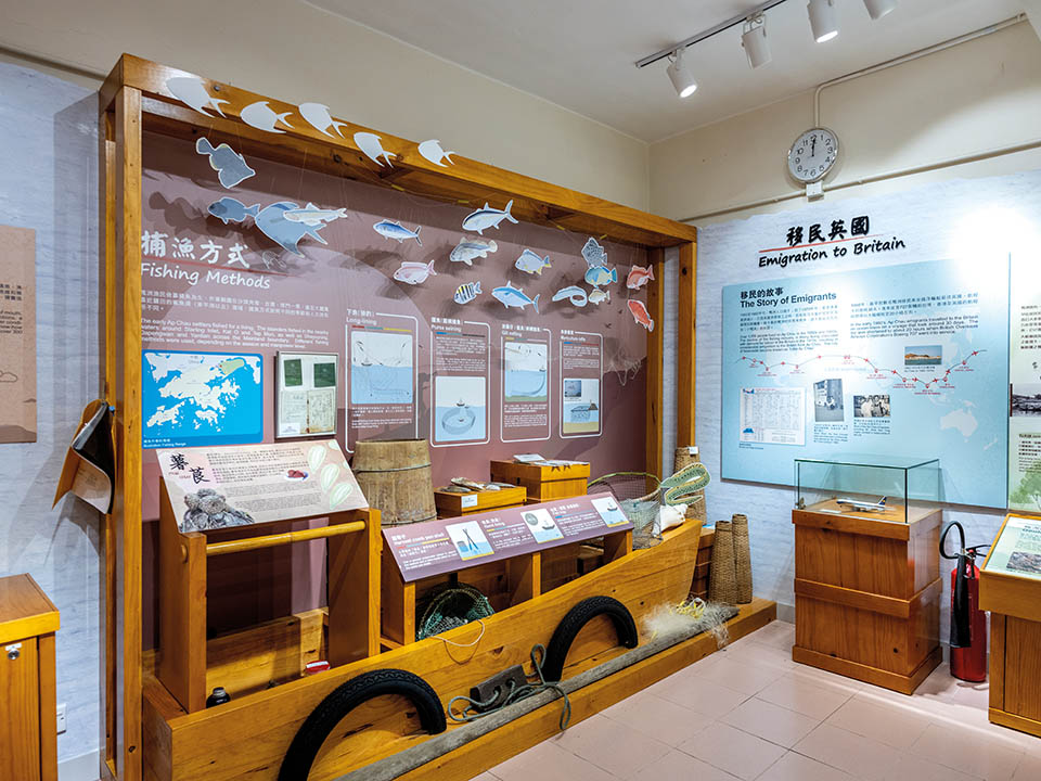
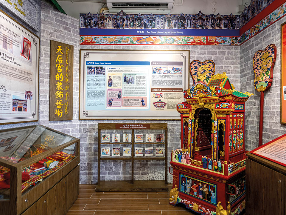
Kat O Story Room
Kat O Story Room offers informative displays highlighting the history, heritage and customs of Kat O’s Hakka and fishermen inhabitants. The island, situated west of Mirs Bay and east of Sha Tau Kok, was once home to about 6,000 residents — including fisherfolk, farmers and others running local businesses. But many moved overseas starting in the 1950s. Today, about 50 people still live on the island — most of whom were born and raised there.
Get me there
-
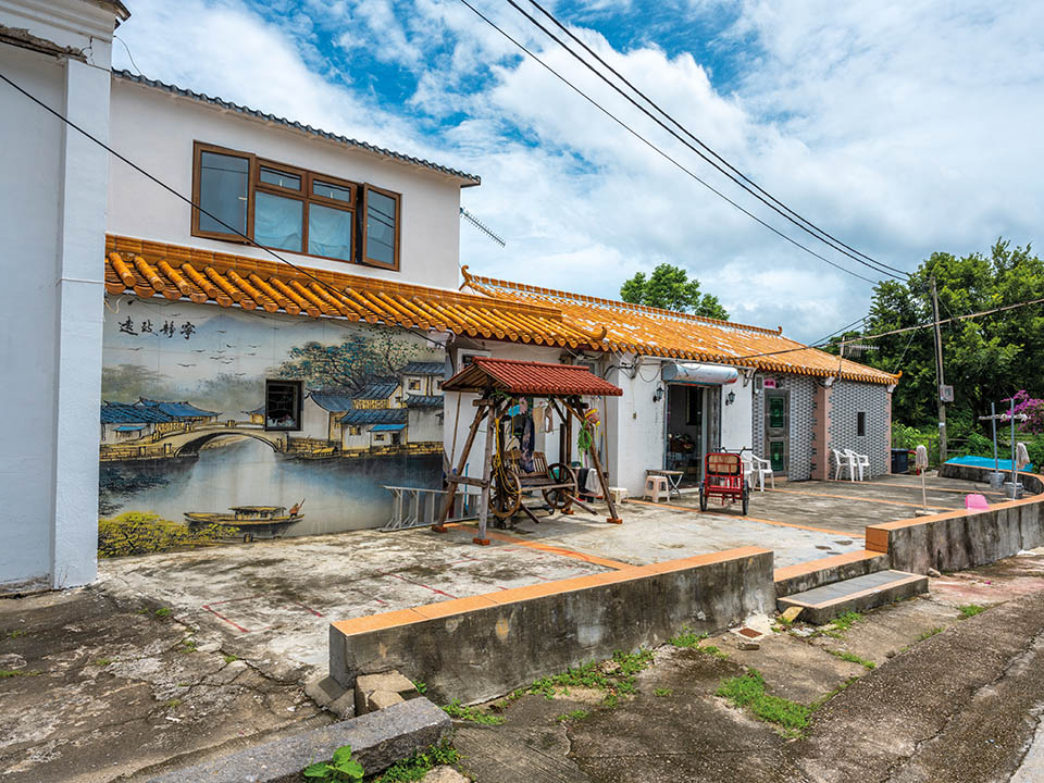
Kat O Main Street
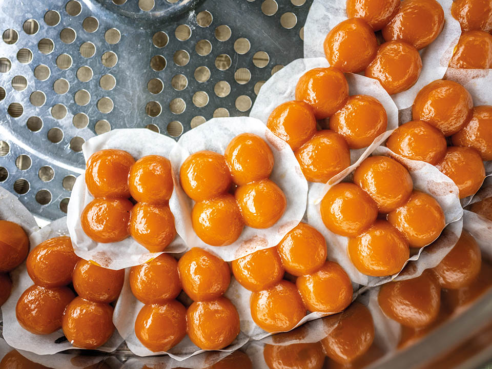
Kat O’s Main Street, lined with small shops and restaurants serving simple, yet delicious local dishes, is one of the island’s most popular locations. Visitors can enjoy local favourites such as melt-in-your-mouth, Hakka-style braised pork, traditional hand-rolled squid balls and steamed scallops served in their shells with garlic and vermicelli. Popular desserts include red bean pudding and Hakka fevervine cha kwo or steamed buns. After your meal, take a relaxing walk and find shops selling a fine selection of dried seafood and sauces to take home as gifts and souvenirs.
Get me there
-
Kat O Heritage Trail
The Kat O Heritage Trail is centred on Kat O Main Street and goes to various heritage sites on the island. The trail is generally level. The path forms two branches, one leading to a lookout at Ko Tei Teng and another to Ko Pang Teng. The former offers distant vistas of Yantian, Shenzhen, and other regions in the north; the latter offers a view across the lyrical Double Haven in the south. There are 27 interpretation panels along Kat O Heritage Trail. Scan the QR code on the panel to listen to stories told by the villagers and geopark guides.
Get me there
Transport
Getting to Ap Chau:
1) From MTR University Station Exit B, take bus 272K and get off at the first stop at Ma Liu Shui Public Pier, then walk 100 metres to Ma Liu Shui New Ferry Pier for the kaito ferry to Kat O and Ap Chau; or walk for about 15 minutes from the station to Ma Liu Shui New Ferry Pier. The kaito ferries here operate only on Saturdays, Sundays and public holidays. The trip takes about 1.5 hours.
2) Take the kaito ferry from Tai Shui Hang. Walk for about six minutes from MTR Tai Shui Hang Station Exit A to the Shatin Area 77 Landing for the kaito ferry to Kat O and Ap Chau. The kaito ferries here operate on Tuesdays and Thursdays (except public holidays). The trip takes about 2 hours.
3) Take the kaito ferry from Sha Tau Kok Public Pier to Ap Chau and Kat O. The kaito ferries here operate daily. The trip takes about an hour. Passengers must obtain a valid Sha Tau Kok Closed Area Permit to access the pier.
Leaving from Kat O:
1) Take the kaito ferry back to Ma Liu Shui New Ferry Pier (leaving at 3:30pm) (on Saturdays, Sundays and public holidays) and catch a bus or taxi at Ma Liu Shui Public Pier back to MTR University Station; or walk back to MTR University Station.
2) Take the kaito ferry back to the Shatin Area 77 Landing (leaving at 3pm) (on Tuesdays and Thursdays (except public holidays)) and walk back to MTR Tai Shui Hang Station.
3) Take the kaito ferry back to the Sha Tau Kok Public Pier.
For details of thekaito ferry service, please visit Transportation Department website.
Visit Hong Kong Geopark Website for more information about Ap Chau
Visit Hong Kong Geopark Website for more information about Kat O
More Routes
Antiquity
Ap Chau & Kat O: explore islands’ Hakka and fishermen culture that has changed little over past decades
Written by South China Morning Post ( Morning Studio )
The tiny island of Ap Chau and its larger neighbour, Kat O, located in Double Haven, have changed little in decades. They form part of the Hong Kong UNESCO Global Geopark. Visitors can relax as they learn about the history, culture and lives of the islands’ fisherfolk. Explore Ap Chau — best known for its spectacular, Instagram-friendly ochre-coloured rock formations, including one shaped like a duck’s head with a sea arch forming its ‘eye’ — and take an enticing hike across Kat O, offering spectacular hilltop views of Double Haven — one of Hong Kong’s most beautiful stretches of ocean.
Refuel
Ap Chau has a few informal pop-up stores offering snacks and drinks, but their availability is unpredictable. Although Kat O has several village stores, many of them are open only at weekends and on public holidays.
Ap Chau Story Room
Start your visit to Ap Chau at Ap Chau Story Room, which details the 0.04 sq km area’s distinctive geology, and culture and heritage of the boat people, who still live there on what is Hong Kong’s smallest inhabited island. In the late 1920s, fisherfolk from Kat O and other nearby island villages began to moor their boats there and build homes. At their peak, they numbered more than 1,000, but most left in the 1970s. The island is named Ap Chau, or ‘Duck Island’ in Cantonese, on account of the curved shape of its rocky landmass, which resembles the body and — thanks to sea and rain erosion — separate head of a prone duck.
Duck’s Neck - Fracture Zone
As you take a short, leisurely stroll along the island’s shoreline you will notice the distinctive ochre sedimentary rock, namely breccia. The gap in the hill created by sea erosion, next to the separate ‘duck’s neck and head’ rock formation, is the perfect place to closely examine the distinctive texture and layers of the ochre-coloured rock.
Breccia
The rock formations on Ap Chau include gravelly, coarse-grained rock fragments, which gets its distinctive brownish-red colour from oxidised iron deposits. The island offers a variety of eye-catching natural rocky coastal features where outcrops are exposed and easily accessible to visitors.
Duck’s Eye - Sea Arch
The ‘duck’s eye’ in the duck’s head — a wide, head-height rocky sea arch formed by the relentless erosion of the sea — lies on the northwestern tip of the island. It is one of the most popular spots on the island among visitors, and offers numerous great photo opportunities for Instagram buffs. The left ‘eye’ looks out across the sea at Mirs Bay and, further north, to the high-rise development of sprawling Shenzhen.
Kat O Tin Hau Temple
Kat O — known as ‘Crooked Island’ because of its twisted shape which created ideal sheltered bays — has long been a popular site for mooring fishing boats, hence its Cantonese name, meaning ‘Lucky Bay’. Its historic connection with fishing explains the presence of its well-preserved Tin Hau Temple, built in 1763 near the island’s northwest shoreline to honour Tin Hau, the ‘Goddess of the Sea’, who protects sailors and fishermen. Its outer walls and roof area feature many brightly coloured ceramic tiles and intricately designed figurines.
Kat O Story Room
Kat O Story Room offers informative displays highlighting the history, heritage and customs of Kat O’s Hakka and fishermen inhabitants. The island, situated west of Mirs Bay and east of Sha Tau Kok, was once home to about 6,000 residents — including fisherfolk, farmers and others running local businesses. But many moved overseas starting in the 1950s. Today, about 50 people still live on the island — most of whom were born and raised there.
Kat O Main Street
Kat O’s Main Street, lined with small shops and restaurants serving simple, yet delicious local dishes, is one of the island’s most popular locations. Visitors can enjoy local favourites such as melt-in-your-mouth, Hakka-style braised pork, traditional hand-rolled squid balls and steamed scallops served in their shells with garlic and vermicelli. Popular desserts include red bean pudding and Hakka fevervine cha kwo or steamed buns. After your meal, take a relaxing walk and find shops selling a fine selection of dried seafood and sauces to take home as gifts and souvenirs.
Kat O Heritage Trail
The Kat O Heritage Trail is centred on Kat O Main Street and goes to various heritage sites on the island. The trail is generally level. The path forms two branches, one leading to a lookout at Ko Tei Teng and another to Ko Pang Teng. The former offers distant vistas of Yantian, Shenzhen, and other regions in the north; the latter offers a view across the lyrical Double Haven in the south. There are 27 interpretation panels along Kat O Heritage Trail. Scan the QR code on the panel to listen to stories told by the villagers and geopark guides.
Transport
Getting to Ap Chau:
1) From MTR University Station Exit B, take bus 272K and get off at the first stop at Ma Liu Shui Public Pier, then walk 100 metres to Ma Liu Shui New Ferry Pier for the kaito ferry to Kat O and Ap Chau; or walk for about 15 minutes from the station to Ma Liu Shui New Ferry Pier. The kaito ferries here operate only on Saturdays, Sundays and public holidays. The trip takes about 1.5 hours.
2) Take the kaito ferry from Tai Shui Hang. Walk for about six minutes from MTR Tai Shui Hang Station Exit A to the Shatin Area 77 Landing for the kaito ferry to Kat O and Ap Chau. The kaito ferries here operate on Tuesdays and Thursdays (except public holidays). The trip takes about 2 hours.
3) Take the kaito ferry from Sha Tau Kok Public Pier to Ap Chau and Kat O. The kaito ferries here operate daily. The trip takes about an hour. Passengers must obtain a valid Sha Tau Kok Closed Area Permit to access the pier.
Leaving from Kat O:
1) Take the kaito ferry back to Ma Liu Shui New Ferry Pier (leaving at 3:30pm) (on Saturdays, Sundays and public holidays) and catch a bus or taxi at Ma Liu Shui Public Pier back to MTR University Station; or walk back to MTR University Station.
2) Take the kaito ferry back to the Shatin Area 77 Landing (leaving at 3pm) (on Tuesdays and Thursdays (except public holidays)) and walk back to MTR Tai Shui Hang Station.
3) Take the kaito ferry back to the Sha Tau Kok Public Pier.
For details of thekaito ferry service, please visit Transportation Department website.
 Live Chat


