Hong Kong’s Immigration Department has simplified eligibility and enrollment for the self-service immigration clearance (e-Channel) for qualifying frequent visitors. Visit their website to learn more.

Speak now


I’m Sorry. I didn’t get that.
Instagrammable
MacLehose Trail Section 4 — Shui Long Wo to Tai Shui Tseng: challenging trek rewards hikers with spectacular picture-perfect views over Sai Kung Peninsula

-

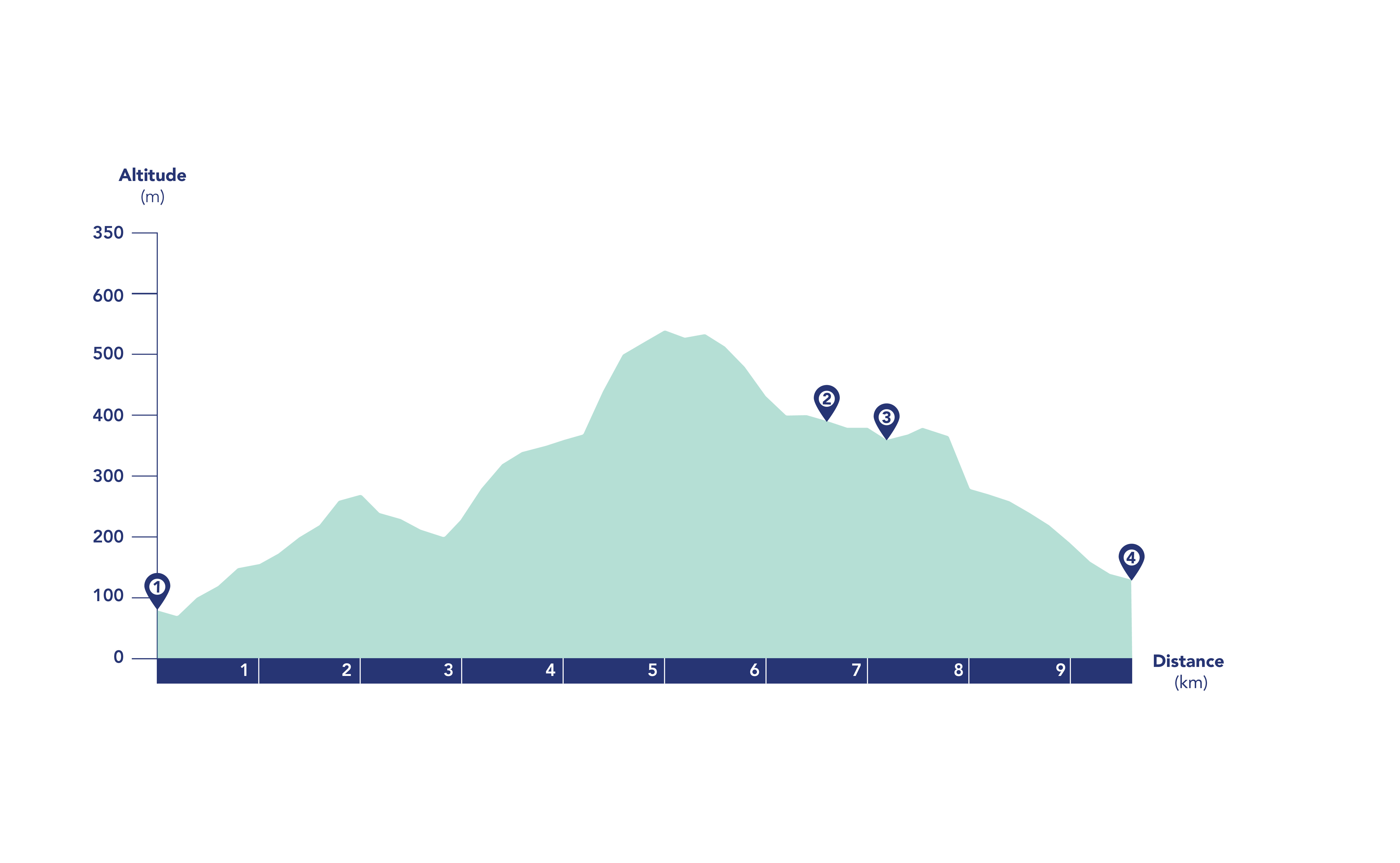
About 9 km
-

3–4 hours
-

Difficult
Written by South China Morning Post ( Morning Studio )
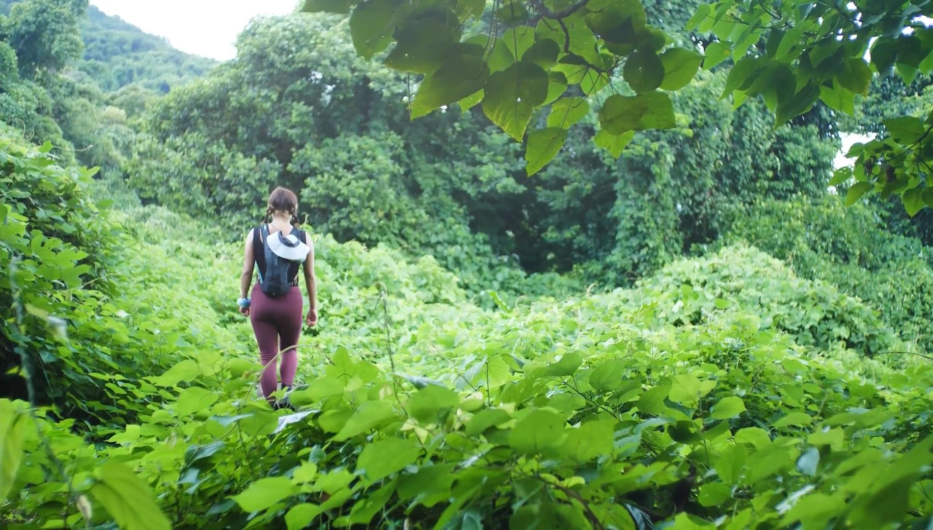
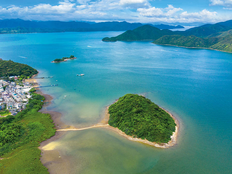
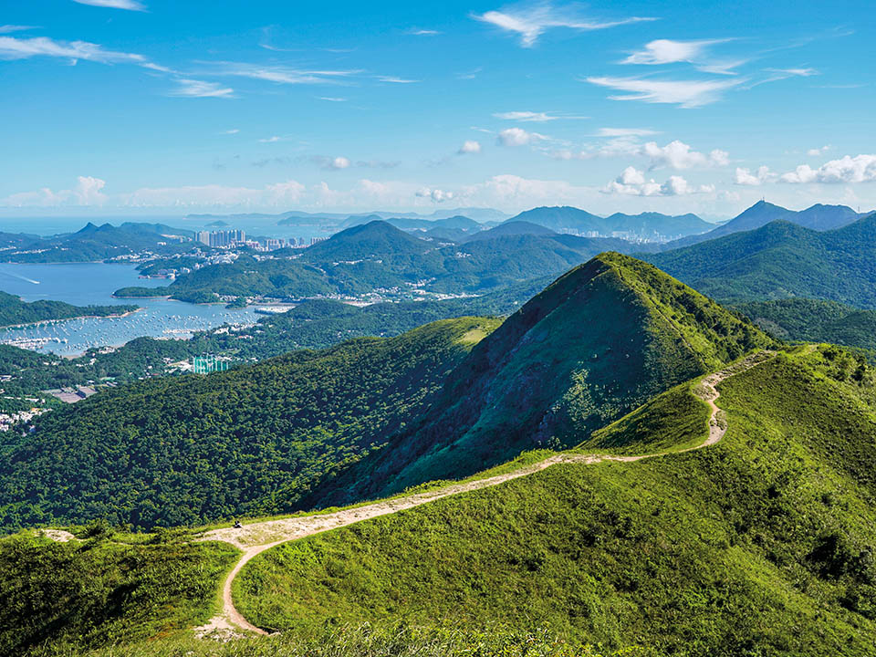
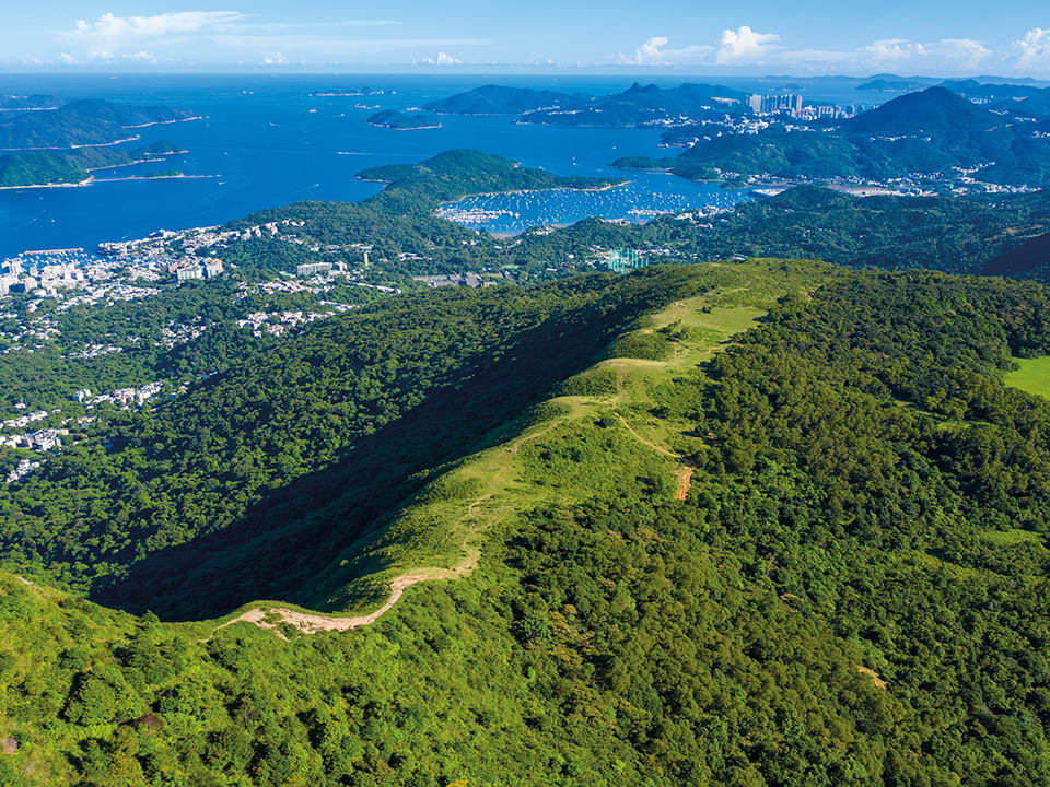
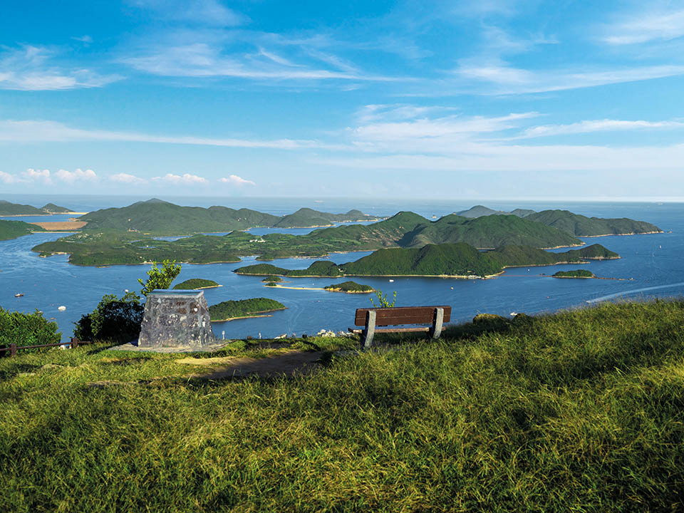
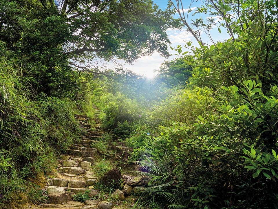
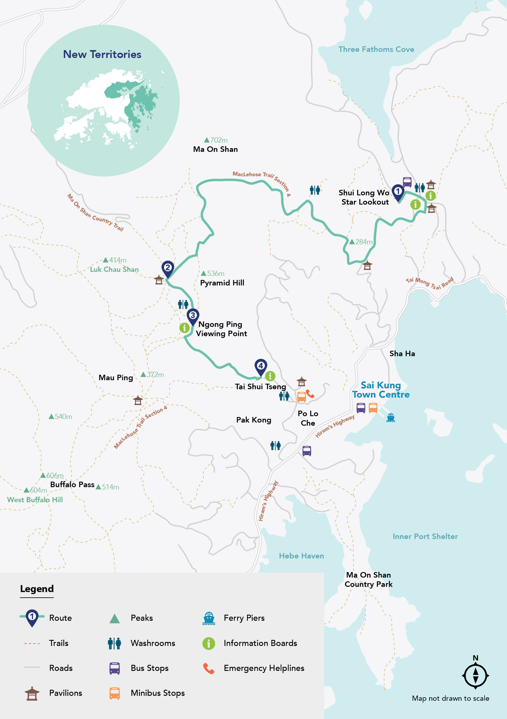
This challenging hike in Ma On Shan Country Park, in the New Territories, covering part of MacLehose Trail Section 4, offers some of Hong Kong’s most breathtaking scenery. At times the steep, rugged trail can be tiring, but it’s worth it: be sure to look back to photograph the stunning hill-flanked waters of Three Fathoms Cove. Other Instagram favourites include the 536-metre-high Pyramid Hill and spectacular panoramic views from Ngong Ping Viewing Point overlooking Sai Kung Town and commanding wide-open vistas of the coves and islands of Inner Port Shelter. At Ngong Ping, take the relaxing detour down the Ma On Shan Country Trail to Tai Shui Tseng and on to the town of Sai Kung to rest your weary limbs and enjoy a laid-back seaside meal.

Refuel
There are two drink vending machines and two water filling stations, one of which is free to use, at the start of the walk in Shui Long Wo, near the public toilet. Be sure to bring your own reusable drinking water bottle as there are no further refuelling points along the route until you reach Sai Kung Town.
-
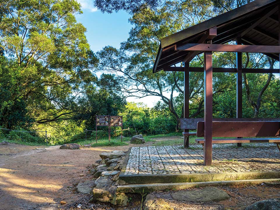
Shui Long Wo Star Lookout
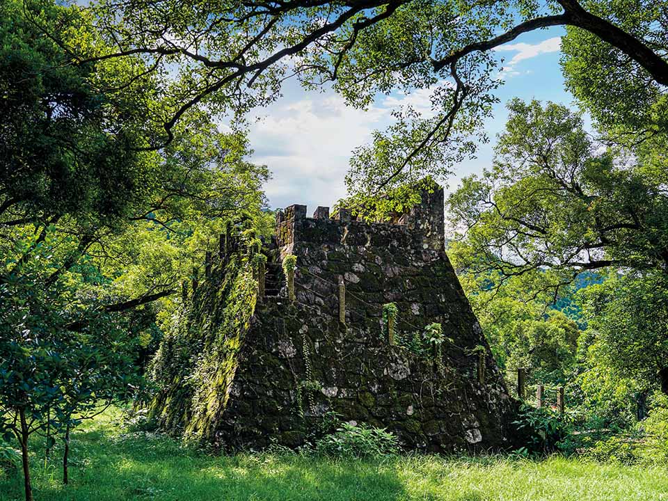
The striking 6 metre-high stone Shui Long Wo Star Lookout, set among lush forest trees beside the entrance to Kei Ling Ha Tree Walk, near the start of the route, resembles a miniature castle, but is actually a replica of Gaocheng Astronomical Observatory, built in the Mainland’s Henan province in 1276 on the orders of Kublai Khan to record time and observe the movement of the sun and stars.
 The Agriculture, Fisheries and Conservation Department’s ‘Enjoy Hiking’ website provides useful information about scenic attractions and hiking trails. It has a search function for users to choose a route that will suit their interests, fitness level and experience.
Get me there
The Agriculture, Fisheries and Conservation Department’s ‘Enjoy Hiking’ website provides useful information about scenic attractions and hiking trails. It has a search function for users to choose a route that will suit their interests, fitness level and experience.
Get me there
-
Pyramid Hill
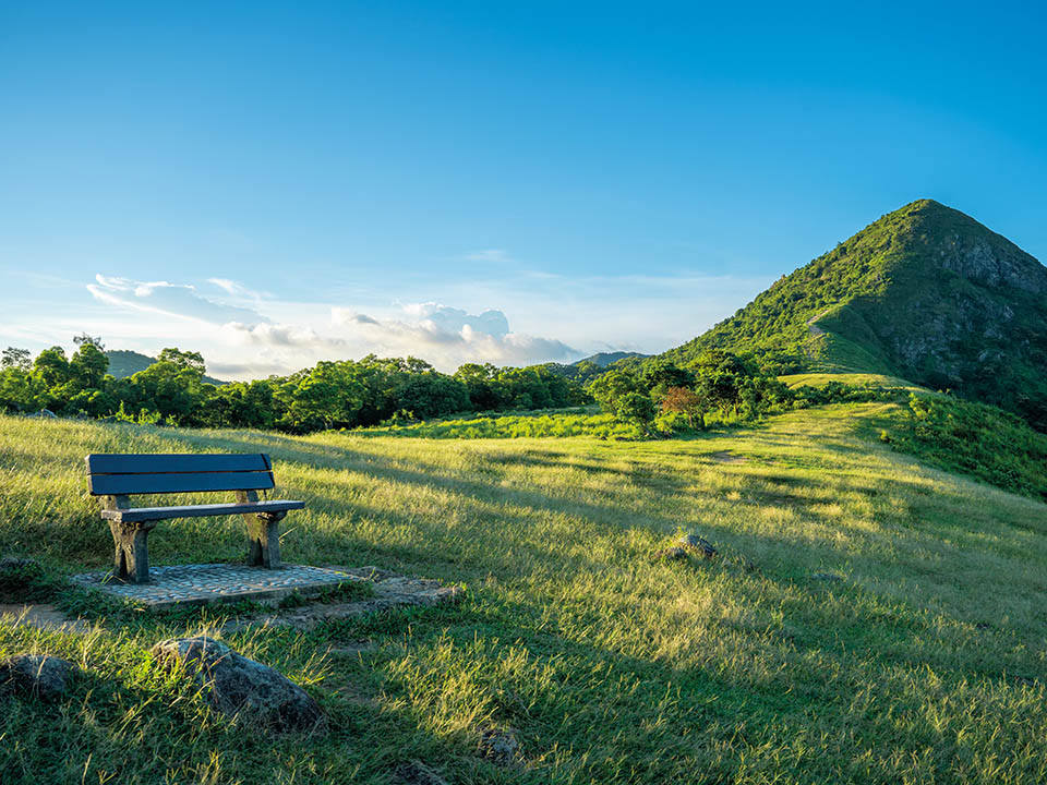
You will encounter the northern side of Pyramid Hill, a 536-metre peak named after its cone-like shape, as you follow a narrow ridgeline before reaching a wooded valley. Stay on the path, which loops around Pyramid Hill, until you reach a small pavilion and then follow the signpost pointing left to reach Ngong Ping. Make sure you turn back to look at the impressive southern side of the hill, and capture some Instagram-worthy pictures. There is no shelter on the exposed hill ridges so bring waterproof attire in case the weather turns wet.
Get me there
-
Ngong Ping Viewing Point
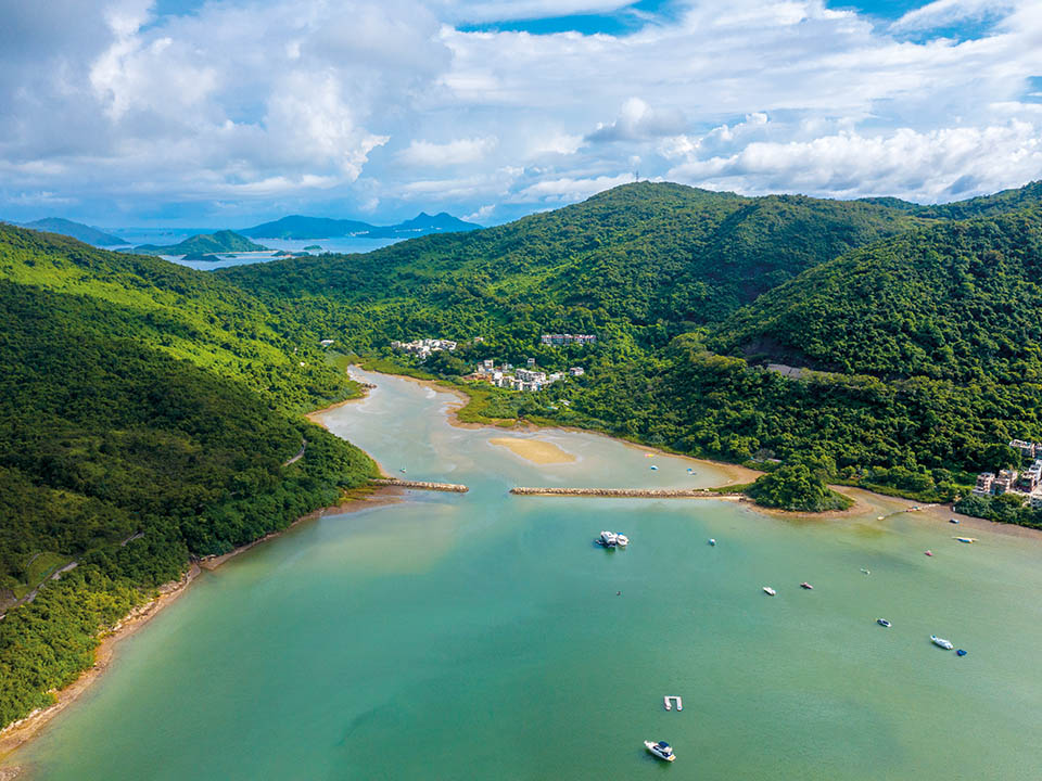
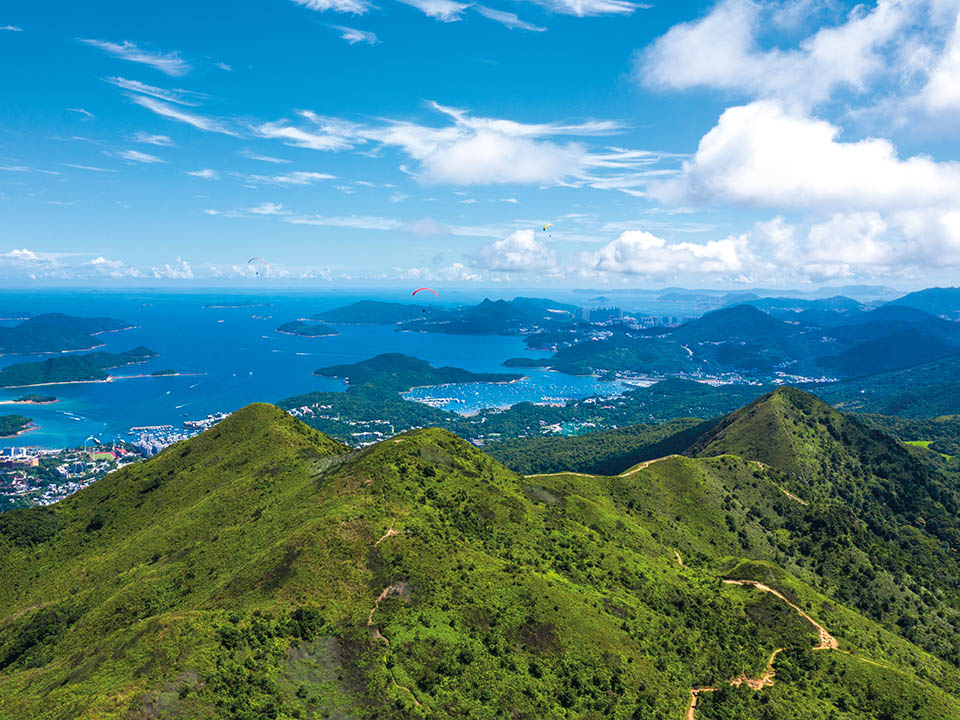
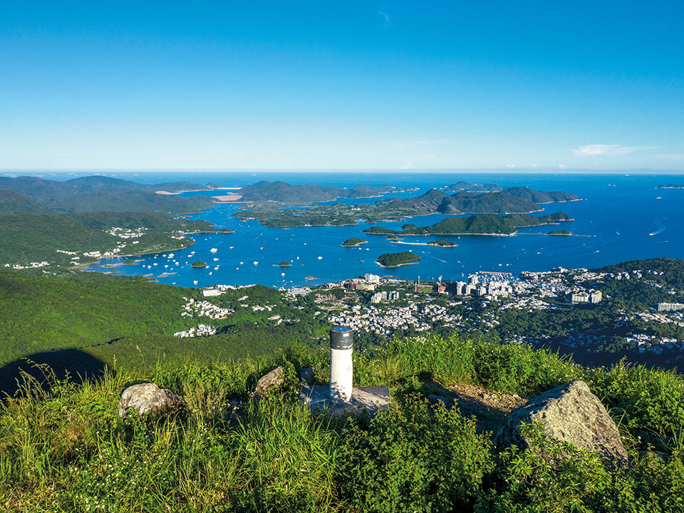
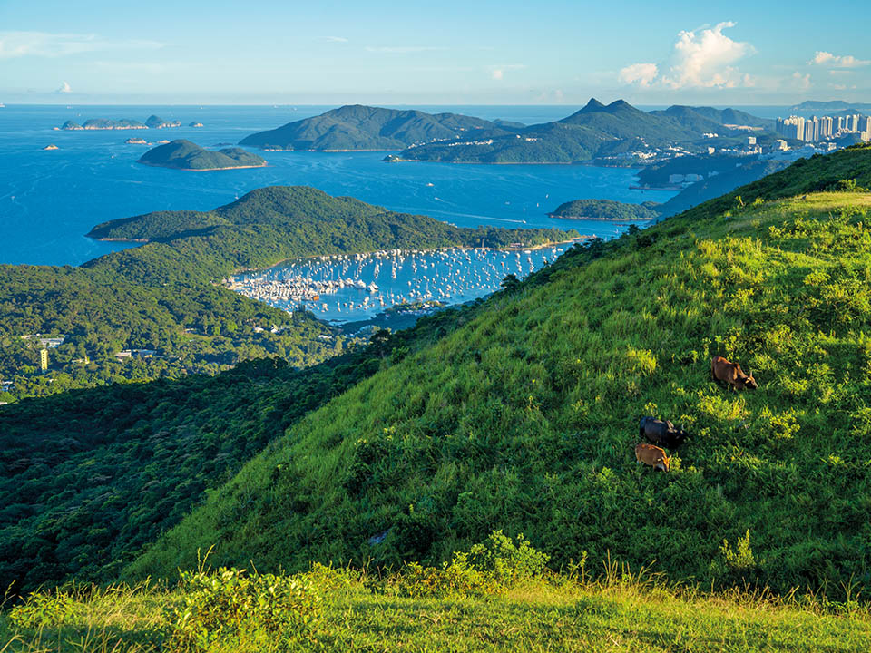
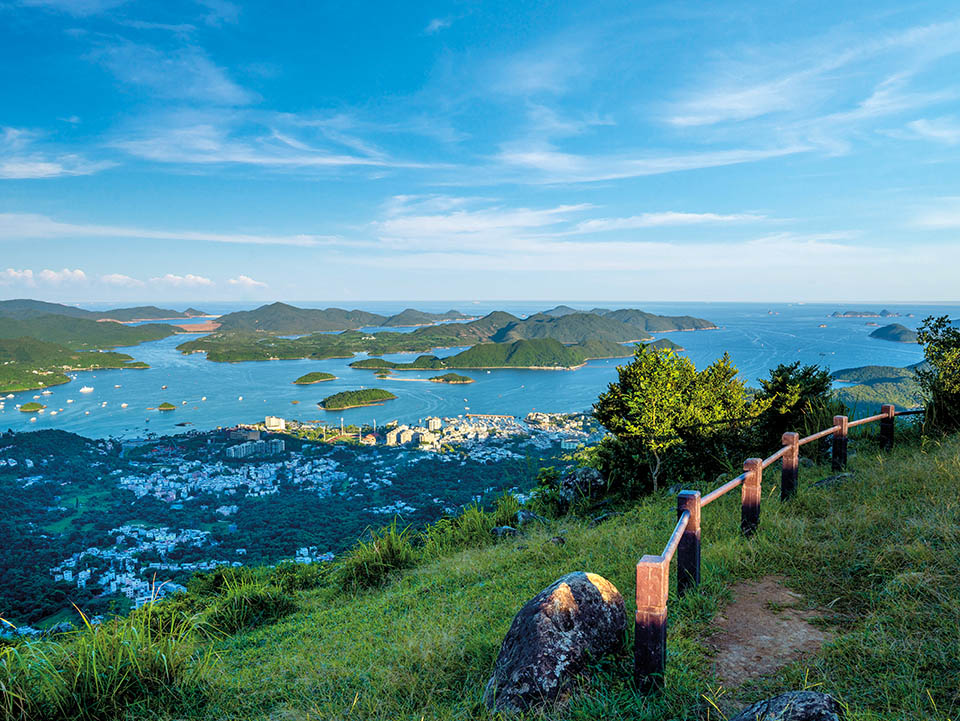
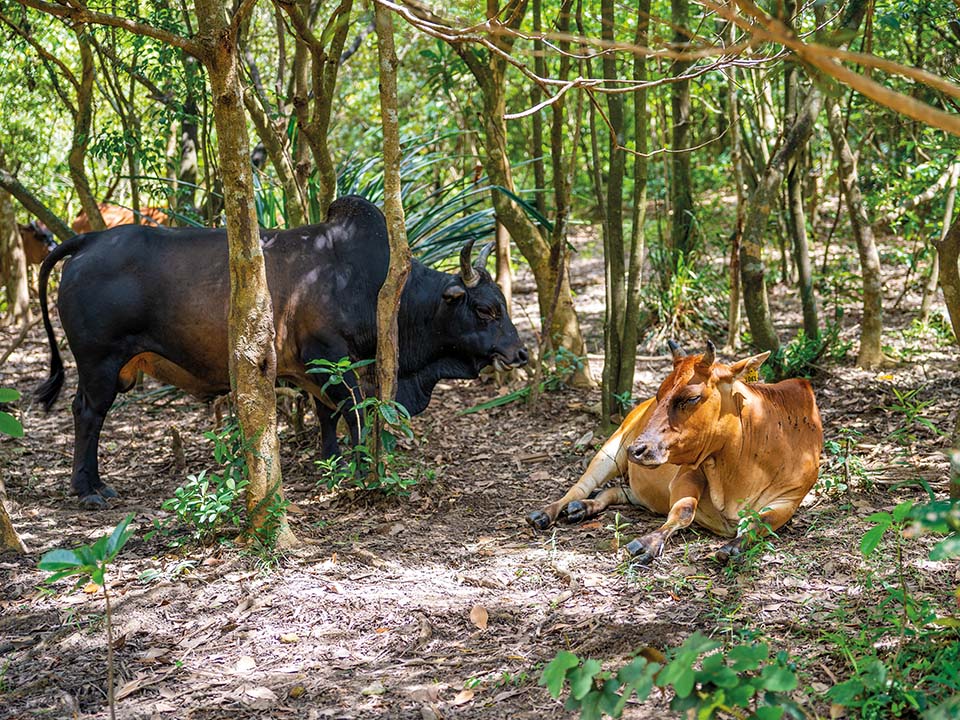
The grassy plateau of Ngong Ping (not to be confused with Ngong Ping on Lantau Island), at the base of Pyramid Hill, is a popular place to rest for both visitors and — if you are lucky enough to see them — a small herd of brown cattle. It is the perfect location to enjoy the area’s breathtaking scenery looking out towards Sai Kung’s Port Shelter and further across the South China Sea. Ngong Ping’s position makes it a favoured spot of members of Hong Kong’s paragliding community. If the wind is right you can expect to see many enthusiasts launching their paragliders off the steep incline.
Get me there
-
Tai Shui Tseng
From Ngong Ping, you can make your descent into Tai Shui Tseng Village in Sai Kung. Rejoin MacLehose Trail Section 4 and continue for a few hundred metres until you reach a map board and signpost. Take the Ma On Shan Country Trail down to the village of Tai Shui Tseng, which forms the beginning of Tai Shui Tseng Ancient Trail, part of a network of ancient paths linking Sai Kung with Sha Tin on the other side of the hill. Yet today the village is known mainly as the starting point of the uphill hike to Ngong Ping plateau.
Get me there
-
Dining Option
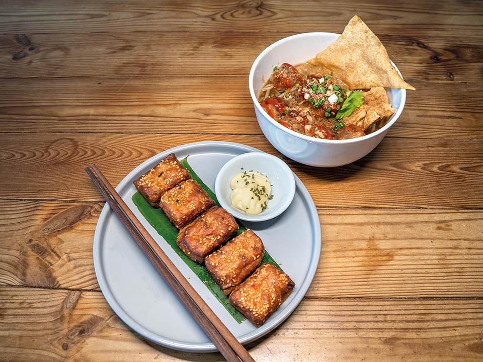
Sai Kung Town Centre
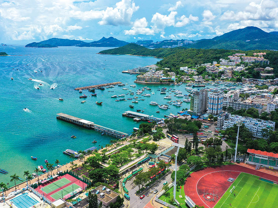
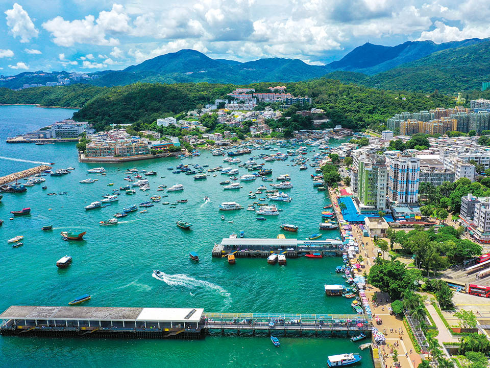
The seafront town of Sai Kung is the perfect place to relax after a challenging hike. Take a stroll along the promenade and look at the anchored boats bobbing on the sea as you savour the engaging atmosphere of this former fishing village. Many visitors come to eat at the many waterfront seafood restaurants, but if you keep walking you will find a good selection of Western and Thai restaurants — many offering al fresco dining — along Yi Chun and Man Nin streets, while in the alley facing the minibus terminus, many small restaurants offer food, noodles and local delicacies.
Get me there
Transport
Getting to Shui Long Wo Star Lookout:
From the MTR Sha Tin Station, head to the bus terminus below Sha Tin New Town Plaza. Take bus 299X / 289R (Saturdays and public holidays only) and get off at Shui Long Wo bus stop. Alternatively, you can ride on the MTR Tuen Ma Line and get off at MTR Wu Kai Sha Station; from Wu Kai Sha Station bus terminus you can take bus 99 / 99R (public holidays) and get off at Shui Long Wo. The entrance to Shui Long Wo Star Lookout is near the car park on the opposite side of the road.
Leaving from Tai Shui Tseng:
From Tai Shui Tseng Village, walk towards Pak Kong Road and follow the road until it joins Hiram’s Highway. From Pak Kong bus stop on Hiram’s Highway, you can take bus 92 / 96R (Saturdays, Sundays and public holidays only) and get off at Sai Kung bus terminus or any of the minibuses heading to Sai Kung Town Centre.
More Routes

Instagrammable
MacLehose Trail Section 4 — Shui Long Wo to Tai Shui Tseng: challenging trek rewards hikers with spectacular picture-perfect views over Sai Kung Peninsula
-
About 9 km
-
3–4 hours
-
Difficult
Written by South China Morning Post ( Morning Studio )
This challenging hike in Ma On Shan Country Park, in the New Territories, covering part of MacLehose Trail Section 4, offers some of Hong Kong’s most breathtaking scenery. At times the steep, rugged trail can be tiring, but it’s worth it: be sure to look back to photograph the stunning hill-flanked waters of Three Fathoms Cove. Other Instagram favourites include the 536-metre-high Pyramid Hill and spectacular panoramic views from Ngong Ping Viewing Point overlooking Sai Kung Town and commanding wide-open vistas of the coves and islands of Inner Port Shelter. At Ngong Ping, take the relaxing detour down the Ma On Shan Country Trail to Tai Shui Tseng and on to the town of Sai Kung to rest your weary limbs and enjoy a laid-back seaside meal.
Refuel
There are two drink vending machines and two water filling stations, one of which is free to use, at the start of the walk in Shui Long Wo, near the public toilet. Be sure to bring your own reusable drinking water bottle as there are no further refuelling points along the route until you reach Sai Kung Town.
Shui Long Wo Star Lookout
The striking 6 metre-high stone Shui Long Wo Star Lookout, set among lush forest trees beside the entrance to Kei Ling Ha Tree Walk, near the start of the route, resembles a miniature castle, but is actually a replica of Gaocheng Astronomical Observatory, built in the Mainland’s Henan province in 1276 on the orders of Kublai Khan to record time and observe the movement of the sun and stars.
The Agriculture, Fisheries and Conservation Department’s ‘Enjoy Hiking’ website provides useful information about scenic attractions and hiking trails. It has a search function for users to choose a route that will suit their interests, fitness level and experience.
Pyramid Hill
You will encounter the northern side of Pyramid Hill, a 536-metre peak named after its cone-like shape, as you follow a narrow ridgeline before reaching a wooded valley. Stay on the path, which loops around Pyramid Hill, until you reach a small pavilion and then follow the signpost pointing left to reach Ngong Ping. Make sure you turn back to look at the impressive southern side of the hill, and capture some Instagram-worthy pictures. There is no shelter on the exposed hill ridges so bring waterproof attire in case the weather turns wet.
Ngong Ping Viewing Point
The grassy plateau of Ngong Ping (not to be confused with Ngong Ping on Lantau Island), at the base of Pyramid Hill, is a popular place to rest for both visitors and — if you are lucky enough to see them — a small herd of brown cattle. It is the perfect location to enjoy the area’s breathtaking scenery looking out towards Sai Kung’s Port Shelter and further across the South China Sea. Ngong Ping’s position makes it a favoured spot of members of Hong Kong’s paragliding community. If the wind is right you can expect to see many enthusiasts launching their paragliders off the steep incline.
Tai Shui Tseng
From Ngong Ping, you can make your descent into Tai Shui Tseng Village in Sai Kung. Rejoin MacLehose Trail Section 4 and continue for a few hundred metres until you reach a map board and signpost. Take the Ma On Shan Country Trail down to the village of Tai Shui Tseng, which forms the beginning of Tai Shui Tseng Ancient Trail, part of a network of ancient paths linking Sai Kung with Sha Tin on the other side of the hill. Yet today the village is known mainly as the starting point of the uphill hike to Ngong Ping plateau.
Sai Kung Town Centre
The seafront town of Sai Kung is the perfect place to relax after a challenging hike. Take a stroll along the promenade and look at the anchored boats bobbing on the sea as you savour the engaging atmosphere of this former fishing village. Many visitors come to eat at the many waterfront seafood restaurants, but if you keep walking you will find a good selection of Western and Thai restaurants — many offering al fresco dining — along Yi Chun and Man Nin streets, while in the alley facing the minibus terminus, many small restaurants offer food, noodles and local delicacies.
Transport
Getting to Shui Long Wo Star Lookout:
From the MTR Sha Tin Station, head to the bus terminus below Sha Tin New Town Plaza. Take bus 299X / 289R (Saturdays and public holidays only) and get off at Shui Long Wo bus stop. Alternatively, you can ride on the MTR Tuen Ma Line and get off at MTR Wu Kai Sha Station; from Wu Kai Sha Station bus terminus you can take bus 99 / 99R (public holidays) and get off at Shui Long Wo. The entrance to Shui Long Wo Star Lookout is near the car park on the opposite side of the road.
Leaving from Tai Shui Tseng:
From Tai Shui Tseng Village, walk towards Pak Kong Road and follow the road until it joins Hiram’s Highway. From Pak Kong bus stop on Hiram’s Highway, you can take bus 92 / 96R (Saturdays, Sundays and public holidays only) and get off at Sai Kung bus terminus or any of the minibuses heading to Sai Kung Town Centre.
 Live Chat


