Hong Kong’s Immigration Department has simplified eligibility and enrollment for the self-service immigration clearance (e-Channel) for qualifying frequent visitors. Visit their website to learn more.

Speak now


I’m Sorry. I didn’t get that.
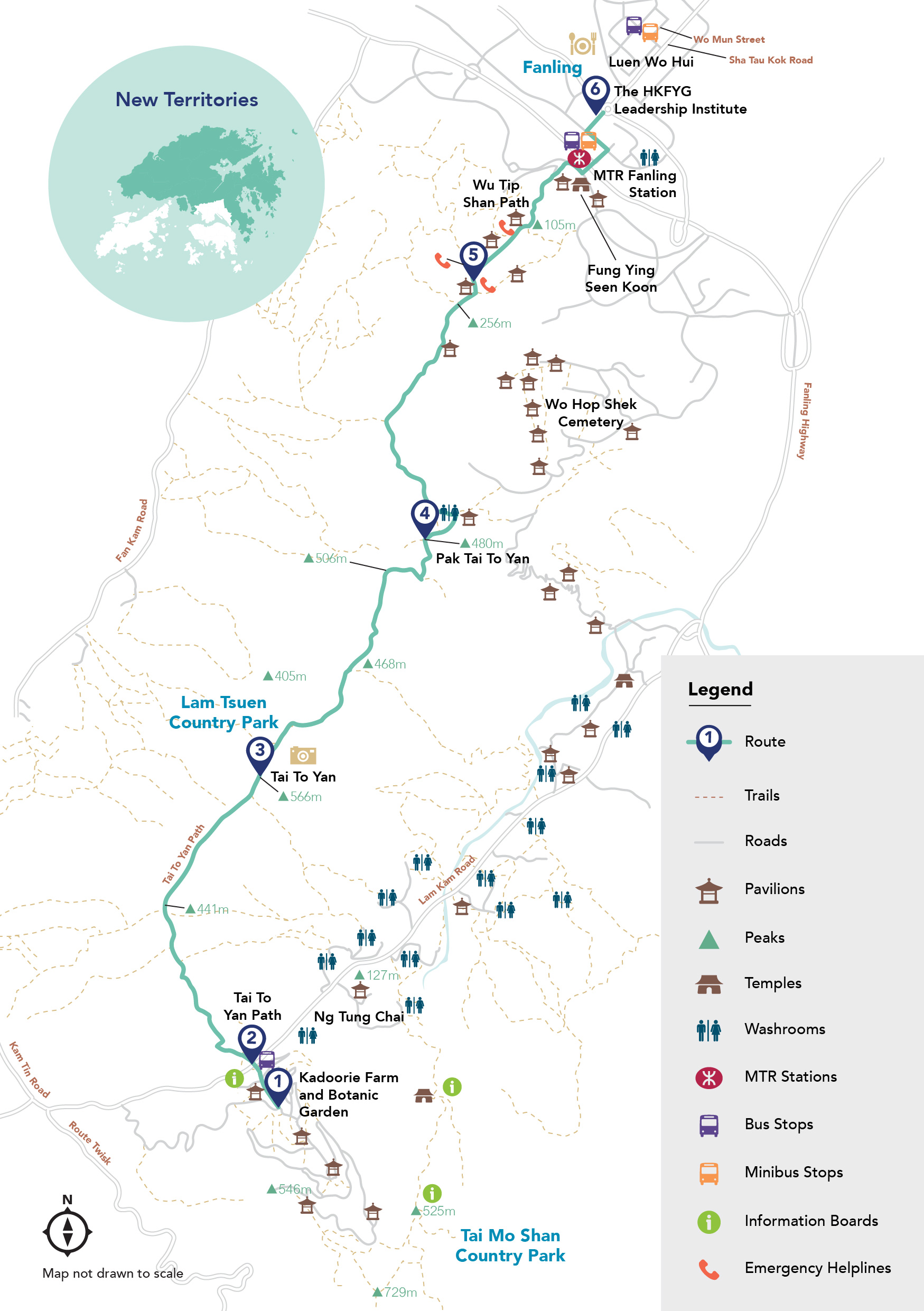
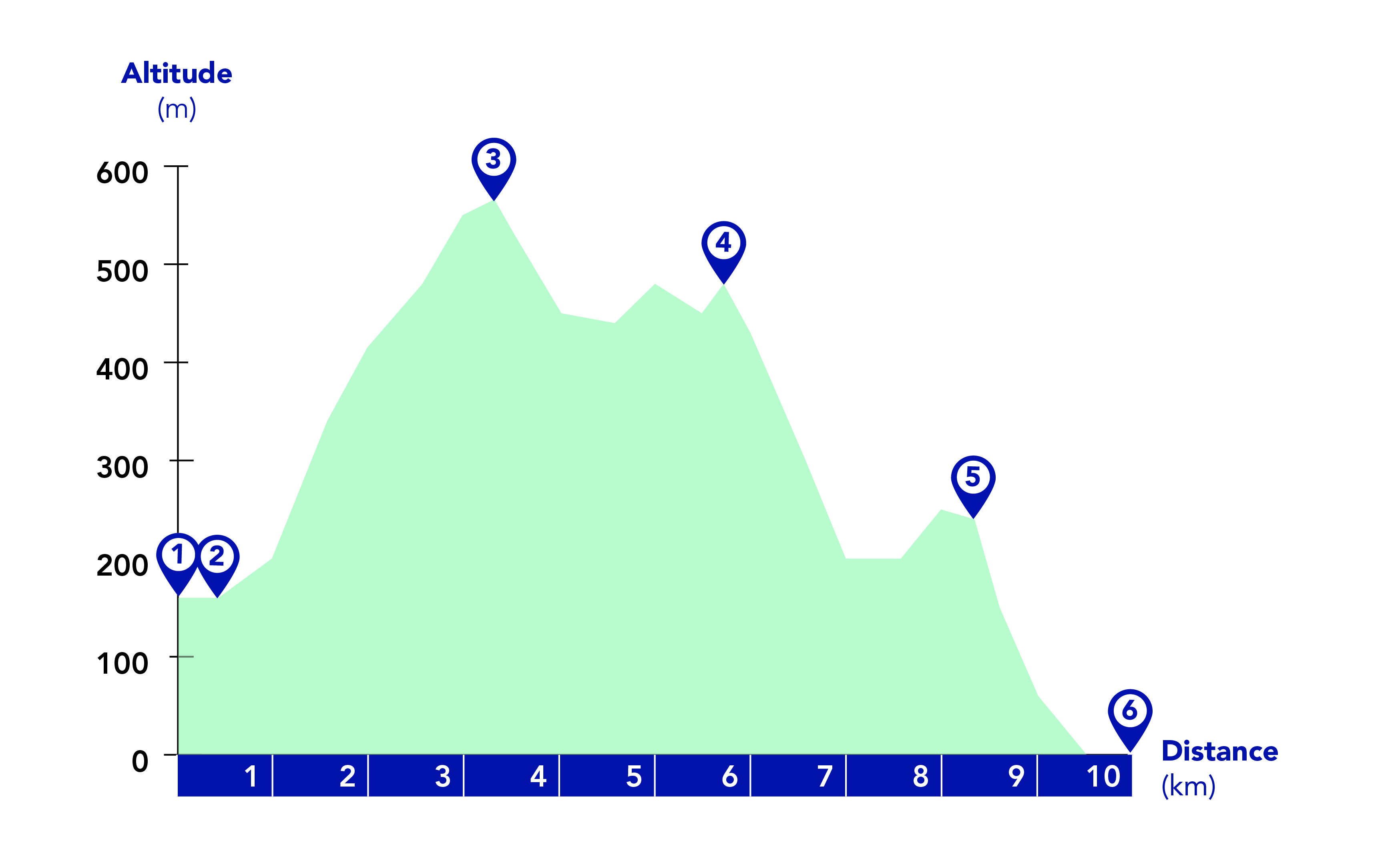
About Tai To Yan
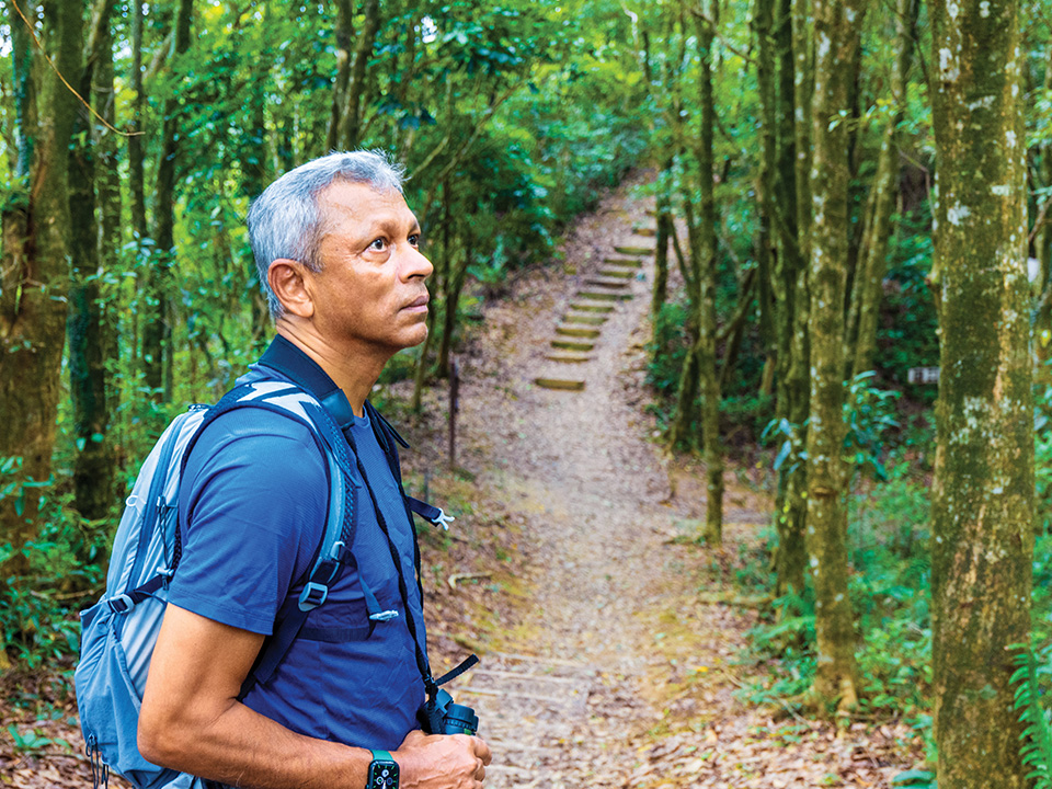
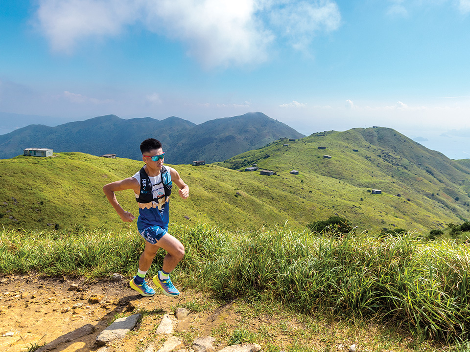
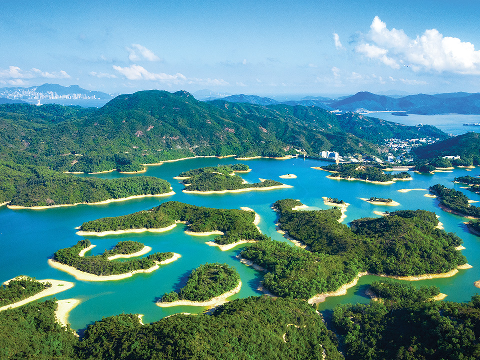
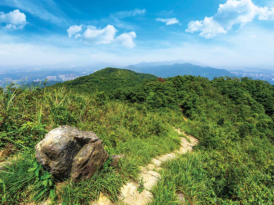
If you’re looking for a hill-walking challenge — or a quiet landscape in which to meditate on the beauty of nature — the craggy Tai To Yan, which means a ‘giant razor’s edge ridge’ in Chinese, may be the mountain for you. At 565 metres, it’s the ninth highest peak in Hong Kong. This occasionally treacherous walk rewards hikers with grand views of Yuen Long Plain and the sweeping Lam Tsuen Valley, set against Shenzhen in the far north. Nature lovers can enjoy Lam Tsuen Country Park’s rich biodiversity and plantations, including thousands of Hong Kong’s native plant species, butterflies and other insects, and wild animals. The Kadoorie Farm and Botanic Garden is also just a stone’s throw away. Experienced hikers often are the only people who come up to Tai To Yan, so you may have this windswept trail to yourself to enjoy the flora and fauna in solitude.

Refuel
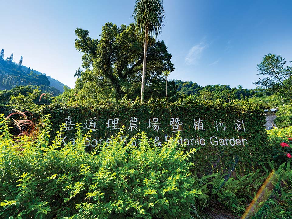
The 148-hectare Kadoorie Farm and Botanic Garden is a good place to warm up before you set off for the challenge of Tai To Yan Path, which starts right across the road.
The farm, set within a deep valley between two ridges, was established in 1956 to provide agricultural aid to local farmers. Over the years, it has successfully turned an area of barren scrubland into a showcase of flora and fauna. Today, it’s a renowned institution in the city to educate the public about biodiversity and sustainability.
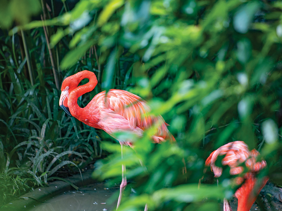
Visitors are welcome to visit the many species of animals residing here and explore the forest, theme gardens, vegetable terraces and trails, as well as conservation and educational facilities. The farm organises events and programmes to support its eco-missions. Be sure to book ahead online before your visit.
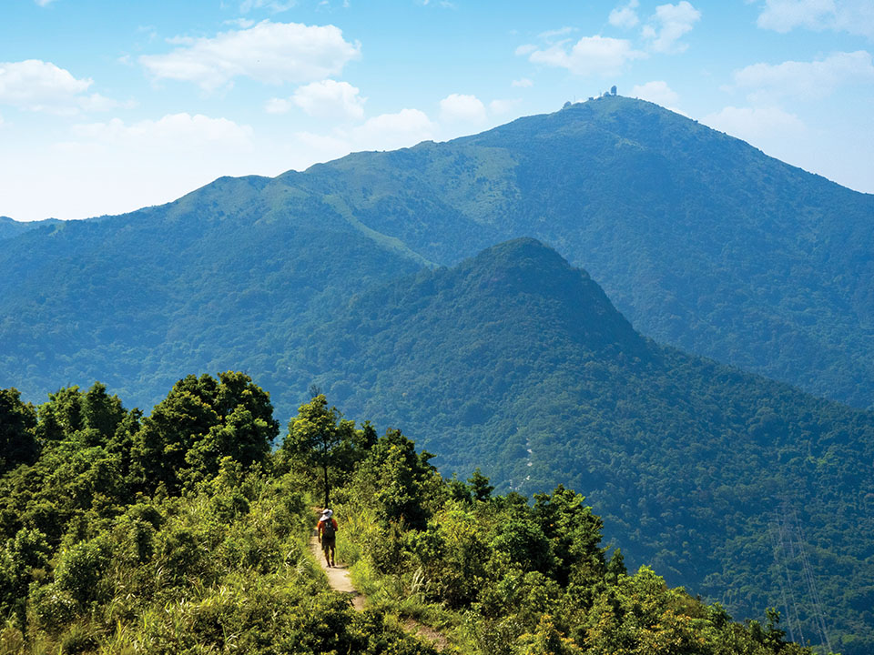
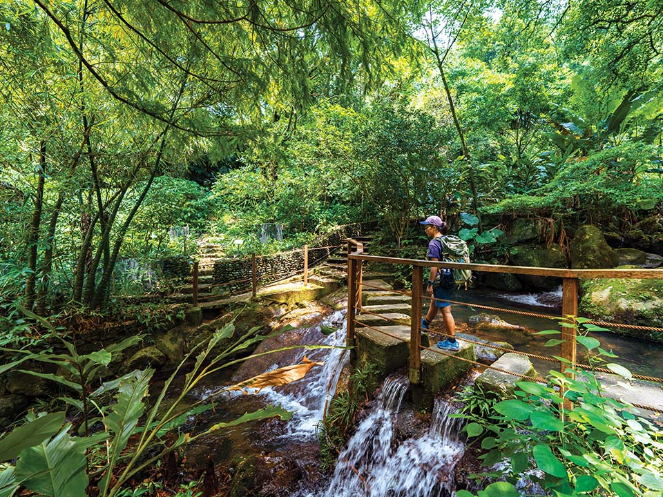
The trail starts across the road from Kadoorie Farm, to the left of the rain shelter. An old stone-slab bridge crosses a stream and leads you into a leafy land of dense banana groves. Soon, a signpost for ‘Fanling Station via Tai To Yan’ puts you on the trail. It heads steeply upwards on stone steps. As you climb above the treeline onto the open hillside, look behind you: the hefty bulk of Hong Kong’s tallest mountain, the 957-metre-high Tai Mo Shan, looms to the south, and the terraced fields of Kadoorie Farm are cut into its foothills. To your right, the wide, flat plains of Kam Tin and Yuen Long stretch to the edge of Deep Bay. To your left, the rural Lam Tsuen valley rolls down towards Tolo Harbour.
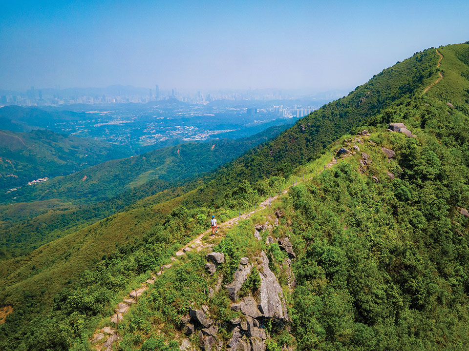
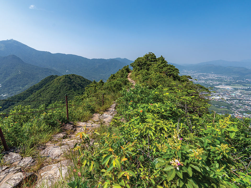
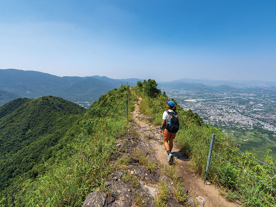
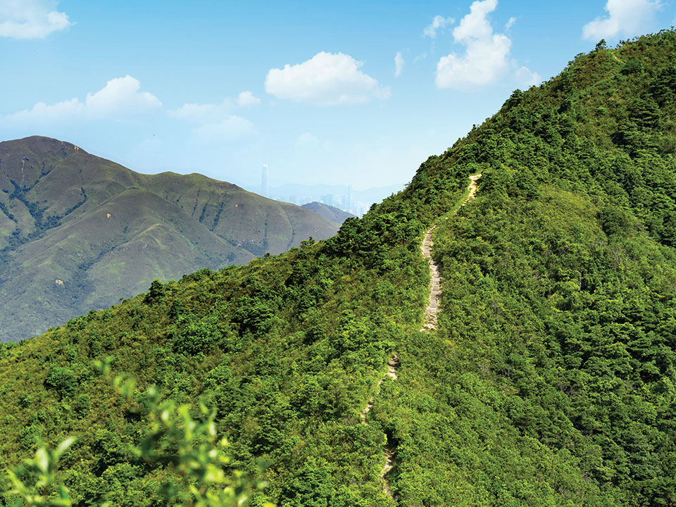
As you climb higher, the path becomes narrower, and soon you walk a thin ridgeline between vertigo-inducing drops on either side. The best viewpoints during the hike are along this ridge, where the trail leads across lichen-covered boulders which are balanced precariously high above the villages far below. Chain fences stretch across the most dizzying gaps. In some places it feels as if you are walking on the upturned blade of a knife — hence the name Tai To Yan, or ‘Big Knife Cliff’. Look back and forth, and you can see your path snaking across a series of dramatic crests. Time it right for an astounding sunset over the ridgeline and the lush rolling hills below.
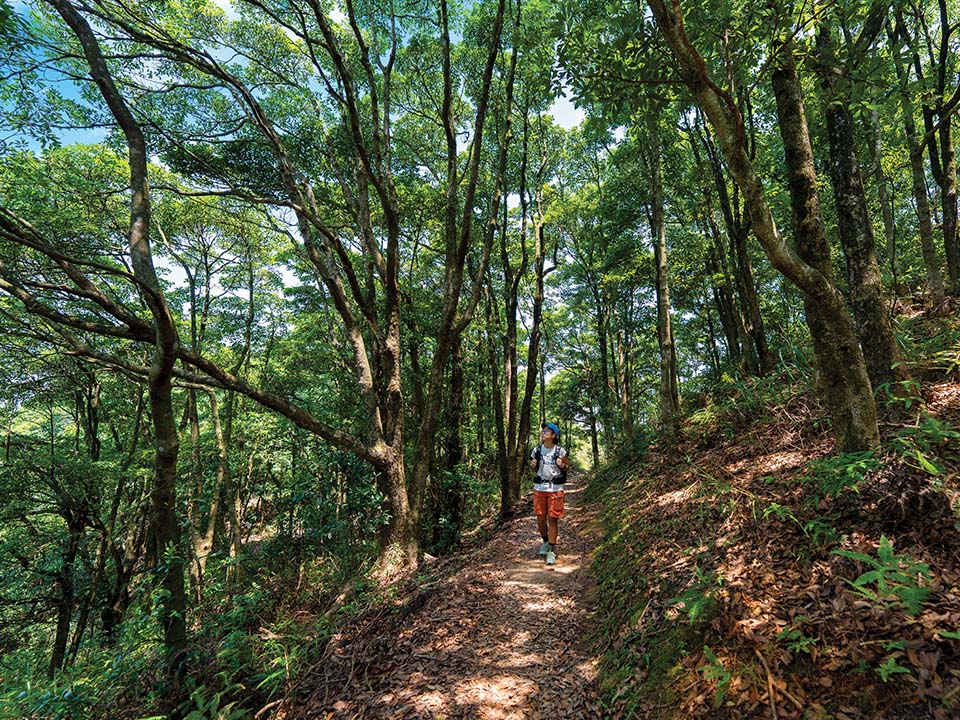
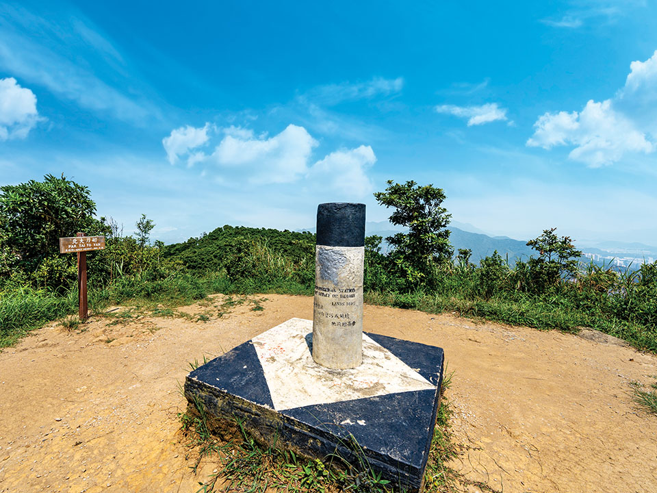
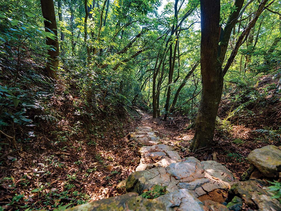
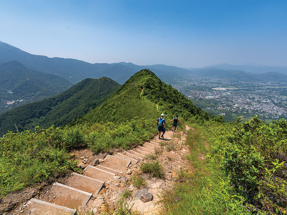
The next summit is the slightly lower Pak Tai To Yan (479 metres), offering views of nearby Kai Kung Leng (or ‘rooster ridge’) to the west, and distant Shenzhen to the north. Then the trail plunges back into wooded valleys where the ground is soft with fallen leaves. Mosses and succulent plants grow lushly on the rocks. Mushrooms sprout on fallen branches that are slowly crumbling in the undergrowth. This upland forest, home to rarely seen animals such as the pangolin, porcupine and leopard cat, is protected as part of Lam Tsuen Country Park.
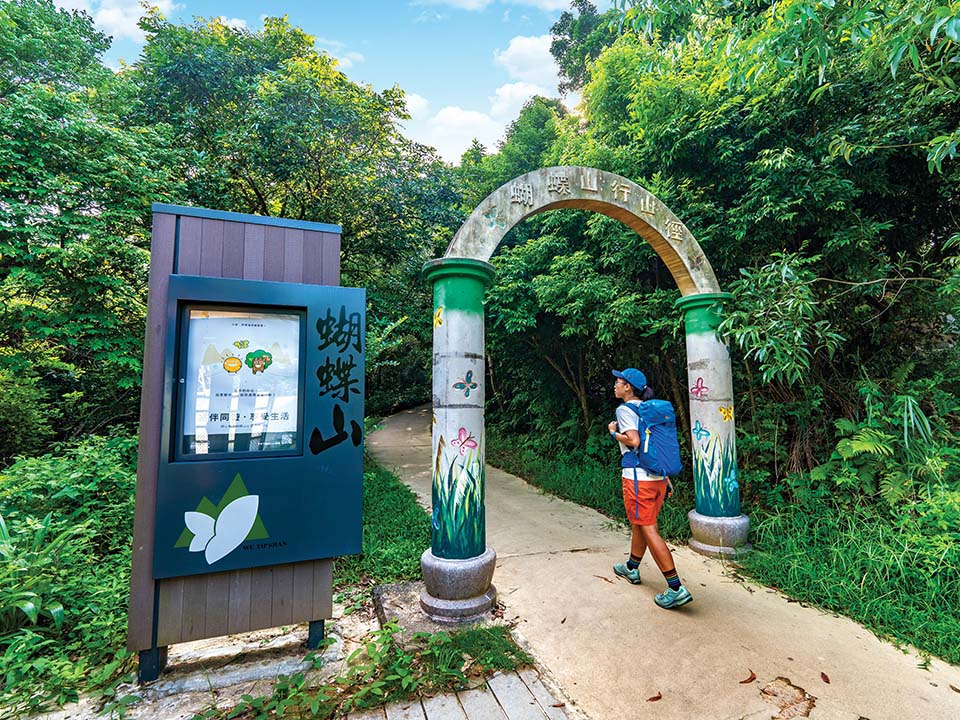
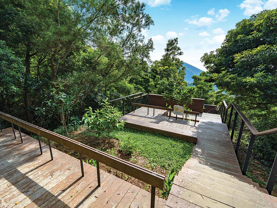
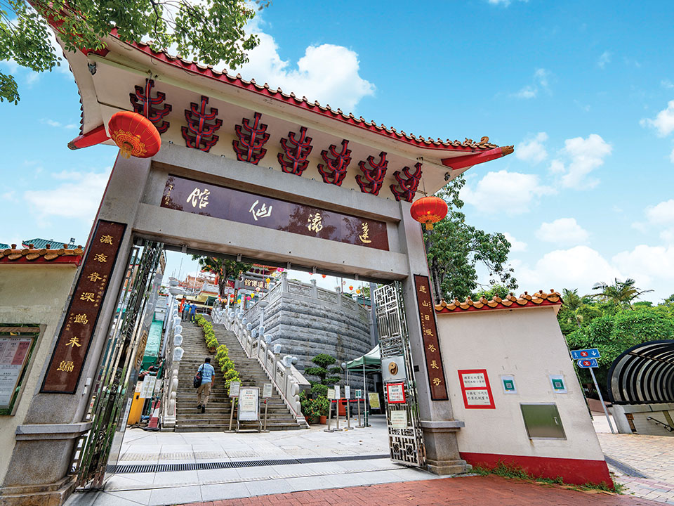
Keep following the directions for Fanling. Soon you commence a descent towards the town on the paved Wu Tip Shan (or ‘butterfly hill’) trail. You have climbed a long way up, so it’s a long way down again, but there are pavilions where you can rest your legs and admire the views. Keep going until you emerge into Fanling beside the Fung Ying Seen Koon Taoist temple complex.
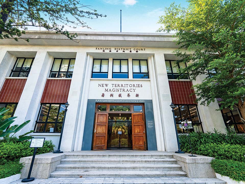
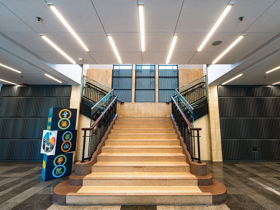
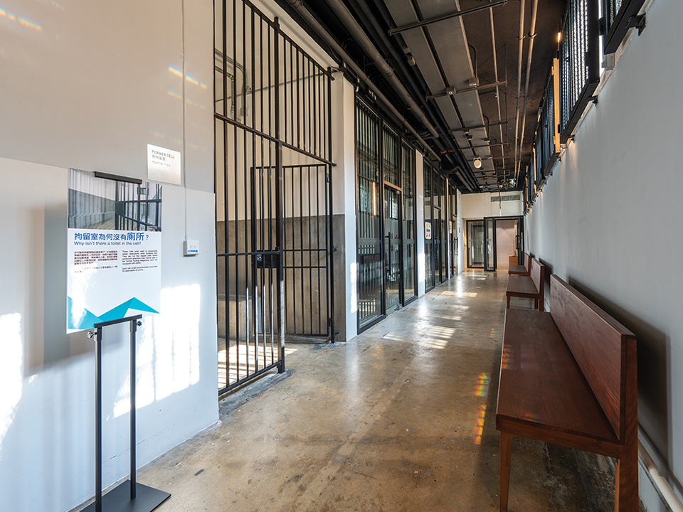
This Grade 3 historic building was built as the former Fanling Magistracy in 1960, but the lawyers and legal clerks moved out in 2002. Its elegant neoclassical facade is typical of public architecture from that era. As part of a scheme to revitalise heritage sites, it is now managed by the Hong Kong Federation of Youth Groups, but visitors are free to enter. You can explore the old courtrooms with the aid of a mobile app, or book ahead for a guided tour by a youth cultural ambassador.


Keep walking northeast along Sha Tau Kok Road from the HKFYG Leadership Institute and you’ll reach the Luen Wo Hui neighbourhood of Fanling. There’s a cooked food centre upstairs in the multi-storey market building on Wo Mun Street, which hosts numerous restaurants in a communal hall. Here you can enjoy authentic Hong Kong-style food at very affordable prices.
The 148-hectare Kadoorie Farm and Botanic Garden is a good place to warm up before you set off for the challenge of Tai To Yan Path, which starts right across the road.
The farm, set within a deep valley between two ridges, was established in 1956 to provide agricultural aid to local farmers. Over the years, it has successfully turned an area of barren scrubland into a showcase of flora and fauna. Today, it’s a renowned institution in the city to educate the public about biodiversity and sustainability.
Visitors are welcome to visit the many species of animals residing here and explore the forest, theme gardens, vegetable terraces and trails, as well as conservation and educational facilities. The farm organises events and programmes to support its eco-missions. Be sure to book ahead online before your visit.
The trail starts across the road from Kadoorie Farm, to the left of the rain shelter. An old stone-slab bridge crosses a stream and leads you into a leafy land of dense banana groves. Soon, a signpost for ‘Fanling Station via Tai To Yan’ puts you on the trail. It heads steeply upwards on stone steps. As you climb above the treeline onto the open hillside, look behind you: the hefty bulk of Hong Kong’s tallest mountain, the 957-metre-high Tai Mo Shan, looms to the south, and the terraced fields of Kadoorie Farm are cut into its foothills. To your right, the wide, flat plains of Kam Tin and Yuen Long stretch to the edge of Deep Bay. To your left, the rural Lam Tsuen valley rolls down towards Tolo Harbour.
As you climb higher, the path becomes narrower, and soon you walk a thin ridgeline between vertigo-inducing drops on either side. The best viewpoints during the hike are along this ridge, where the trail leads across lichen-covered boulders which are balanced precariously high above the villages far below. Chain fences stretch across the most dizzying gaps. In some places it feels as if you are walking on the upturned blade of a knife — hence the name Tai To Yan, or ‘Big Knife Cliff’. Look back and forth, and you can see your path snaking across a series of dramatic crests. Time it right for an astounding sunset over the ridgeline and the lush rolling hills below.
The next summit is the slightly lower Pak Tai To Yan (479 metres), offering views of nearby Kai Kung Leng (or ‘rooster ridge’) to the west, and distant Shenzhen to the north. Then the trail plunges back into wooded valleys where the ground is soft with fallen leaves. Mosses and succulent plants grow lushly on the rocks. Mushrooms sprout on fallen branches that are slowly crumbling in the undergrowth. This upland forest, home to rarely seen animals such as the pangolin, porcupine and leopard cat, is protected as part of Lam Tsuen Country Park.
Keep following the directions for Fanling. Soon you commence a descent towards the town on the paved Wu Tip Shan (or ‘butterfly hill’) trail. You have climbed a long way up, so it’s a long way down again, but there are pavilions where you can rest your legs and admire the views. Keep going until you emerge into Fanling beside the Fung Ying Seen Koon Taoist temple complex.
This Grade 3 historic building was built as the former Fanling Magistracy in 1960, but the lawyers and legal clerks moved out in 2002. Its elegant neoclassical facade is typical of public architecture from that era. As part of a scheme to revitalise heritage sites, it is now managed by the Hong Kong Federation of Youth Groups, but visitors are free to enter. You can explore the old courtrooms with the aid of a mobile app, or book ahead for a guided tour by a youth cultural ambassador.
Keep walking northeast along Sha Tau Kok Road from the HKFYG Leadership Institute and you’ll reach the Luen Wo Hui neighbourhood of Fanling. There’s a cooked food centre upstairs in the multi-storey market building on Wo Mun Street, which hosts numerous restaurants in a communal hall. Here you can enjoy authentic Hong Kong-style food at very affordable prices.