Speak now


I’m Sorry. I didn’t get that.
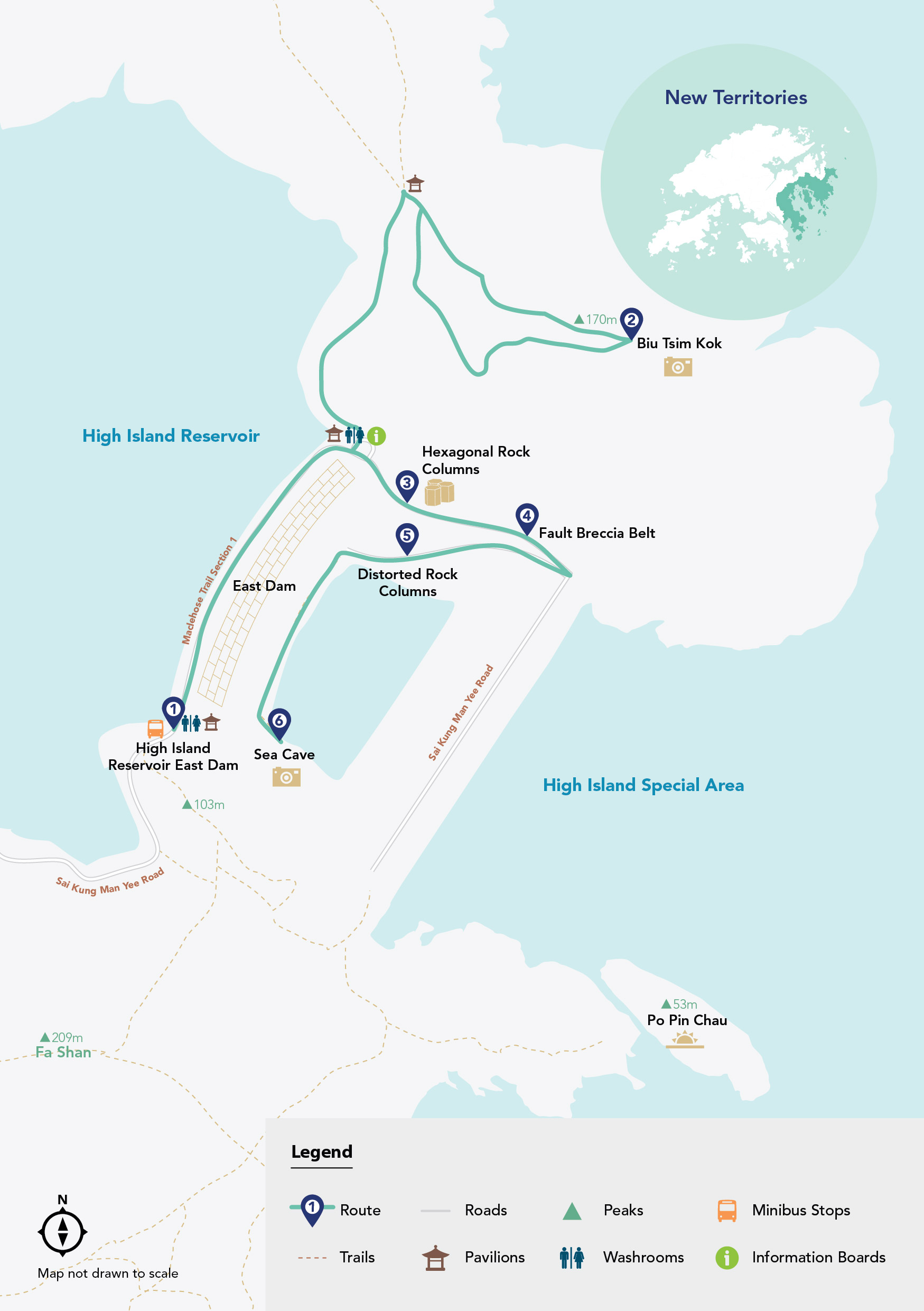
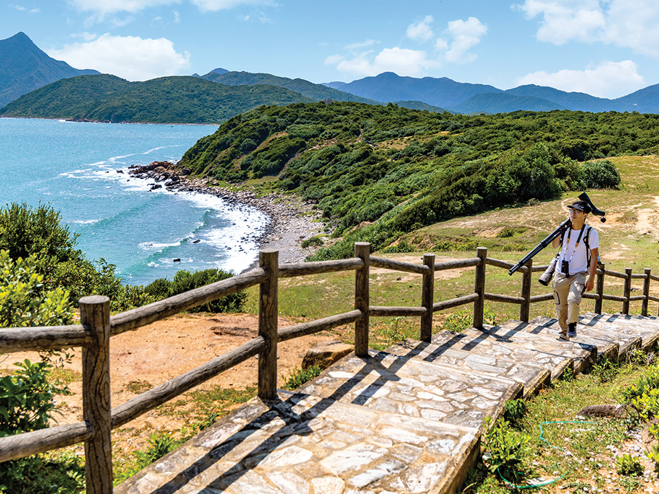
About High Island Geo Trail
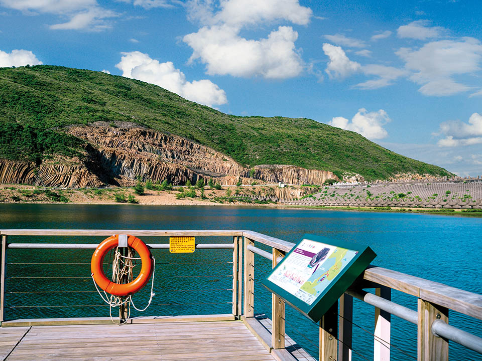
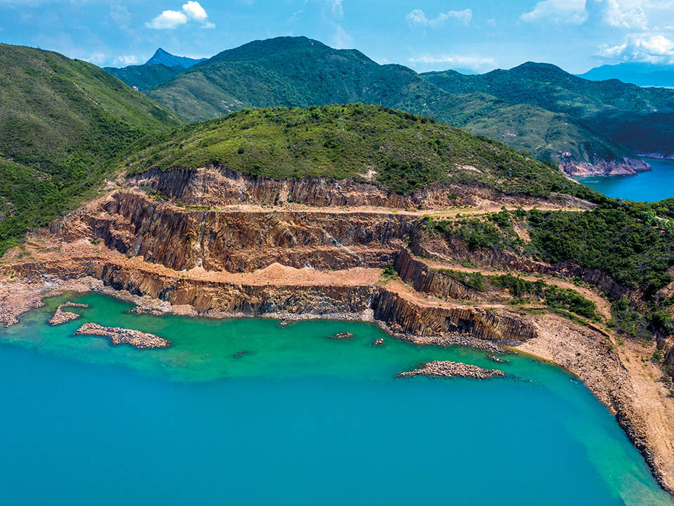
High Island Geo Trail lies beside the beautiful High Island Reservoir — created after two large dams blocked a narrow channel between High Island and the eastern side of Sai Kung Peninsula. The area, situated within Hong Kong UNESCO Global Geopark, is home to breathtaking rock landscapes of international geological importance formed when a supervolcano erupted 140 million years ago. Signs dotting the leisurely trail offer insights into Instagram-friendly delights including towering cliff faces lined with hexagonal rock columns, mysterious caves and sea stacks and — atop Biu Tsim Kok hill — stunning coastal scenery, such as picturesque Long Ke Wan.

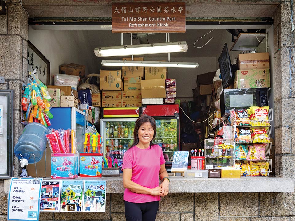
Refuel
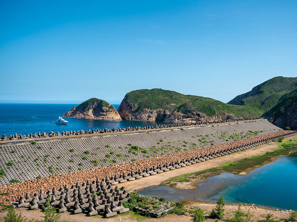
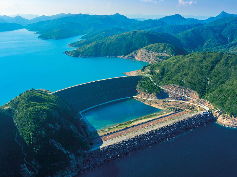
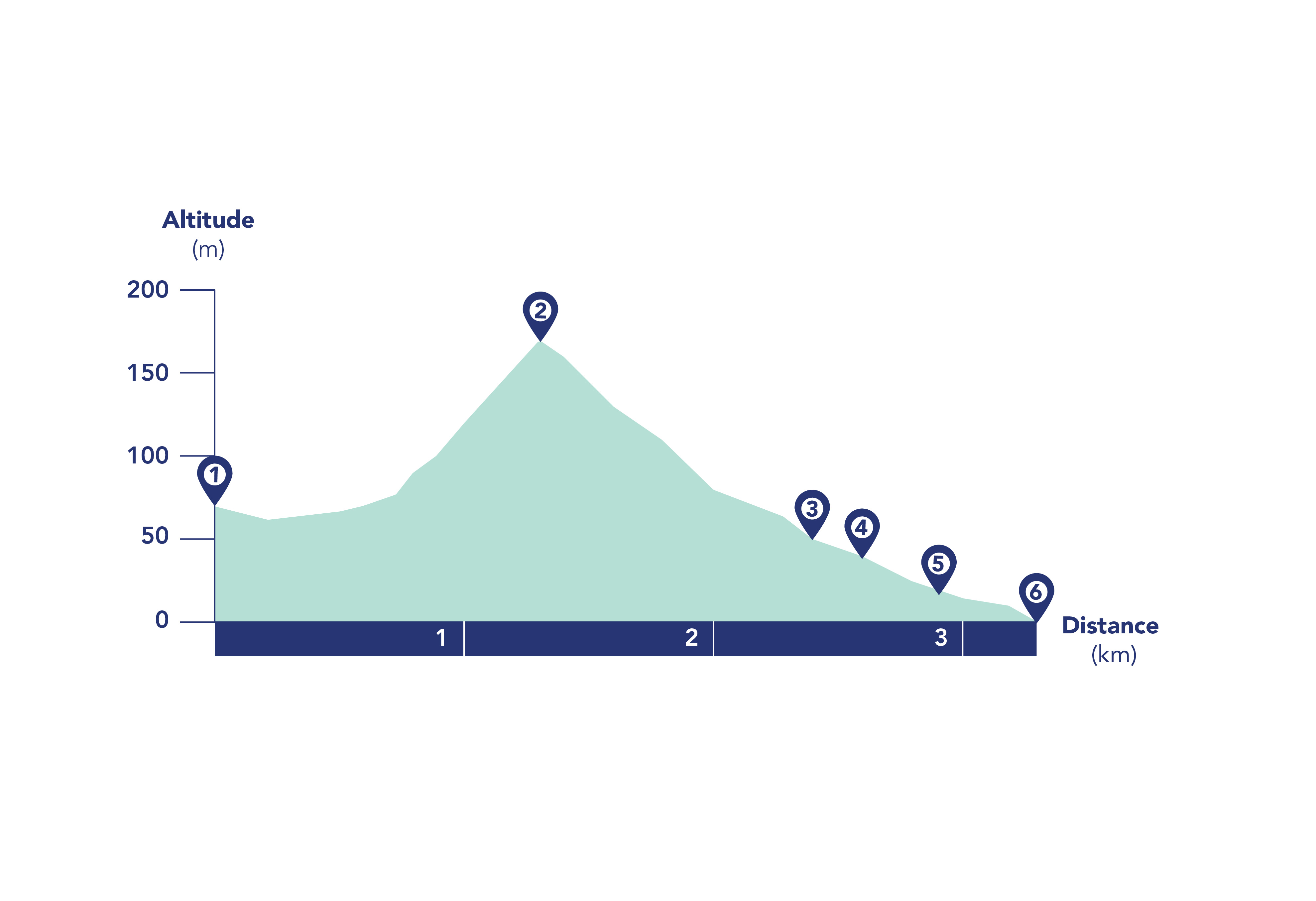
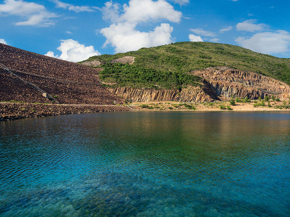
A blue, anchor-shaped monument beside East Dam, next to the beautiful, rolling hill-flanked 6.67 sq km reservoir, marks the start of the trail. The route, which loops along the side of the Pacific Ocean-facing East Dam and its protective breakwater, offers impressive Instagram-worthy views of the reservoir, dam and breakwater dolosse, or double T-shaped concrete wave breakers, and — out to sea — exposed rock columns along the side of the triangular sea stack, Po Pin Chau, which has been separated from the Fa Shan headland by sea erosion.
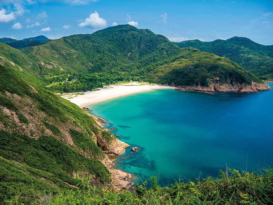
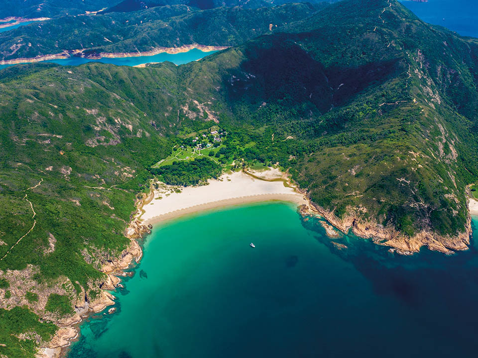
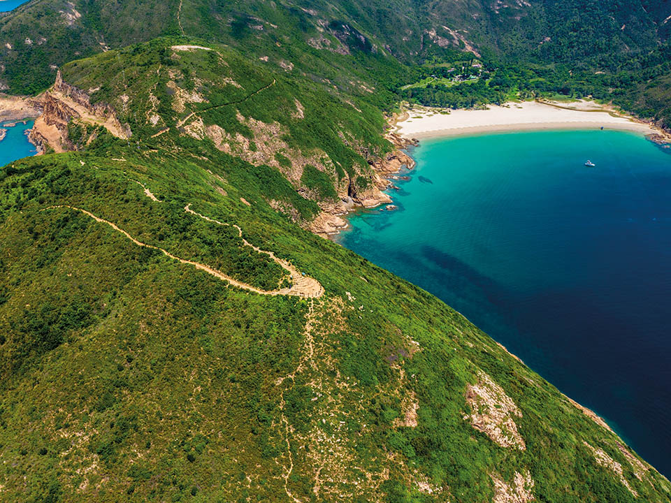
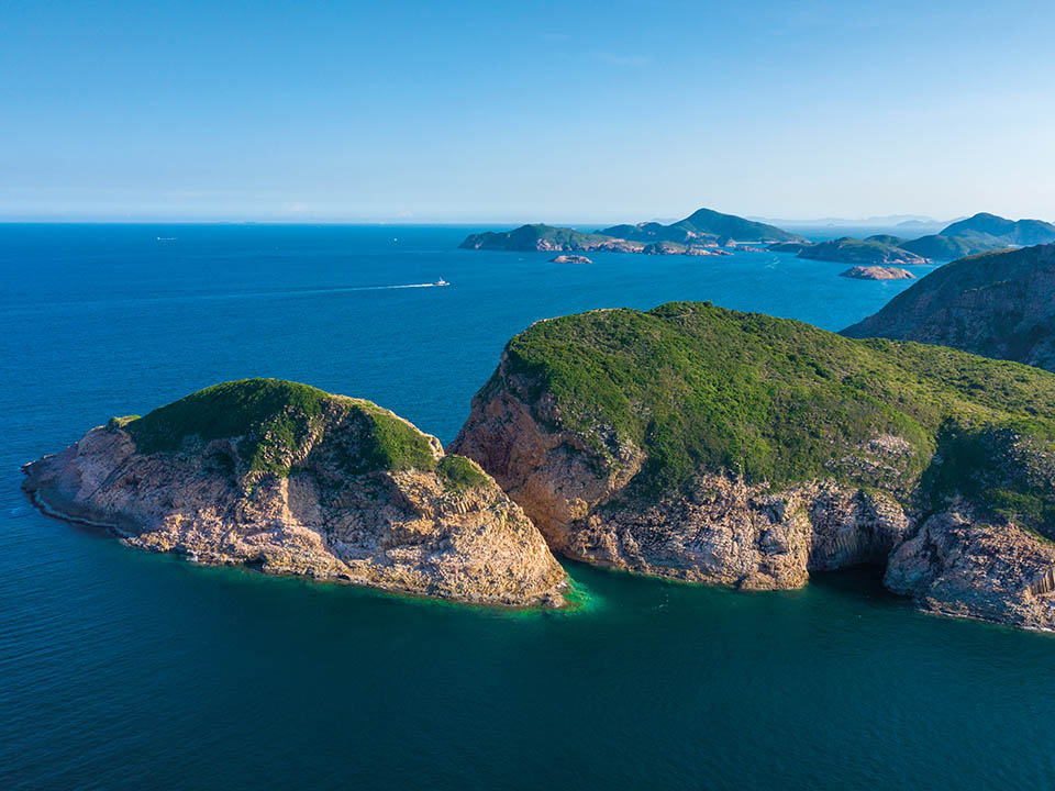
This 1 km-long extension to the trail leads uphill to Biu Tsim Kok viewing point, which offers 360-degree views of the reservoir, Po Pin Chau sea stack, Ung Kong Group, Ninepin Group and spectacular Long Ke Wan, known for its idyllic, gently curving bay, crystal-clear waters and unspoilt beach of fine white sand.
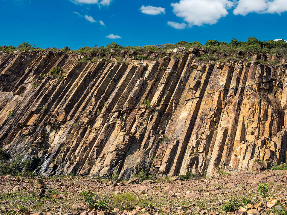
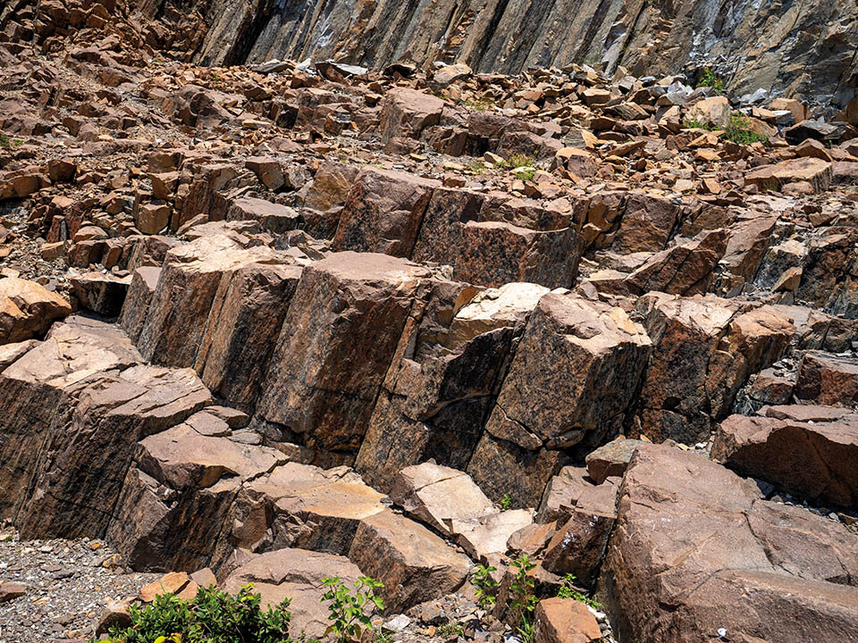

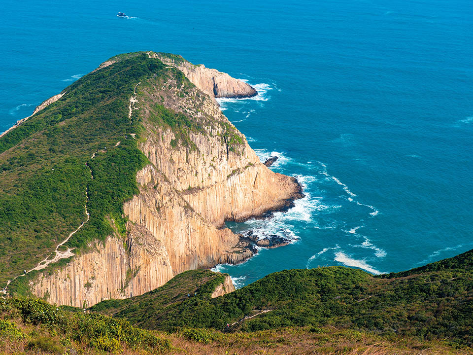
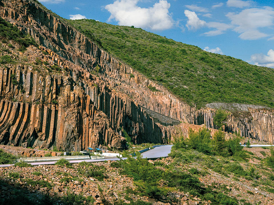
The stunning, light-coloured rock columns found in the Geopark’s Sai Kung Volcanic Rock Region — created as dense volcanic ash and lava cooled following massive eruptions 140 million years ago — are estimated to cover an area of more than 100 sq km — including some located underwater. Those that are visible rise up to a height of 100 metres and have an average diameter of 1.2 metres.
This fracture zone of hexagonal rock columns is easy to miss when you are admiring the cliffs covered in numerous hexagonal columns; but the information boards along the trail will help you spot one. A fault breccia belt is created when the hexagonal columns along a fault line are broken into fragments during a tectonic movement.
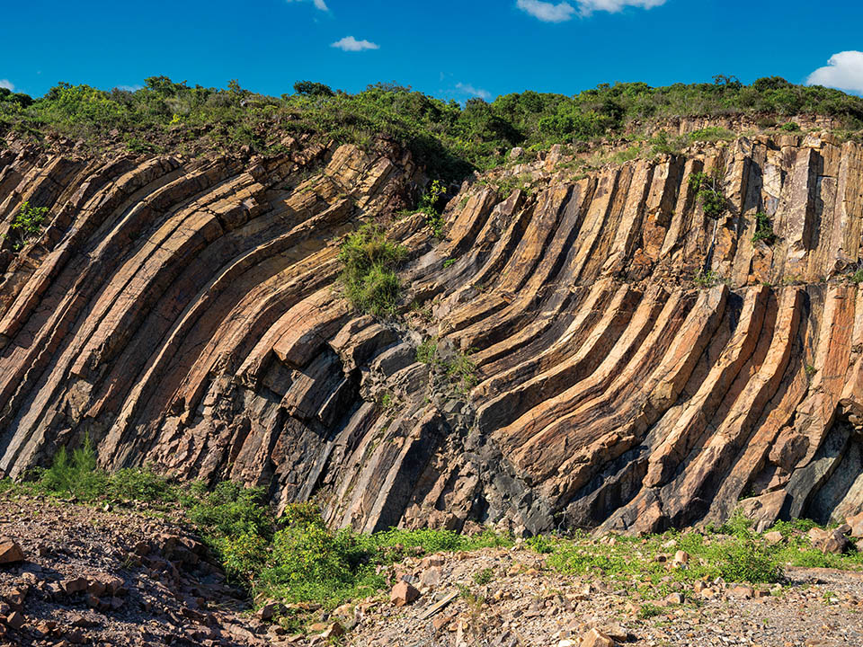
The trail takes you past one rock face featuring an area of distorted, S-shaped columns, as if they have melted in the sun. This area of hexagonal rock columns were twisted — by the effects of a geological movement — before the rock columns completely solidified. Some years later, hot magma was able to force its way between the weakened columns and spread across the top of the columns, forming a dyke as it turned into a dark-coloured rock.
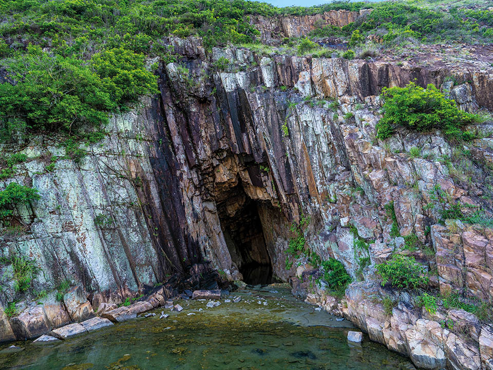
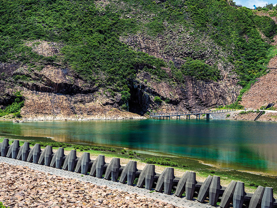
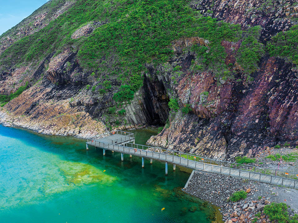
A wooden walkway at the end of the trail takes you near the entrance to a sea cave, which looks slightly out of place below East Dam. This area — originally part of the narrow waterway running along the fault line between High Island and Sai Kung Peninsula — was blocked off to form the reservoir. The cave was created, slowly over time, as waves wore away the coastline’s softer rock.
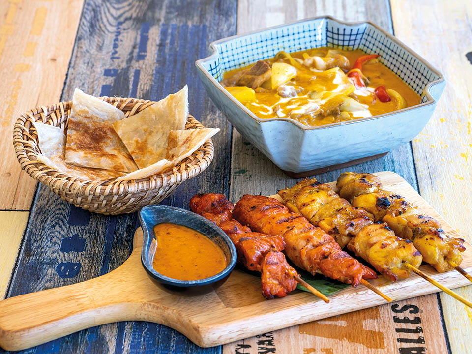
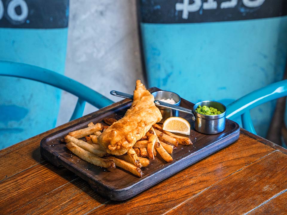
Sai Kung is known for its many waterfront seafood restaurants, which are particularly popular with visitors. But there is also a fine selection of trendy restaurants, cafes and Hong Kong-style cha chaan tengs along the promenade and lively side streets, which serve a vast range of Western and Eastern cuisines. Think pizzas, pastas, Thai curries, English fish and chips and Turkish kebabs.
A blue, anchor-shaped monument beside East Dam, next to the beautiful, rolling hill-flanked 6.67 sq km reservoir, marks the start of the trail. The route, which loops along the side of the Pacific Ocean-facing East Dam and its protective breakwater, offers impressive Instagram-worthy views of the reservoir, dam and breakwater dolosse, or double T-shaped concrete wave breakers, and — out to sea — exposed rock columns along the side of the triangular sea stack, Po Pin Chau, which has been separated from the Fa Shan headland by sea erosion.
This 1 km-long extension to the trail leads uphill to Biu Tsim Kok viewing point, which offers 360-degree views of the reservoir, Po Pin Chau sea stack, Ung Kong Group, Ninepin Group and spectacular Long Ke Wan, known for its idyllic, gently curving bay, crystal-clear waters and unspoilt beach of fine white sand.
The stunning, light-coloured rock columns found in the Geopark’s Sai Kung Volcanic Rock Region — created as dense volcanic ash and lava cooled following massive eruptions 140 million years ago — are estimated to cover an area of more than 100 sq km — including some located underwater. Those that are visible rise up to a height of 100 metres and have an average diameter of 1.2 metres.
This fracture zone of hexagonal rock columns is easy to miss when you are admiring the cliffs covered in numerous hexagonal columns; but the information boards along the trail will help you spot one. A fault breccia belt is created when the hexagonal columns along a fault line are broken into fragments during a tectonic movement.
The trail takes you past one rock face featuring an area of distorted, S-shaped columns, as if they have melted in the sun. This area of hexagonal rock columns were twisted — by the effects of a geological movement — before the rock columns completely solidified. Some years later, hot magma was able to force its way between the weakened columns and spread across the top of the columns, forming a dyke as it turned into a dark-coloured rock.
A wooden walkway at the end of the trail takes you near the entrance to a sea cave, which looks slightly out of place below East Dam. This area — originally part of the narrow waterway running along the fault line between High Island and Sai Kung Peninsula — was blocked off to form the reservoir. The cave was created, slowly over time, as waves wore away the coastline’s softer rock.
Sai Kung is known for its many waterfront seafood restaurants, which are particularly popular with visitors. But there is also a fine selection of trendy restaurants, cafes and Hong Kong-style cha chaan tengs along the promenade and lively side streets, which serve a vast range of Western and Eastern cuisines. Think pizzas, pastas, Thai curries, English fish and chips and Turkish kebabs.