Hong Kong’s Immigration Department has simplified eligibility and enrollment for the self-service immigration clearance (e-Channel) for qualifying frequent visitors. Visit their website to learn more.

Speak now


I’m Sorry. I didn’t get that.
Adventure
Wilson Trail Section 9 — Hok Tau Reservoir to Pat Sin Leng: enjoy spectacular views on invigorating mountain trail that spans the wilderness

-

About 10 km
-

5–6 hours
-

Difficult
Written by South China Morning Post ( Morning Studio )

Ride safely
When cycling, please remember to always follow road safety regulations, wear proper protective gear and stay alert, especially on unfamiliar or busy routes, to ensure your safety and the safety of others on the road.
For more safe cycling information, please click here.
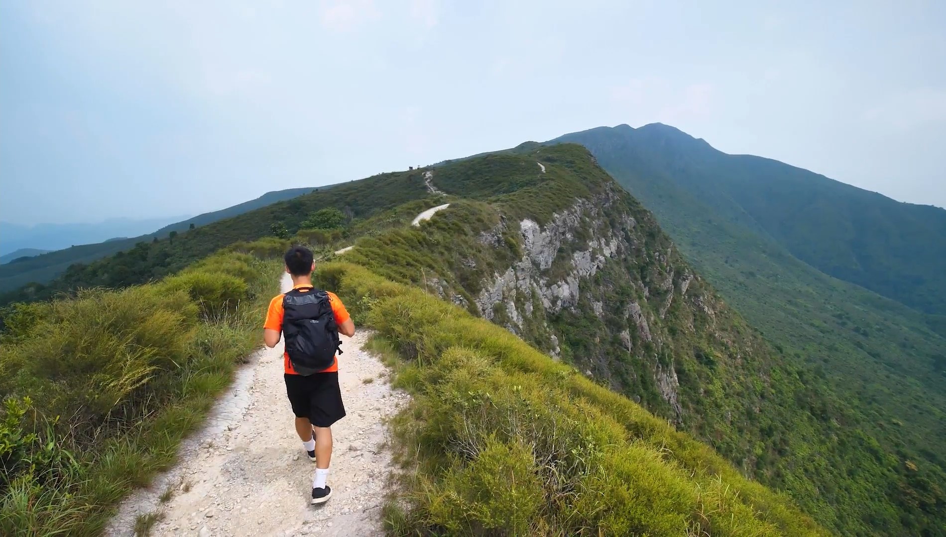
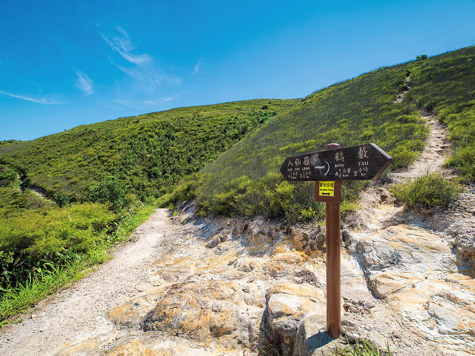
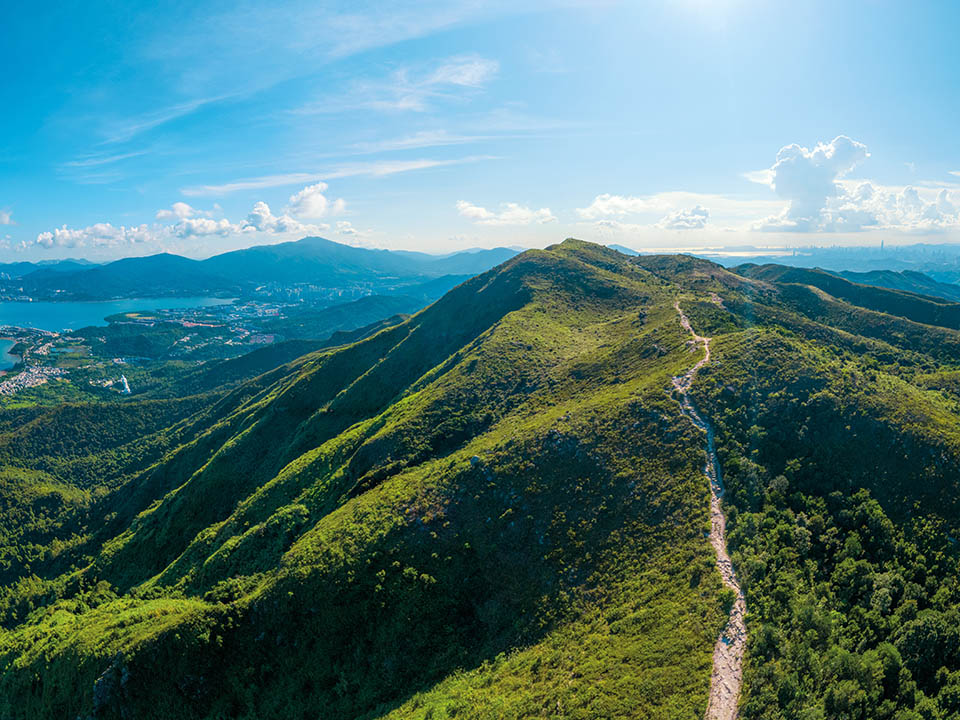
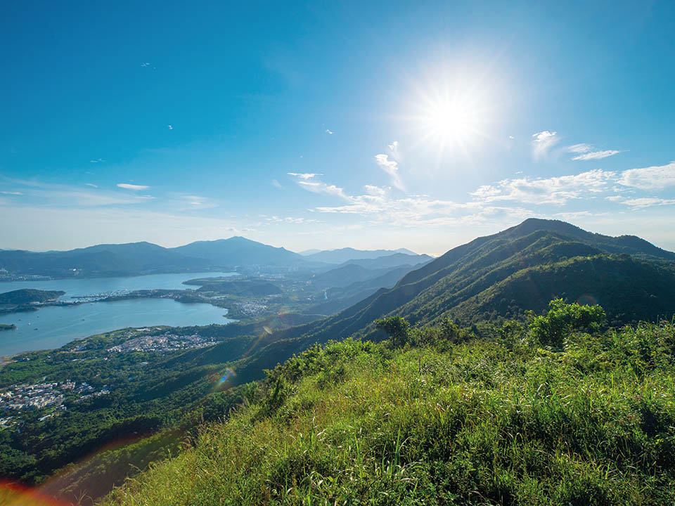
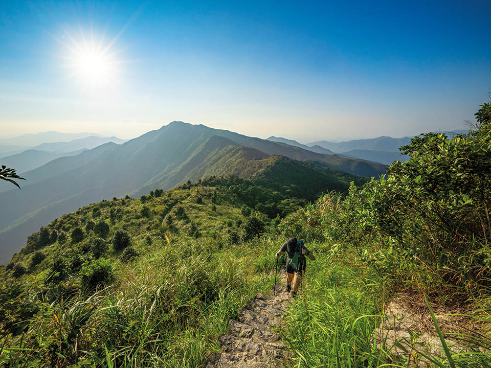
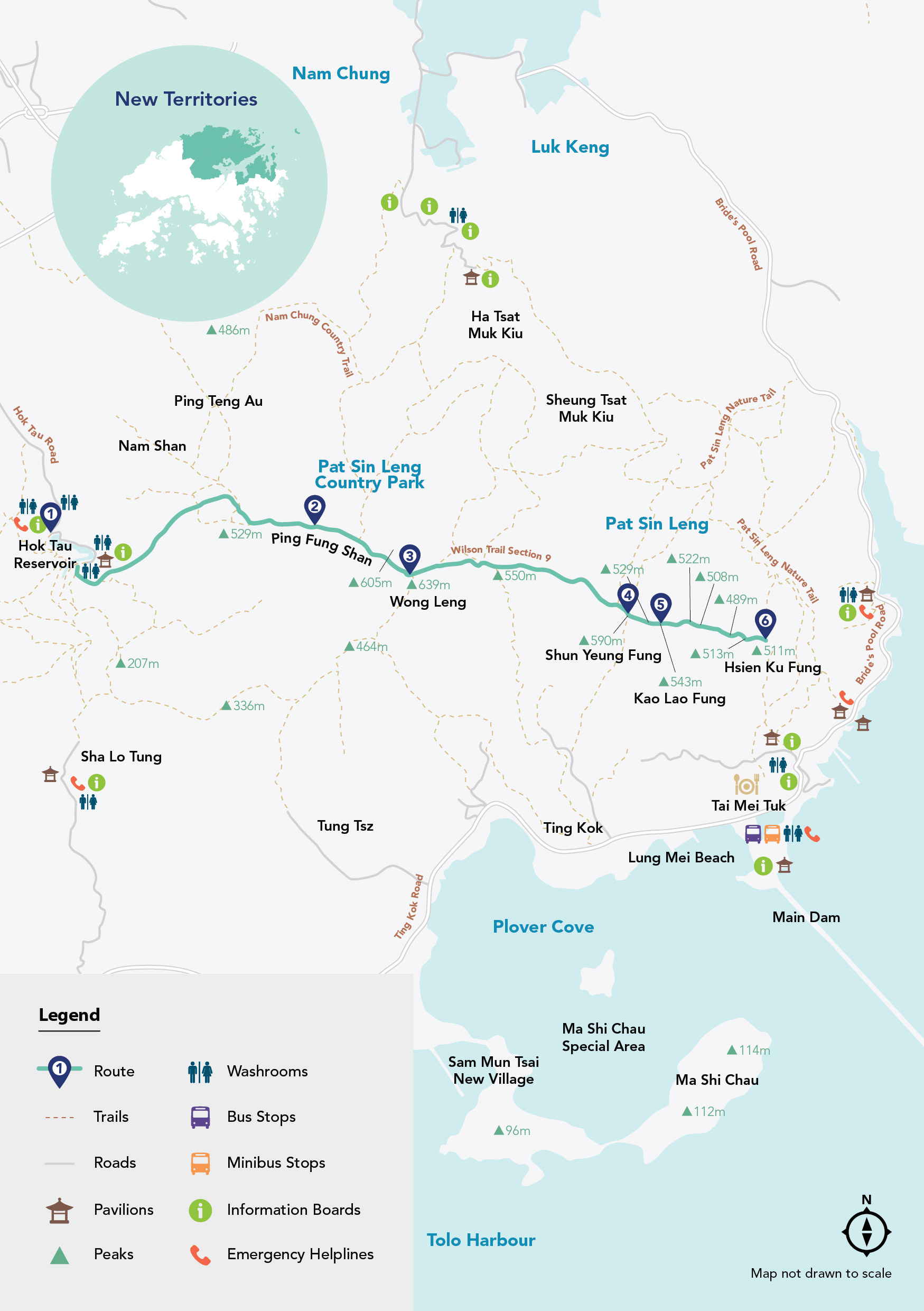
This high-altitude challenge in the northeastern New Territories rewards you with incomparable views over hillsides, forests and the sea. The country parks contain some of Hong Kong’s most rugged peaks. Exploring them is straightforward thanks to the city’s criss-crossing hiking network, including the Wilson Trail — stretching 78 km from Stanley Gap, on Hong Kong Island, to Nam Chung in the New Territories. Section 9 follows the Pat Sin Leng — or ‘ridge of the eight immortals’ — ridgeline linking eight peaks named after figures from Chinese folklore. This invigorating journey will ensure you discover a strikingly beautiful, yet surprisingly wild side of Hong Kong few see.

Refuel
There is a single drink vending machine on this route, somewhat hidden behind a tree on the left of the road, just as you start walking near Hok Tau Wai Pavilion. This is a challenging hike, so be sure to bring adequate supplies of water and snacks. You can stock up at convenience stores in MTR Fanling Station before you go.
-
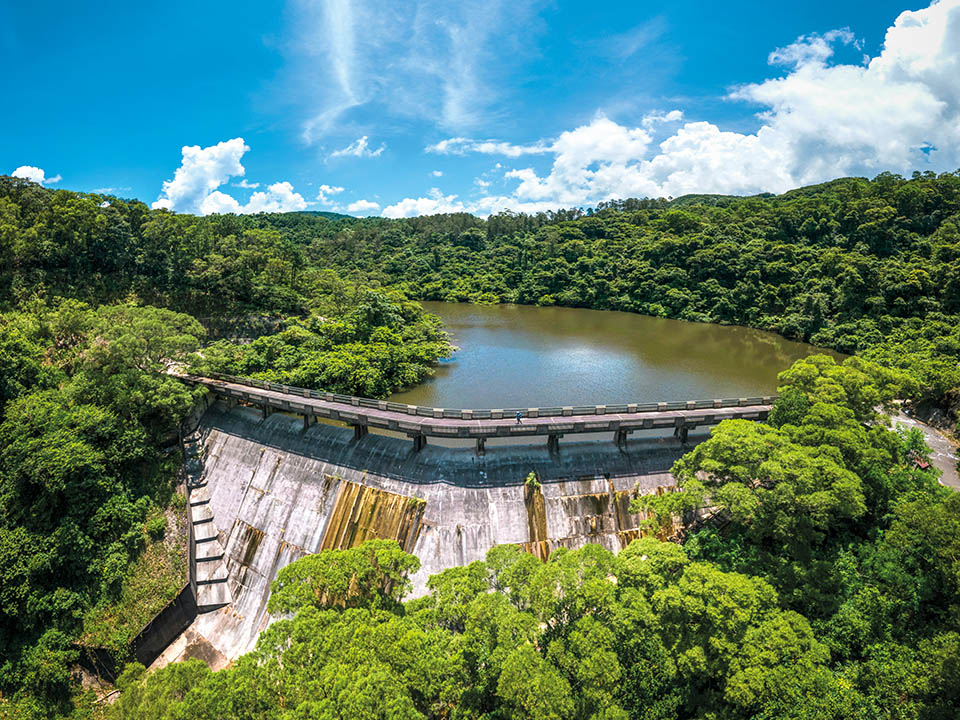
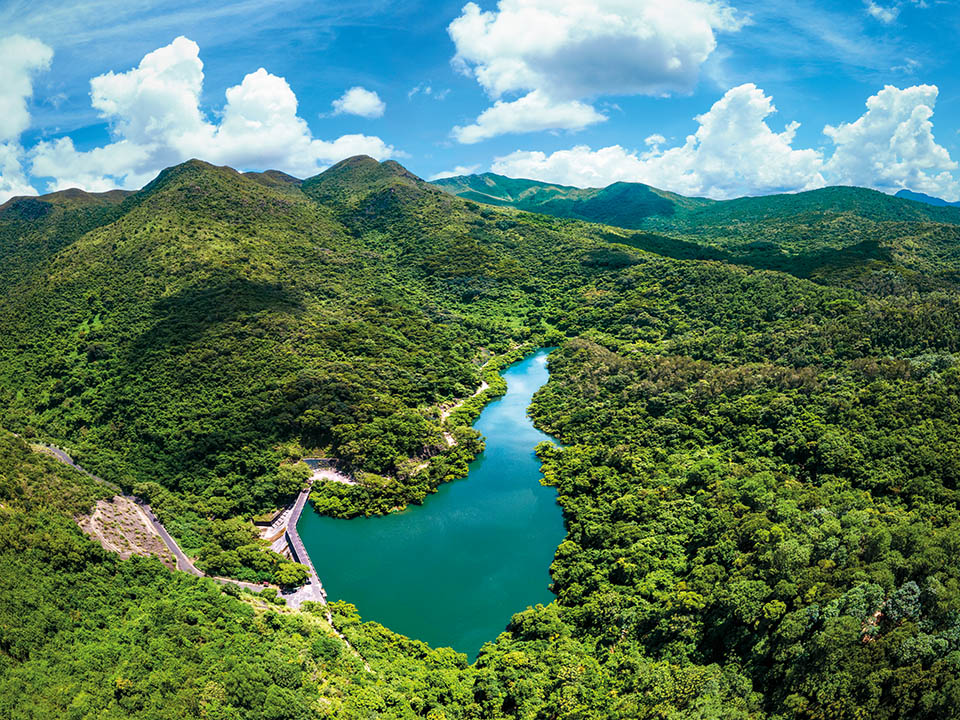
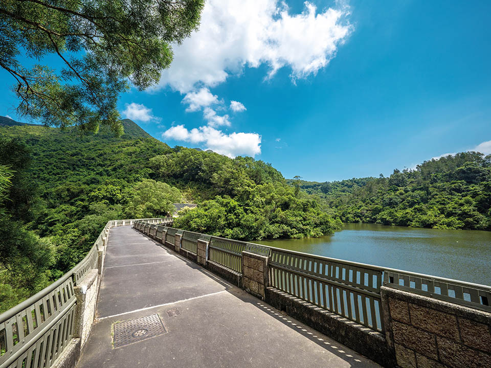
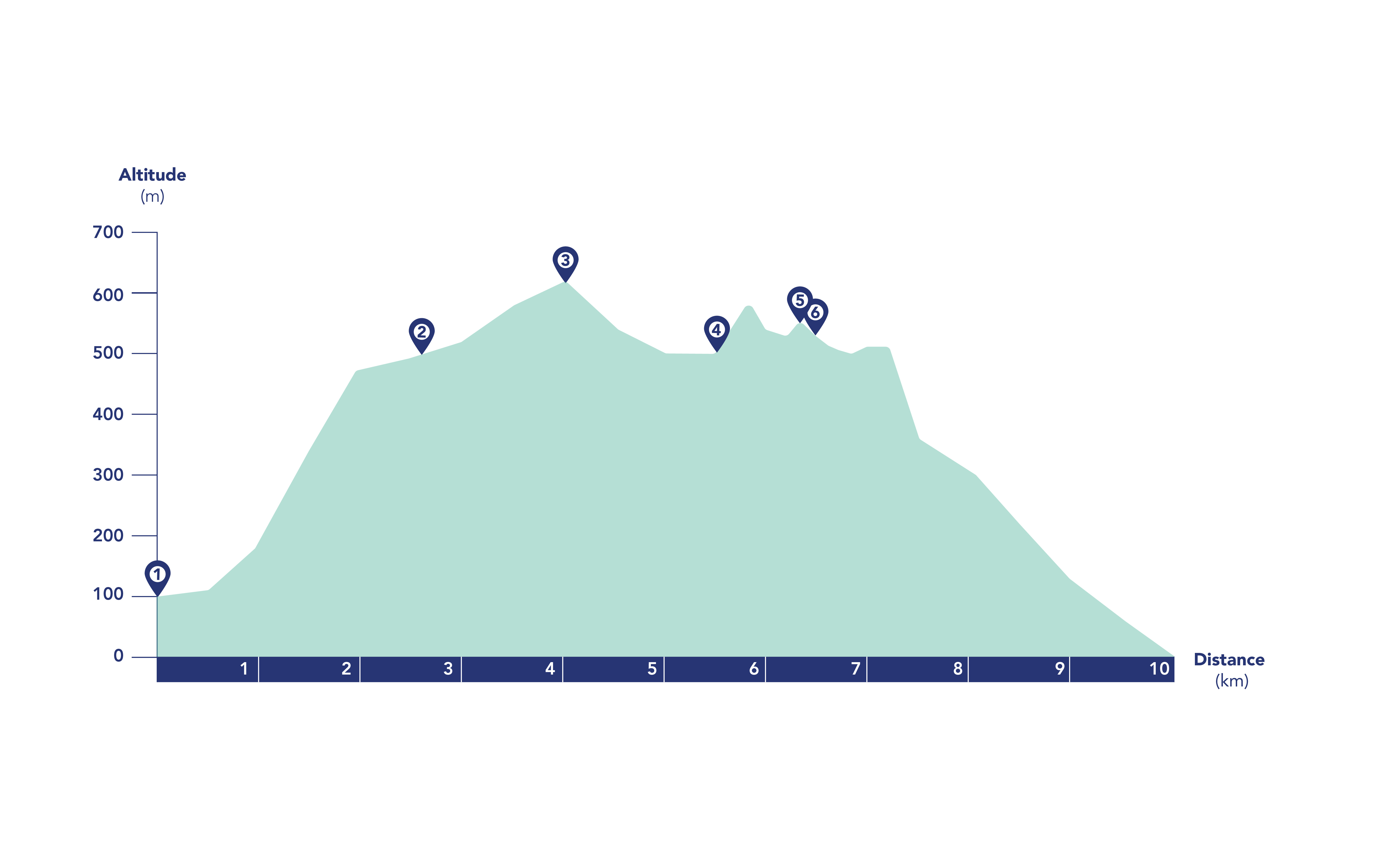
Hok Tau Reservoir
You will hear the rush of water flowing over rocks before you arrive at the dam of the small, S-shaped Hok Tau Reservoir. This is a small freshwater pool hidden away at the head of a peaceful, wooded valley, built not to supply drinking water to the city but to irrigate the farmers’ fields below. It is also a major breeding ground for dragonflies and more than 70 species of butterflies. Turn left to walk across the stone dam. Boughs of trees hang right down to the water, as if they were drinking from the reservoir.
 This hike is remote and largely unshaded, so it’s important that you bring enough water (more than 2 litres per person) and different kinds of sun protection: hat, sunglasses and sunscreen. Wear sturdy hiking shoes. The weather can change quickly in mountain areas, so light waterproof clothing may be useful. Charge your phone before setting out and bring a paper map, too. Make use of the Hong Kong Observatory’s trail weather service for the latest weather conditions of each route. Visit the Agriculture, Fisheries and Conservation Department’s website for more hiking safety tips.
Get me there
This hike is remote and largely unshaded, so it’s important that you bring enough water (more than 2 litres per person) and different kinds of sun protection: hat, sunglasses and sunscreen. Wear sturdy hiking shoes. The weather can change quickly in mountain areas, so light waterproof clothing may be useful. Charge your phone before setting out and bring a paper map, too. Make use of the Hong Kong Observatory’s trail weather service for the latest weather conditions of each route. Visit the Agriculture, Fisheries and Conservation Department’s website for more hiking safety tips.
Get me there
-
Ping Fung Shan
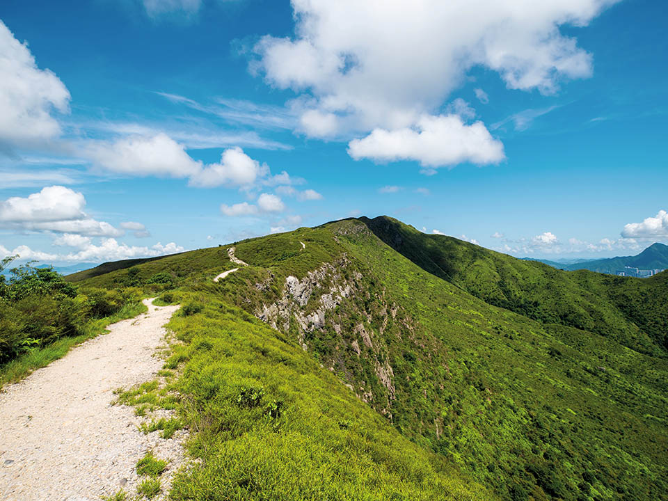
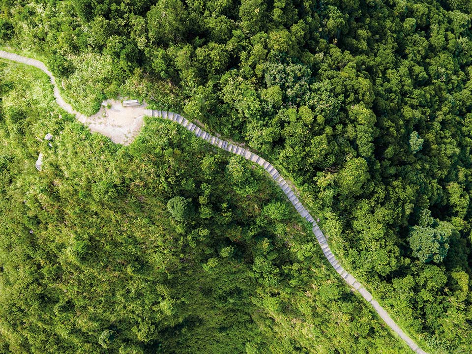
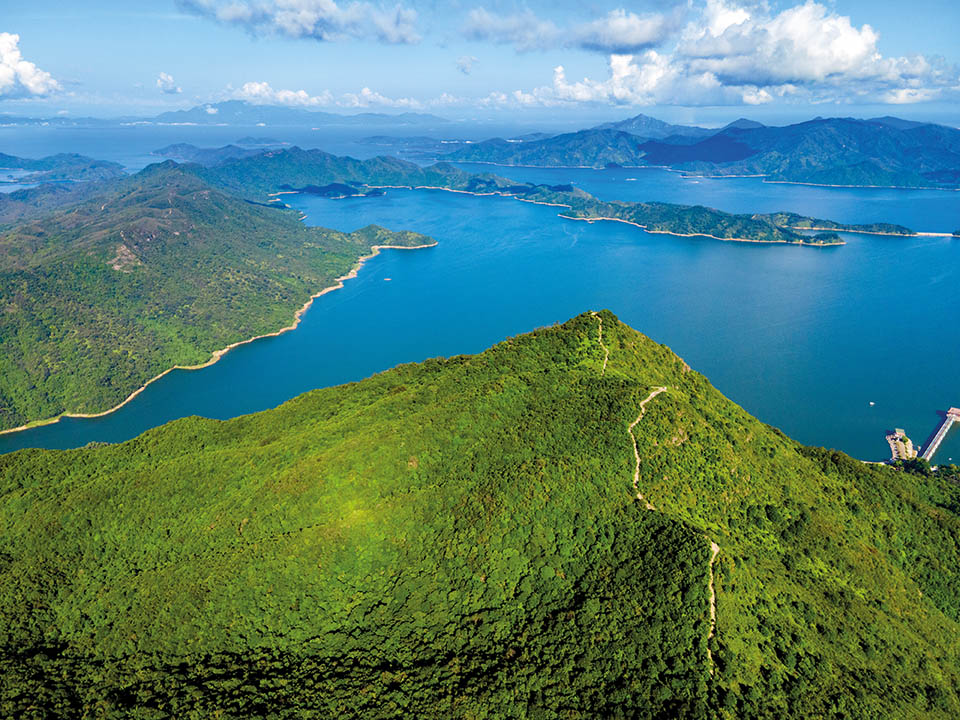
Rough-cut stone steps lead straight up from the reservoir and continue upwards until you have left the shade of the forest behind. It’s a steep, unrelenting climb, but you are rewarded at the top with a truly panoramic view of the green, rolling landscape around you. You will have a great side-on view of Ping Fung Shan, a ridge of craggy cliffs, before you move onwards to walk along their edge.
Get me there
-
Wong Leng
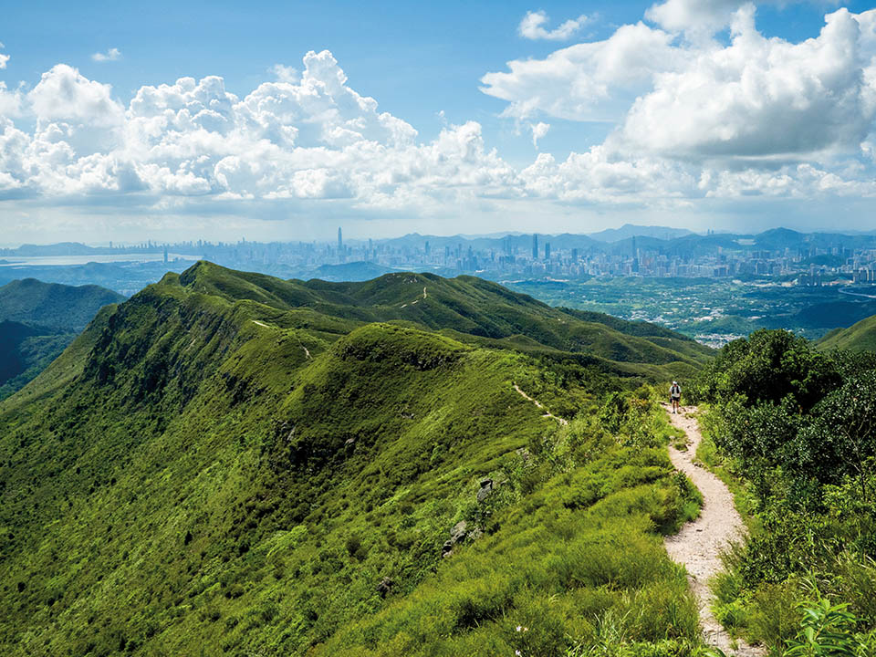
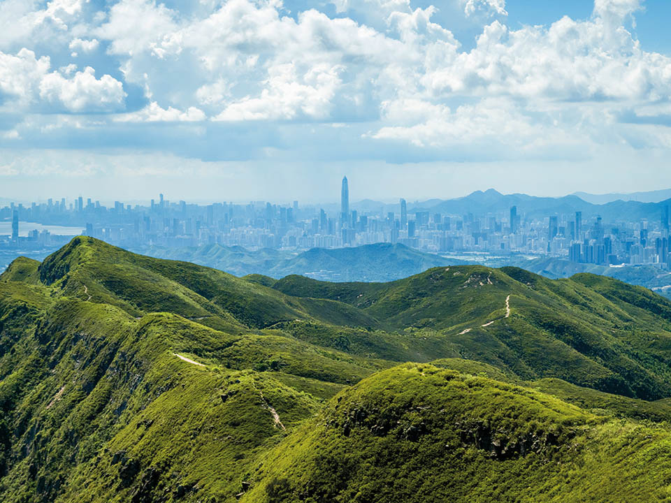
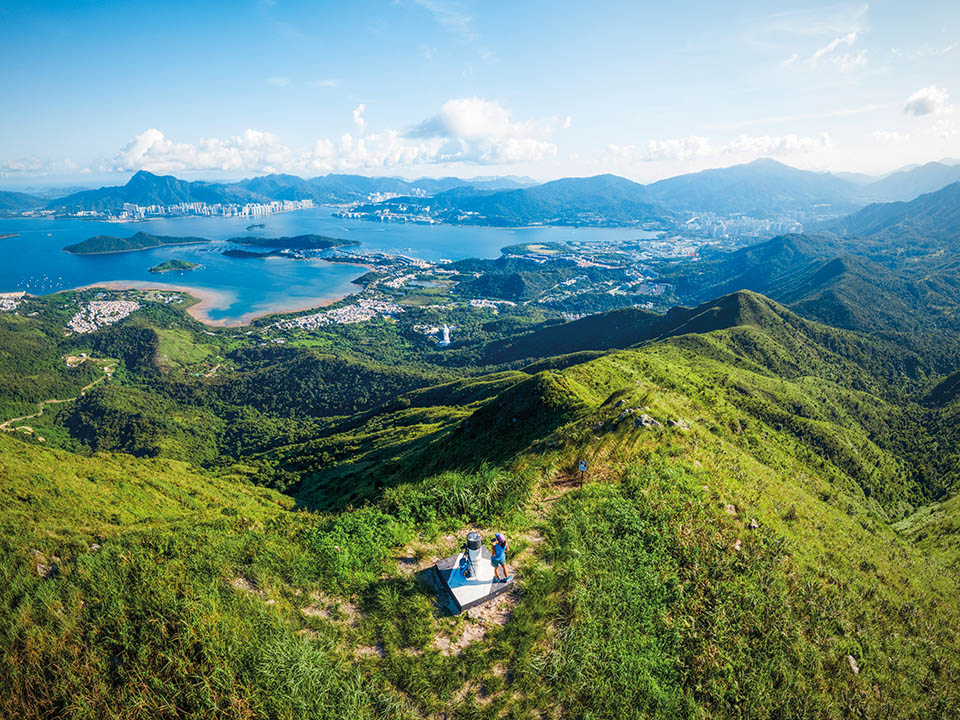
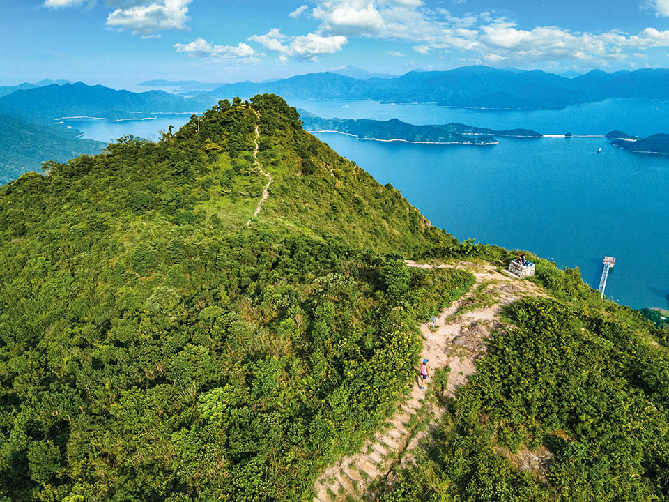
You must take a short detour from the path to reach the summit of Wong Leng, which at 639 metres, is the highest point on this hike. Suddenly, your view to the south opens up to reveal the wide, calm expanse of Tolo Harbour. Mangroves line its shores. Far below you, and looking small from up here, a giant Kwun Yam statue at Tsz Shan Monastery looks out to sea. Turn to the north, and your view stretches to the coast of Shenzhen.
Get me there
-
Pat Sin Leng
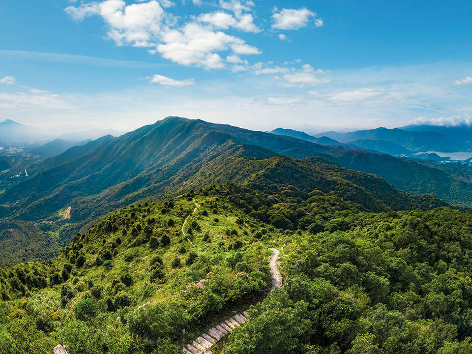
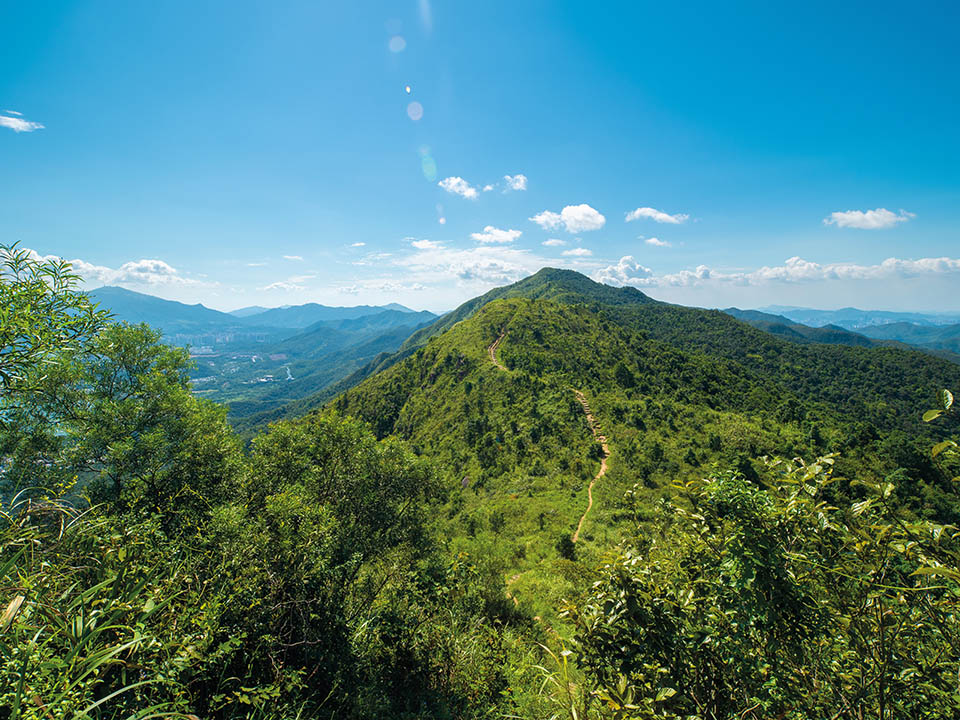
Shun Yeung Fung is the first peak of Pat Sin Leng or ‘ridge of the eight immortals’ — a row of eight peaks, each named after an immortal from Chinese mythology. Your legs may be feeling less than immortal at this stage, so take a breather. This is a good place to look back west at the spurs and ridges you have climbed to get this far; and then look east to see your trail snaking over the hilltops which still lie ahead.
Get me there
-
Kao Lao Fung
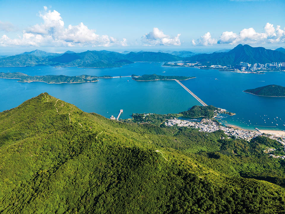
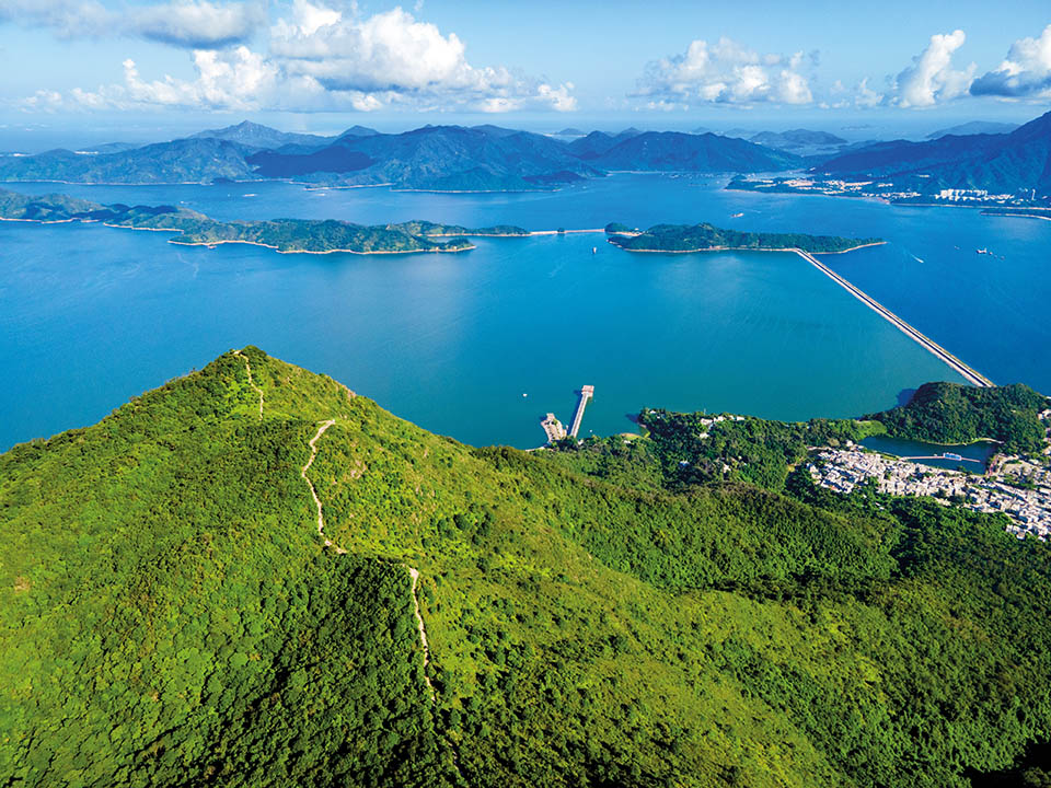
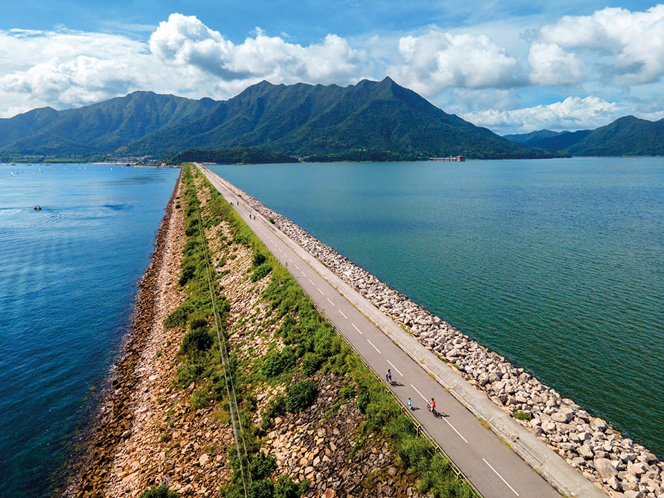
In between the toothlike peaks, you delve into sheltered highland valleys thick with foliage. When you reach Kao Lao Fung — the third peak of Pat Sin Leng — you are directly above the seaside village of Tai Mei Tuk. If the wind blows the right way, you can hear the sounds of people on the beach. Behind the 2 km-long dam, the Plover Cove Reservoir was the world’s first ‘reservoir in the sea’ which was built by closing off a sea inlet and filling it with fresh water.
Get me there
-
Hsien Ku Fung
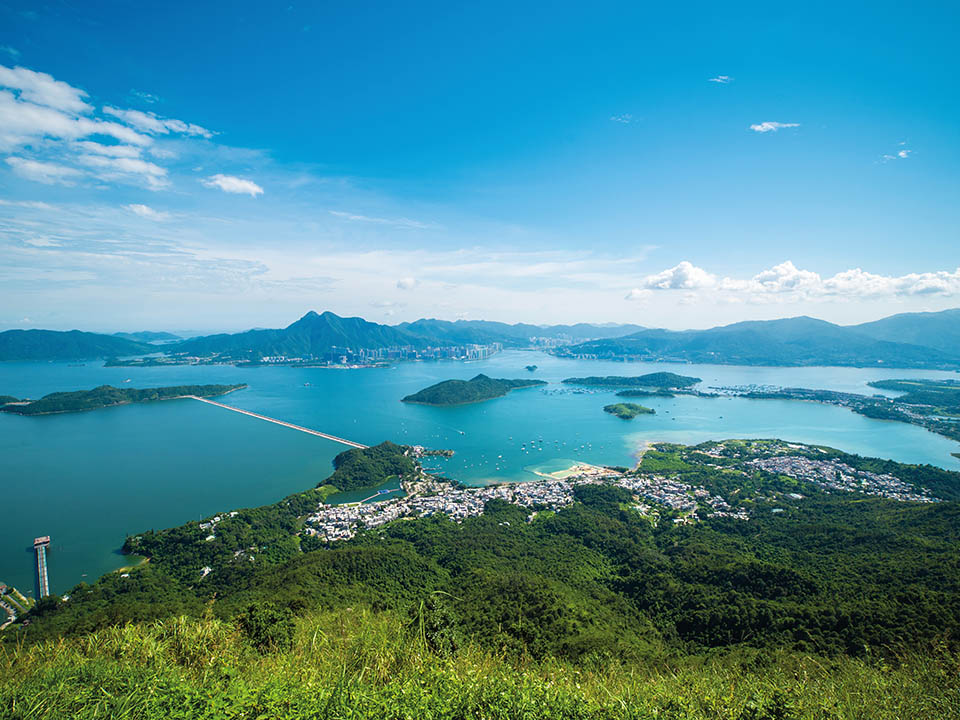
Slap yourself on the back, or ask one of your hiking friends to do so: you have reached the final peak of the Pat Sin Leng, no small achievement, and you can enjoy the view — and capture some Instagram-worthy photographs. From here you are looking out directly east, across Plover Cove to the green islands of Double Haven, and beyond to the open waters of the South China Sea. Perhaps take in the gorgeous landscape around you and start planning your next exploration.
Get me there
-
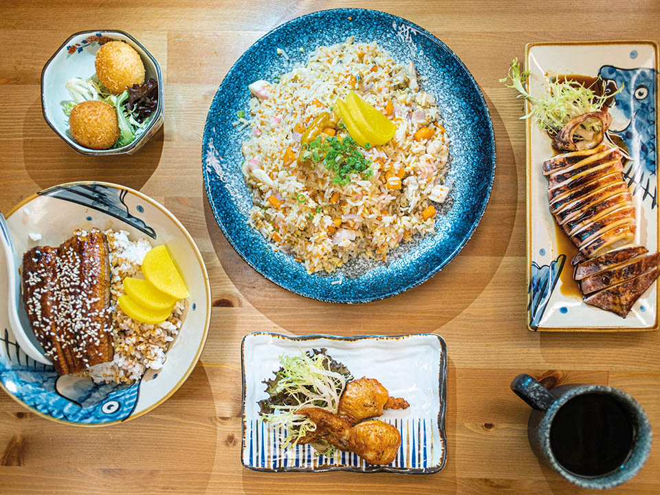
Dining Option
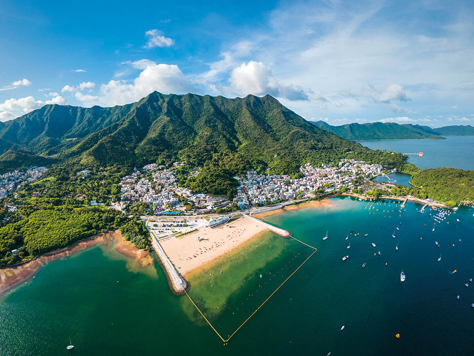
Tai Mei Tuk
People come to the area of Tai Mei Tuk to play water sports and cycle across Plover Cove Reservoir’s magnificent main dam. There are more than a dozen roadside restaurants — choose from Chinese, Thai, Western, Japanese or Italian. If you have time, you can walk up to the main dam to enjoy spectacular Instagram-worthy views of the reservoir on one side and Tolo Harbour on the other, or you can take a stroll on the newly opened Lung Mei Beach, to the west of Tai Mei Tuk.
Get me there

Transport
Getting to Hok Tau Reservoir:
From MTR Fanling Station Exit C, take minibus 52B to the final stop at the village of Hok Tau Wai. The driver may let you off at a pavilion on Hok Tau Road before turning into the village. Walk up the road for 20 minutes to reach the reservoir.
Leaving from Hsien Ku Fung:
Take the steps downhill and follow the Pat Sin Leng Nature Trail to Tai Mei Tuk. It’s a walk through dense forest which will take about an hour. When you are sufficiently recharged from your epic trek, take bus 75K / 75P (Saturdays only) / 275R (public holidays only) or minibus 20C back to MTR Tai Po Market Station.
More Routes

Adventure
Wilson Trail Section 9 — Hok Tau Reservoir to Pat Sin Leng: enjoy spectacular views on invigorating mountain trail that spans the wilderness
-
About 10 km
-
5–6 hours
-
Difficult
Written by South China Morning Post ( Morning Studio )
Ride safely
When cycling, please remember to always follow road safety regulations, wear proper protective gear and stay alert, especially on unfamiliar or busy routes, to ensure your safety and the safety of others on the road.
For more safe cycling information, please click here.
This high-altitude challenge in the northeastern New Territories rewards you with incomparable views over hillsides, forests and the sea. The country parks contain some of Hong Kong’s most rugged peaks. Exploring them is straightforward thanks to the city’s criss-crossing hiking network, including the Wilson Trail — stretching 78 km from Stanley Gap, on Hong Kong Island, to Nam Chung in the New Territories. Section 9 follows the Pat Sin Leng — or ‘ridge of the eight immortals’ — ridgeline linking eight peaks named after figures from Chinese folklore. This invigorating journey will ensure you discover a strikingly beautiful, yet surprisingly wild side of Hong Kong few see.
Refuel
There is a single drink vending machine on this route, somewhat hidden behind a tree on the left of the road, just as you start walking near Hok Tau Wai Pavilion. This is a challenging hike, so be sure to bring adequate supplies of water and snacks. You can stock up at convenience stores in MTR Fanling Station before you go.
Hok Tau Reservoir
You will hear the rush of water flowing over rocks before you arrive at the dam of the small, S-shaped Hok Tau Reservoir. This is a small freshwater pool hidden away at the head of a peaceful, wooded valley, built not to supply drinking water to the city but to irrigate the farmers’ fields below. It is also a major breeding ground for dragonflies and more than 70 species of butterflies. Turn left to walk across the stone dam. Boughs of trees hang right down to the water, as if they were drinking from the reservoir.
This hike is remote and largely unshaded, so it’s important that you bring enough water (more than 2 litres per person) and different kinds of sun protection: hat, sunglasses and sunscreen. Wear sturdy hiking shoes. The weather can change quickly in mountain areas, so light waterproof clothing may be useful. Charge your phone before setting out and bring a paper map, too. Make use of the Hong Kong Observatory’s trail weather service for the latest weather conditions of each route. Visit the Agriculture, Fisheries and Conservation Department’s website for more hiking safety tips.
Ping Fung Shan
Rough-cut stone steps lead straight up from the reservoir and continue upwards until you have left the shade of the forest behind. It’s a steep, unrelenting climb, but you are rewarded at the top with a truly panoramic view of the green, rolling landscape around you. You will have a great side-on view of Ping Fung Shan, a ridge of craggy cliffs, before you move onwards to walk along their edge.
Wong Leng
You must take a short detour from the path to reach the summit of Wong Leng, which at 639 metres, is the highest point on this hike. Suddenly, your view to the south opens up to reveal the wide, calm expanse of Tolo Harbour. Mangroves line its shores. Far below you, and looking small from up here, a giant Kwun Yam statue at Tsz Shan Monastery looks out to sea. Turn to the north, and your view stretches to the coast of Shenzhen.
Pat Sin Leng
Shun Yeung Fung is the first peak of Pat Sin Leng or ‘ridge of the eight immortals’ — a row of eight peaks, each named after an immortal from Chinese mythology. Your legs may be feeling less than immortal at this stage, so take a breather. This is a good place to look back west at the spurs and ridges you have climbed to get this far; and then look east to see your trail snaking over the hilltops which still lie ahead.
Kao Lao Fung
In between the toothlike peaks, you delve into sheltered highland valleys thick with foliage. When you reach Kao Lao Fung — the third peak of Pat Sin Leng — you are directly above the seaside village of Tai Mei Tuk. If the wind blows the right way, you can hear the sounds of people on the beach. Behind the 2 km-long dam, the Plover Cove Reservoir was the world’s first ‘reservoir in the sea’ which was built by closing off a sea inlet and filling it with fresh water.
Hsien Ku Fung
Slap yourself on the back, or ask one of your hiking friends to do so: you have reached the final peak of the Pat Sin Leng, no small achievement, and you can enjoy the view — and capture some Instagram-worthy photographs. From here you are looking out directly east, across Plover Cove to the green islands of Double Haven, and beyond to the open waters of the South China Sea. Perhaps take in the gorgeous landscape around you and start planning your next exploration.
Tai Mei Tuk
People come to the area of Tai Mei Tuk to play water sports and cycle across Plover Cove Reservoir’s magnificent main dam. There are more than a dozen roadside restaurants — choose from Chinese, Thai, Western, Japanese or Italian. If you have time, you can walk up to the main dam to enjoy spectacular Instagram-worthy views of the reservoir on one side and Tolo Harbour on the other, or you can take a stroll on the newly opened Lung Mei Beach, to the west of Tai Mei Tuk.
Transport
Getting to Hok Tau Reservoir:
From MTR Fanling Station Exit C, take minibus 52B to the final stop at the village of Hok Tau Wai. The driver may let you off at a pavilion on Hok Tau Road before turning into the village. Walk up the road for 20 minutes to reach the reservoir.
Leaving from Hsien Ku Fung:
Take the steps downhill and follow the Pat Sin Leng Nature Trail to Tai Mei Tuk. It’s a walk through dense forest which will take about an hour. When you are sufficiently recharged from your epic trek, take bus 75K / 75P (Saturdays only) / 275R (public holidays only) or minibus 20C back to MTR Tai Po Market Station.
 Live Chat


