
Speak now


I’m Sorry. I didn’t get that.
Written by South China Morning Post (Morning Studio)

Did you know?
Hong Kong Geopark became a member of the Global Geoparks Network in 2011 and renamed Hong Kong UNESCO Global Geopark in 2015.
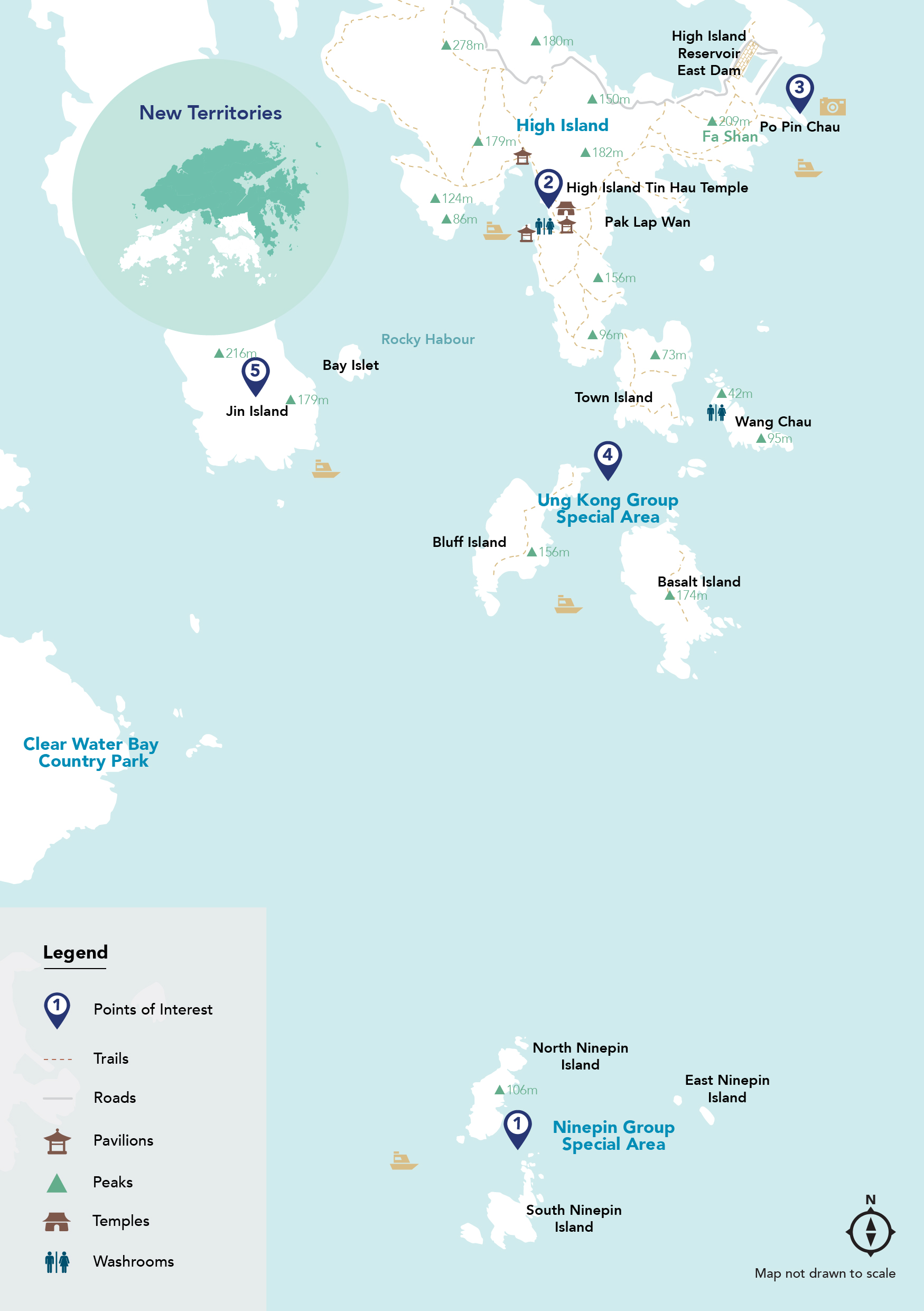
The huge land and sea area of the Sai Kung Peninsula is known for its spectacular rolling hills and country parks, uninhabited islands, white-sand beaches and breathtaking coastline, including towering cliffs featuring hexagonal volcanic rock columns, sea caves and arches. These geo-heritage delights can best be admired from the sea while taking a half-day boat trip from the coastal town of Sai Kung.
Located in the eastern part of Hong Kong, the Hong Kong UNESCO Global Geopark comprises two geological regions within its single, unified boundary: the Sai Kung Volcanic Rock Region and the Northeast New Territories Sedimentary Rock Region. Two separate clusters of islands and islets, Ung Kong Group and Ninepin Group, featuring globally rare hexagonal rock columns — Formed as the mixture of volcanic ash and lava cooled following a supervolcano eruption 140 million years ago — lie within the Geopark’s Sai Kung Volcanic Rock Region in Hong Kong’s southeastern waters, and they are not to be missed.
Feature Stories

Refuel
Make sure you take enough drinking water and snacks with you on the boat trip as High Island is the only stop that provides the chance to refuel. It features a farm breeding sea urchins and a village store serving the delicacy with fried rice, plus other seafood and traditional dishes, next to the Tin Hau temple at Tung A Village Pier.
-
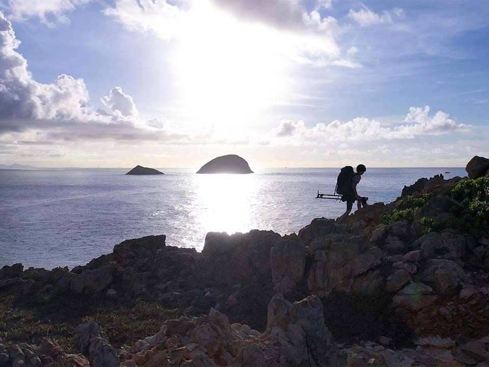
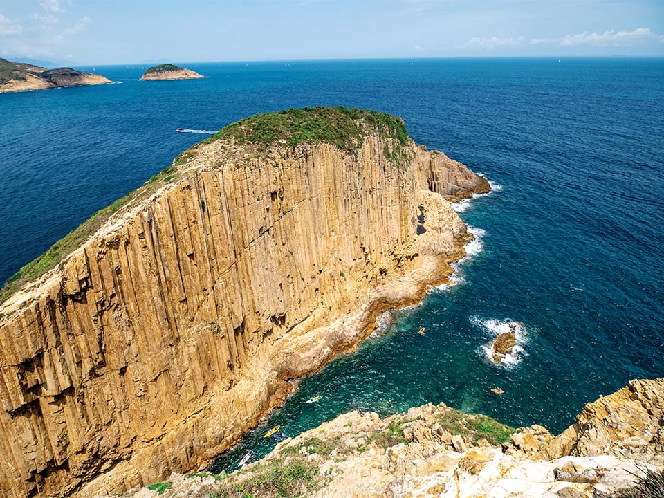
South and North Ninepin Islands
The first stop on your six-hour boat trip is the Ninepin Group of islands, comprising three large islands — North, South and East Ninepin Islands — and numerous smaller islets, known as Kwo Chau, or ‘Fruit Islands’ in Cantonese. This uninhabited archipelago, created from volcanic hexagonal rock formations, lies 15 km southeast of Sai Kung. The islands, which stand up out of the sea like a set of wooden pins in a bowling game (hence their English name), are known for their impressive sea- and wind-eroded coastlines.
North Ninepin is home to Big Cannon Rock, a gigantic hexagonal column rising horizontally from its east-coast cliff, while South Ninepin features Rock Chamber, a dramatic, horizontal, rectangular cave that is a favourite among Instagram photography buffs.
The Geopark’s volcanic columns — which differ in texture and chemical composition from similar rock formations elsewhere in the world — created cliffs that rise up to 100 metres high. Most columns are about 1.2 metres in diameter, but some can exceed 2 metres. The coastal waters around the Ninepins offer a sheltered habitat for a rich diversity of coral and more than 120 species of fish. The boat trip heads into the open sea, which can get choppy, so bring some motion sickness medicine just in case.
Some islands and coastal areas have no visitor facilities. They should only be observed from a boat. Don’t go ashore or visit them when there are strong easterly winds. To avoid accidents, don’t climb on outcrops, slopes or rocky shores. Visit the Hong Kong Geopark website to learn more about the ‘Guidelines for Visiting Geopark’.Get me there
-
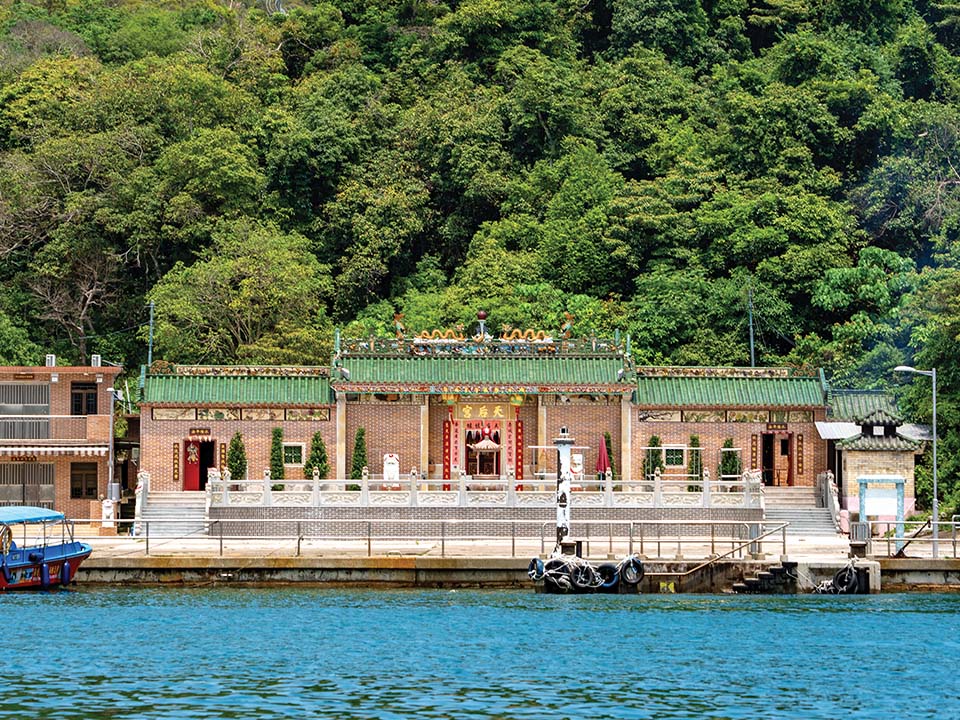
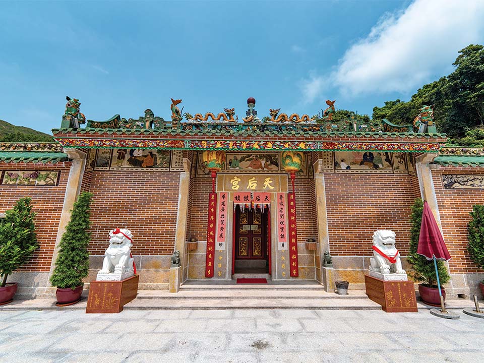
High Island Tin Hau Temple
High Island, or Leung Shuen Wan, situated 10 km north of the Ninepin Group, lost its status as an island of a few fishing villages in 1978, when it was connected to the Sai Kung Peninsula by dams built to create High Island Reservoir.
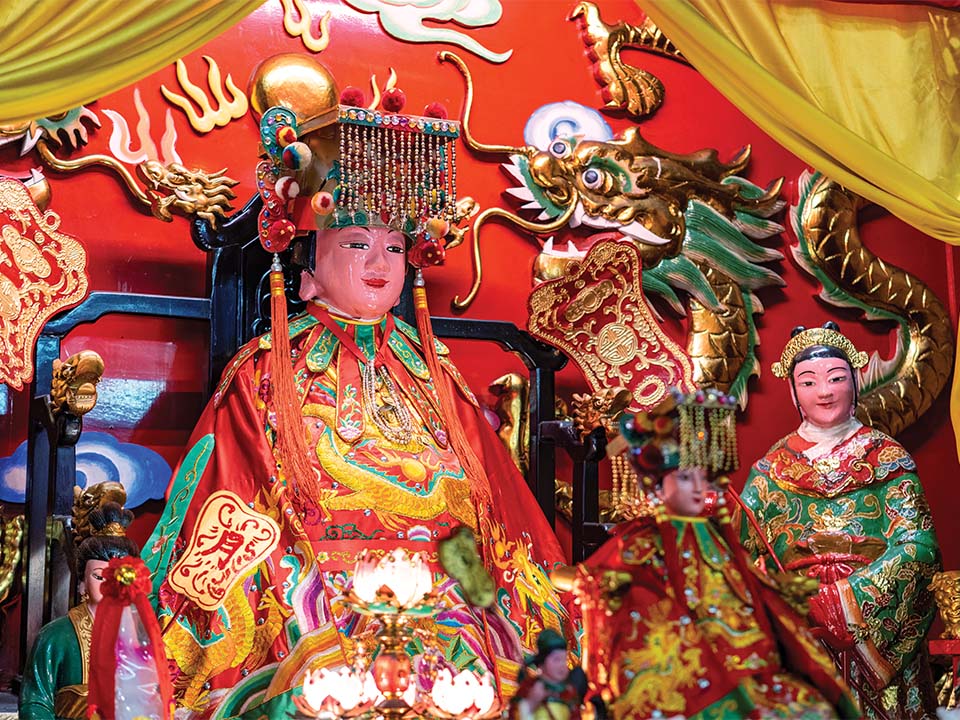
The boat will moor at High Island Public Pier, located beside a colourful Tin Hau temple built during the Qing (1644-1911) dynasty. Before the 1940s, this house of worship — which features a tiny, charming garden area — doubled as the local school. Its biennial Tin Hau Festival held during the third lunar month — marked by Cantonese opera performances and religious rituals and a sea parade featuring a statue of the ‘Goddess of the Sea’ — has been listed as an example of Hong Kong Intangible Cultural Heritage. The island’s sea urchin farm offers fresh produce, with the delicacy best enjoyed as an ingredient of aromatic fried rice.
Sai Kung Town is a popular starting point for people keen to see the Geopark’s hexagonal volcanic rock formations by boat. You can learn about the area’s volcanic history at the Hong Kong UNESCO Global Geopark Volcano Discovery Centre, near Sai Kung Public Pier, before you go. Visit the official website to learn more.
Get me there
-
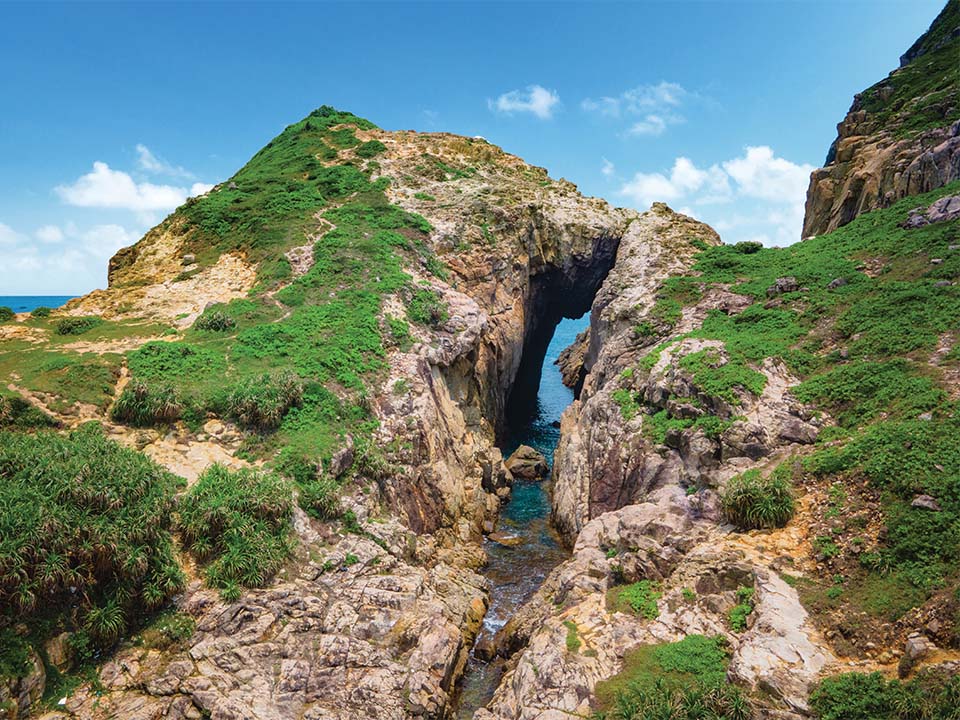
Po Pin Chau
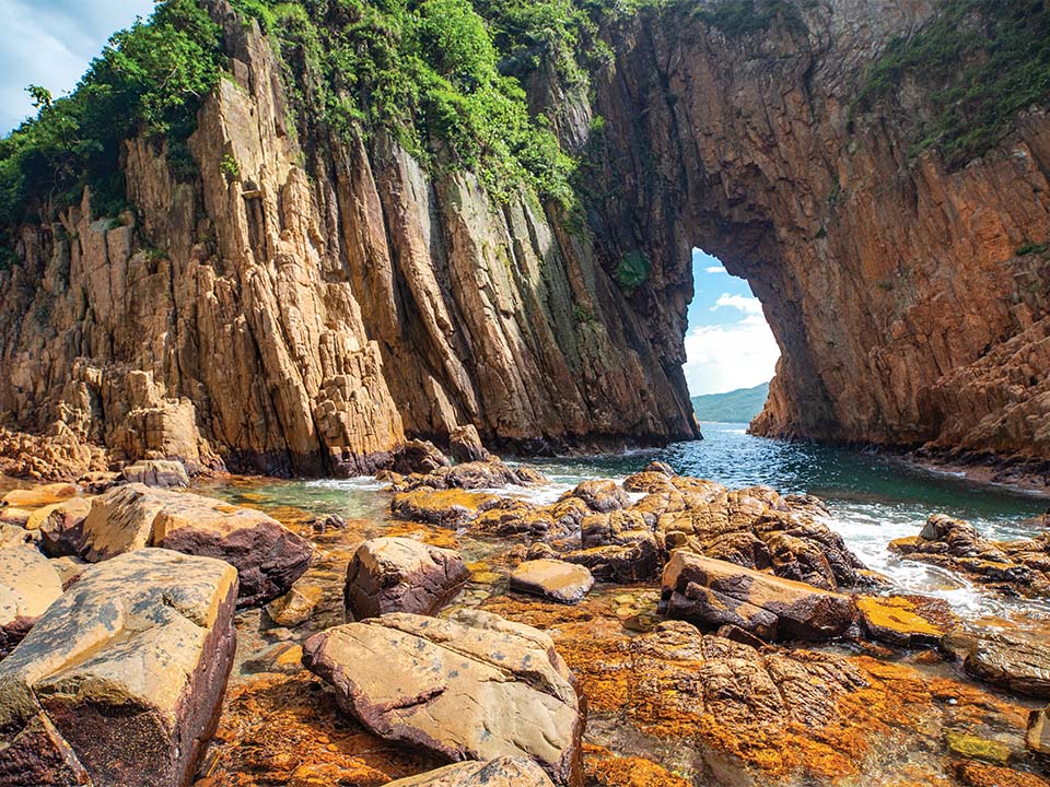
A short boat ride from the public pier will bring you to the dramatic rock formation of Po Pin Chau. This triangular sea stack, which looks like a giant ‘room divider’, is formed of hundreds of interconnected volcanic hexagonal rock columns. It stands 200 metres wide and 63 metres high, and was separated from the Fa Shan (‘Flower Mountain’) headland by sea erosion.
If the sea is relatively calm, your boat will be able to go near the outcrop, providing you with a great Instagram-worthy photo opportunity. From the boat, you will also be able to see visitors hiking along nearby High Island Reservoir East Dam, which offer insights into Instagram-friendly delights including towering cliff faces lined with hexagonal rock columns, mysterious caves and sea stacks.
Check the weather forecast before you depart, and avoid visiting the Geopark during bad weather. Wear clothing suitable for outdoor activities, including hats and sunglasses, and bring sun protection and waterproof gear.
Get me there
-
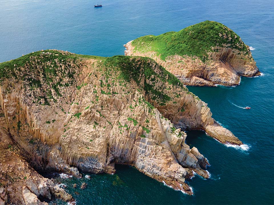
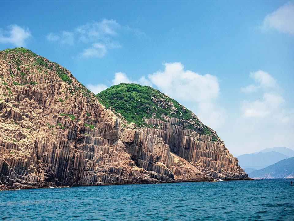
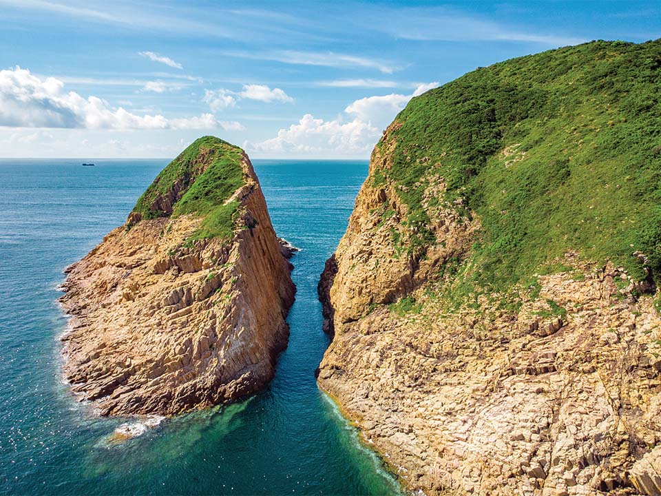
Ung Kong Group
The cluster of islands known as Ung Kong Group, consisting of Bluff Island, Wang Chau and Basalt Island, lies off the southern tip of High Island, not far from Po Pin Chau.
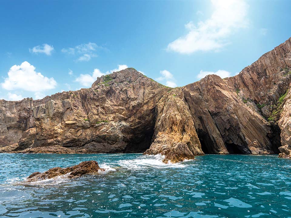
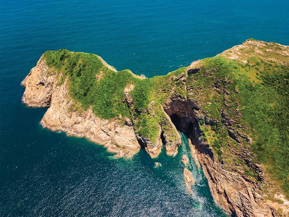
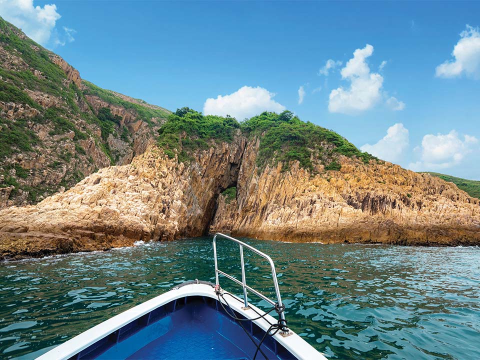
The sight of the dramatic craggy island coastlines, which tower more than 100 metres above sea level, will whisk you and your imagination off to another world. Every turn of the boat will conjure up the view of a different sea cave or impressive rocky outcrop.
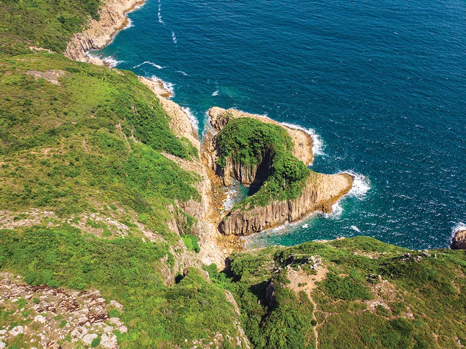
Lam Wan Kok Cave, on the eastern shore of Basalt Island, which looks like the blade of a giant sword, is one of the largest sea arches on the three islands. Its appearance has earned it the nickname of ‘Guan Gong Knife Cave’, in reference to Guan Gong, the Chinese God of War.
A ride around the uninhabited Bluff Island, the westernmost island of the three, offers some of the most spectacular views of the cliffs along the coastline, including a tall, thin otherworldly outcrop nicknamed ‘praying hand rock’ that would not look out of place in a fantasy land.Get me there
-
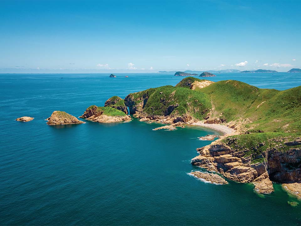
Jin Island
The last stop of the boat tour is at Jin Island, or Tiu Chung Chau (which means ‘church bell island’ in Cantonese), to the northwest of Bluff Island. Jin Island got its Chinese name from a bell-shaped sea arch at its southern end.
The northern tip of this island is literally a stone’s throw from Kau Sai Village on the eponymous neighbouring island, but arguably its most famous site is near the southern end — a rock arch nicknamed ‘goldfish wagging tail’, in reference to its shape on maps of the area.
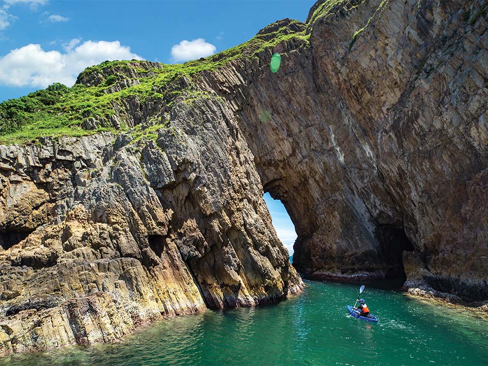
This part of the island is also the site of many impressive sea caves, which have been slowly carved by the motion of waves over thousands of years. You are likely to see kayakers paddling along in the coastal waters at weekends.Get me there
-
Dining Option
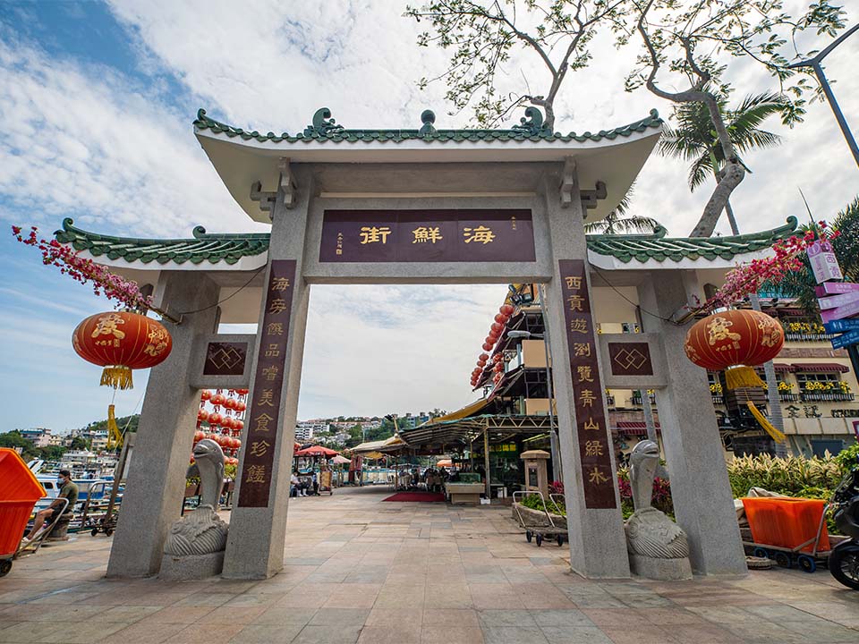
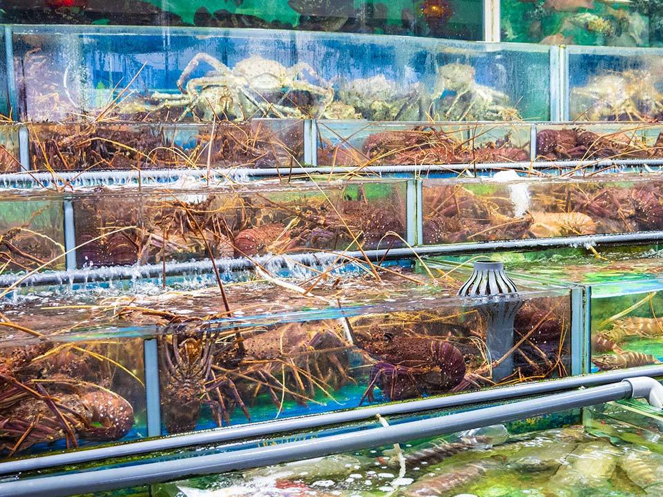
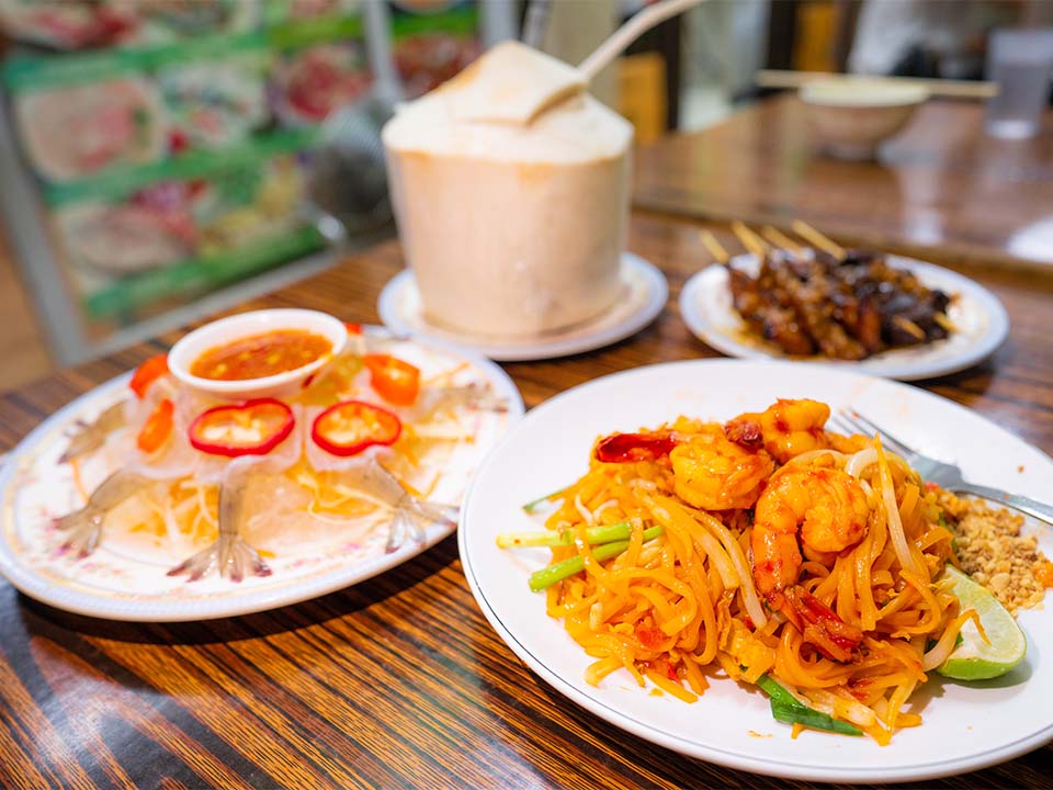
Sai Kung Town Centre
Sai Kung Waterfront Park is home to a selection of restaurants and bars. But the promenade, Sai Kung Main Street, and numerous side streets close to the Tin Hau temple also offer many trendy restaurants, cafes and cha chaan tengs. The lively alleyways near the minibus terminal, close to Sai Kung Public Pier, are also full of eateries serving a vast range of popular Western and Eastern cuisines, including pizzas, Thai curries, English fish and chips and Turkish kebabs.
Get me there

Transport
Getting to Sai Kung Town Centre:
Take any public transport to Sai Kung Town Centre (for instance, bus 92 from MTR Diamond Hill Station or bus 299X from Sha Tin Central Bus Terminus). You will find the Volcano Discovery Centre at Sai Kung Waterfront Park, next to the Sai Kung Bus Terminus.
Leaving from Sai Kung Town Centre:
After being dropped off at Sai Kung Town, you can take any of the same buses and minibuses to travel back to the city centre.

Local Tour
To visit the Geopark, you can charter a boat or join one of the guided boat tours. There is a list of Recommended Geopark Guides and Accredited Geopark Guides on the Geopark’s official website. A few of the recommended local operators provide regular group tours to Ung Kong and Ninepin Islands.
ECO Travel Limited
Website: http://www.ecotravel.hk/en/home-en/
Email: enquiry@ecotravel.hk
Phone: +852 3105 0767
Disclaimer:
Details of the local tours are subject to the terms and conditions of the operators. The Hong Kong Tourism Board and the local operators reserve the right to amend, change or cancel any details concerning the tours at any time without prior notice. Customers can refer to the local operators if they have any enquiries.
More Routes
Written by South China Morning Post (Morning Studio)
Did you know?
Hong Kong Geopark became a member of the Global Geoparks Network in 2011 and renamed Hong Kong UNESCO Global Geopark in 2015.
The huge land and sea area of the Sai Kung Peninsula is known for its spectacular rolling hills and country parks, uninhabited islands, white-sand beaches and breathtaking coastline, including towering cliffs featuring hexagonal volcanic rock columns, sea caves and arches. These geo-heritage delights can best be admired from the sea while taking a half-day boat trip from the coastal town of Sai Kung.
Located in the eastern part of Hong Kong, the Hong Kong UNESCO Global Geopark comprises two geological regions within its single, unified boundary: the Sai Kung Volcanic Rock Region and the Northeast New Territories Sedimentary Rock Region. Two separate clusters of islands and islets, Ung Kong Group and Ninepin Group, featuring globally rare hexagonal rock columns — Formed as the mixture of volcanic ash and lava cooled following a supervolcano eruption 140 million years ago — lie within the Geopark’s Sai Kung Volcanic Rock Region in Hong Kong’s southeastern waters, and they are not to be missed.
Feature Stories
Refuel
Make sure you take enough drinking water and snacks with you on the boat trip as High Island is the only stop that provides the chance to refuel. It features a farm breeding sea urchins and a village store serving the delicacy with fried rice, plus other seafood and traditional dishes, next to the Tin Hau temple at Tung A Village Pier.
South and North Ninepin Islands
The first stop on your six-hour boat trip is the Ninepin Group of islands, comprising three large islands — North, South and East Ninepin Islands — and numerous smaller islets, known as Kwo Chau, or ‘Fruit Islands’ in Cantonese. This uninhabited archipelago, created from volcanic hexagonal rock formations, lies 15 km southeast of Sai Kung. The islands, which stand up out of the sea like a set of wooden pins in a bowling game (hence their English name), are known for their impressive sea- and wind-eroded coastlines.
North Ninepin is home to Big Cannon Rock, a gigantic hexagonal column rising horizontally from its east-coast cliff, while South Ninepin features Rock Chamber, a dramatic, horizontal, rectangular cave that is a favourite among Instagram photography buffs.
The Geopark’s volcanic columns — which differ in texture and chemical composition from similar rock formations elsewhere in the world — created cliffs that rise up to 100 metres high. Most columns are about 1.2 metres in diameter, but some can exceed 2 metres. The coastal waters around the Ninepins offer a sheltered habitat for a rich diversity of coral and more than 120 species of fish.
The boat trip heads into the open sea, which can get choppy, so bring some motion sickness medicine just in case.
Some islands and coastal areas have no visitor facilities. They should only be observed from a boat. Don’t go ashore or visit them when there are strong easterly winds. To avoid accidents, don’t climb on outcrops, slopes or rocky shores. Visit the Hong Kong Geopark website to learn more about the ‘Guidelines for Visiting Geopark’.
High Island Tin Hau Temple
High Island, or Leung Shuen Wan, situated 10 km north of the Ninepin Group, lost its status as an island of a few fishing villages in 1978, when it was connected to the Sai Kung Peninsula by dams built to create High Island Reservoir.
The boat will moor at High Island Public Pier, located beside a colourful Tin Hau temple built during the Qing (1644-1911) dynasty. Before the 1940s, this house of worship — which features a tiny, charming garden area — doubled as the local school. Its biennial Tin Hau Festival held during the third lunar month — marked by Cantonese opera performances and religious rituals and a sea parade featuring a statue of the ‘Goddess of the Sea’ — has been listed as an example of Hong Kong Intangible Cultural Heritage. The island’s sea urchin farm offers fresh produce, with the delicacy best enjoyed as an ingredient of aromatic fried rice.
Sai Kung Town is a popular starting point for people keen to see the Geopark’s hexagonal volcanic rock formations by boat. You can learn about the area’s volcanic history at the Hong Kong UNESCO Global Geopark Volcano Discovery Centre, near Sai Kung Public Pier, before you go. Visit the official website to learn more.
Po Pin Chau
A short boat ride from the public pier will bring you to the dramatic rock formation of Po Pin Chau. This triangular sea stack, which looks like a giant ‘room divider’, is formed of hundreds of interconnected volcanic hexagonal rock columns. It stands 200 metres wide and 63 metres high, and was separated from the Fa Shan (‘Flower Mountain’) headland by sea erosion.
If the sea is relatively calm, your boat will be able to go near the outcrop, providing you with a great Instagram-worthy photo opportunity. From the boat, you will also be able to see visitors hiking along nearby High Island Reservoir East Dam, which offer insights into Instagram-friendly delights including towering cliff faces lined with hexagonal rock columns, mysterious caves and sea stacks.
Check the weather forecast before you depart, and avoid visiting the Geopark during bad weather. Wear clothing suitable for outdoor activities, including hats and sunglasses, and bring sun protection and waterproof gear.
Ung Kong Group
The cluster of islands known as Ung Kong Group, consisting of Bluff Island, Wang Chau and Basalt Island, lies off the southern tip of High Island, not far from Po Pin Chau.
The sight of the dramatic craggy island coastlines, which tower more than 100 metres above sea level, will whisk you and your imagination off to another world. Every turn of the boat will conjure up the view of a different sea cave or impressive rocky outcrop.
Lam Wan Kok Cave, on the eastern shore of Basalt Island, which looks like the blade of a giant sword, is one of the largest sea arches on the three islands. Its appearance has earned it the nickname of ‘Guan Gong Knife Cave’, in reference to Guan Gong, the Chinese God of War.
A ride around the uninhabited Bluff Island, the westernmost island of the three, offers some of the most spectacular views of the cliffs along the coastline, including a tall, thin otherworldly outcrop nicknamed ‘praying hand rock’ that would not look out of place in a fantasy land.
Jin Island
The last stop of the boat tour is at Jin Island, or Tiu Chung Chau (which means ‘church bell island’ in Cantonese), to the northwest of Bluff Island. Jin Island got its Chinese name from a bell-shaped sea arch at its southern end.
The northern tip of this island is literally a stone’s throw from Kau Sai Village on the eponymous neighbouring island, but arguably its most famous site is near the southern end — a rock arch nicknamed ‘goldfish wagging tail’, in reference to its shape on maps of the area.
This part of the island is also the site of many impressive sea caves, which have been slowly carved by the motion of waves over thousands of years. You are likely to see kayakers paddling along in the coastal waters at weekends.
Sai Kung Town Centre
Sai Kung Waterfront Park is home to a selection of restaurants and bars. But the promenade, Sai Kung Main Street, and numerous side streets close to the Tin Hau temple also offer many trendy restaurants, cafes and cha chaan tengs. The lively alleyways near the minibus terminal, close to Sai Kung Public Pier, are also full of eateries serving a vast range of popular Western and Eastern cuisines, including pizzas, Thai curries, English fish and chips and Turkish kebabs.
Transport
Getting to Sai Kung Town Centre:
Take any public transport to Sai Kung Town Centre (for instance, bus 92 from MTR Diamond Hill Station or bus 299X from Sha Tin Central Bus Terminus). You will find the Volcano Discovery Centre at Sai Kung Waterfront Park, next to the Sai Kung Bus Terminus.
Leaving from Sai Kung Town Centre:
After being dropped off at Sai Kung Town, you can take any of the same buses and minibuses to travel back to the city centre.
Local Tour
To visit the Geopark, you can charter a boat or join one of the guided boat tours. There is a list of Recommended Geopark Guides and Accredited Geopark Guides on the Geopark’s official website. A few of the recommended local operators provide regular group tours to Ung Kong and Ninepin Islands.
ECO Travel Limited
Website: http://www.ecotravel.hk/en/home-en/
Email: enquiry@ecotravel.hk
Phone: +852 3105 0767
Disclaimer:
Details of the local tours are subject to the terms and conditions of the operators. The Hong Kong Tourism Board and the local operators reserve the right to amend, change or cancel any details concerning the tours at any time without prior notice. Customers can refer to the local operators if they have any enquiries.
 Live Chat


