
Speak now


I’m Sorry. I didn’t get that.

Average hiking time: About 6 hours | Distance: About 16 km | Difficulty: Very Difficult
The first two sections of the famous MacLehose Trail set a rhythm of alternating peak and beach. Let the waves refresh you before you turn your feet towards the next rise, where the sounds of the sea drop away again to leave you with your own laboured breathing.
Take a glimpse of the MacLehose Trail through trail running
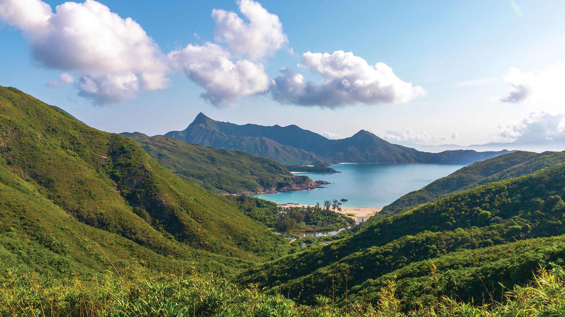
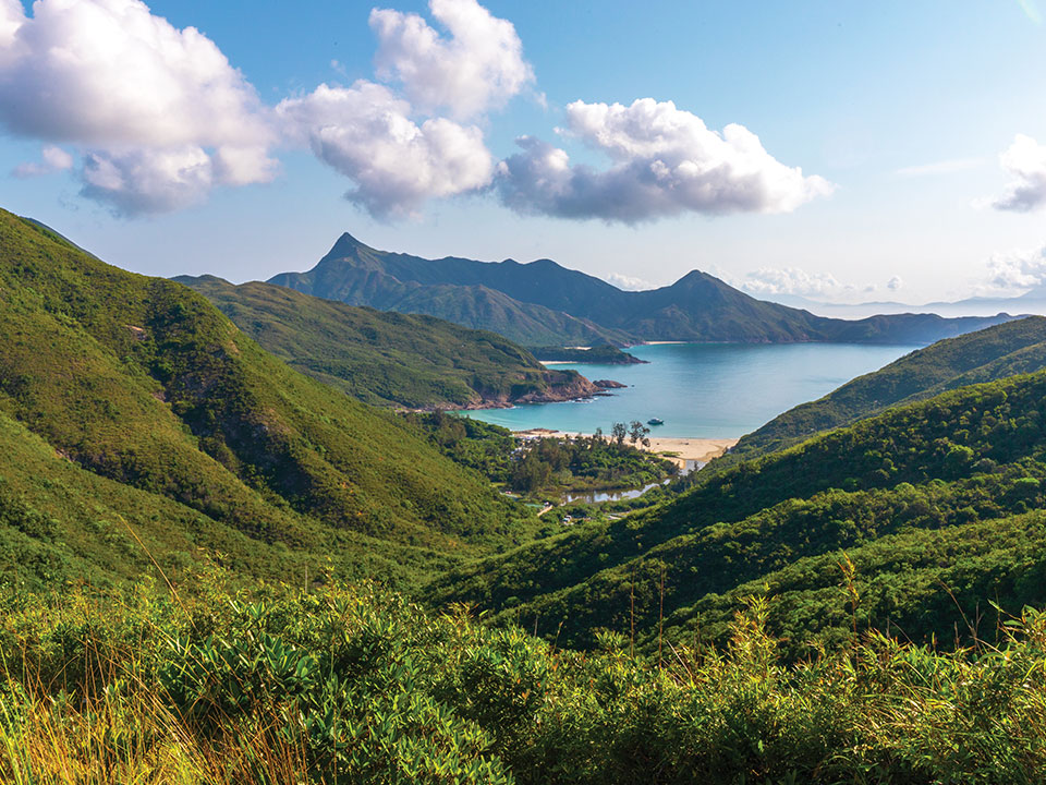
Stop 1: High Island Reservoir East Dam
Begin at High Island Reservoir East Dam and make sure you walk along the High Island Geo Trail to see the hexagonal rock columns formed over 140 million years ago. You can also take a detour to Biu Tsim Kok, which offers a view over the pristine white-sand beach of Long Ke Wan.
Stop 2: Long Ke Wan
Descend into Long Ke Wan, a secluded bay protected by stunning cliffs, silent save for a modest surf breaking on the sands.
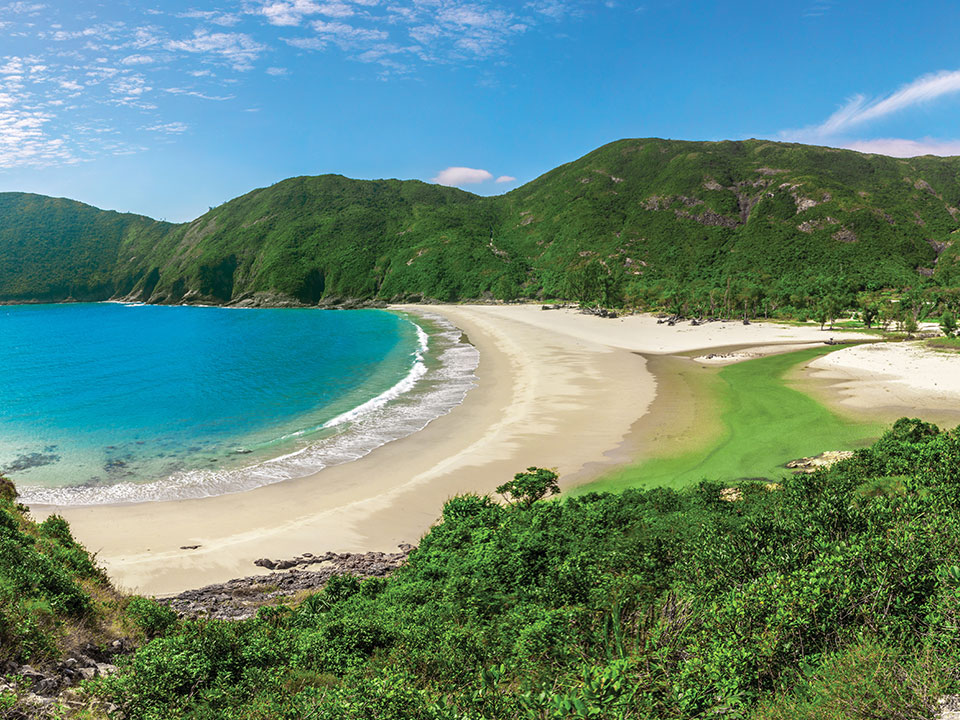
Stop 3: Sai Wan
Long Ke Wan is followed by a tough climb, affording sweeping views of the country park as you head for Sai Wan.
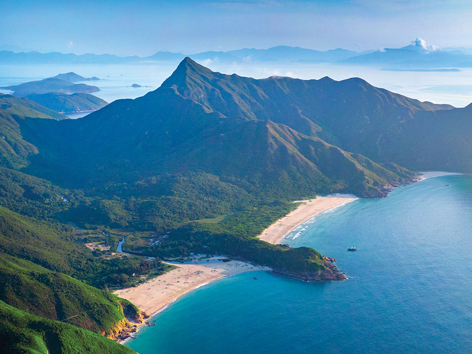
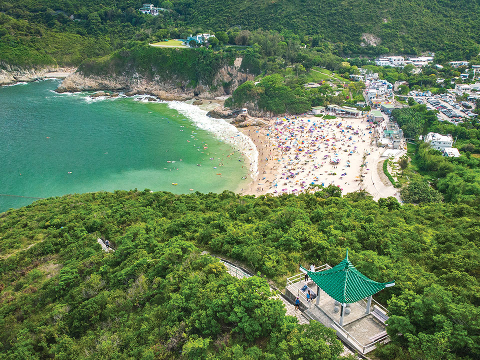
Stop 4: Ham Tin Wan
Widely considered Hong Kong’s most spectacular beach, at Ham Tin Wan often the waves are the only sound.
Refuel
There are a few cafes and village stores in Sai Wan and Ham Tin Wan.
Stop 5: Pak Tam Au
Keep going until you reach Pak Tam Au. This is the end of MacLehose Trail Section 2.
Getting to High Island Reservoir East Dam
- From MTR Diamond Hill Station Exit C2, take bus 92 to Sai Kung Town, then a taxi to East Dam.
- From Sha Tin New Town Plaza Bus Terminus, take bus 299X to Sai Kung Town, then a taxi to East Dam.
- From MTR Hang Hau Station Exit B1, take minibus 101M to Sai Kung Town, then a taxi to East Dam.
Leaving from Pak Tam Au
- From Pak Tam Au, take bus 96R to MTR Diamond Hill Station (Sundays and public holidays only).
- Take bus 94 or minibus 7 back to Sai Kung Town.
Can't get enough of Sai Kung? Your post-hike adventures await here.
Information in this article is subject to change without advance notice. Please contact the relevant product or service providers for enquiries.
The Hong Kong Tourism Board disclaims any liability as to the quality or fitness for purpose of third party products and services; and makes no representation or warranty as to the accuracy, adequacy or reliability of any information contained herein.
 Live Chat


