Speak now


I’m Sorry. I didn’t get that.
About Lai Chi Chong and Tap Mun
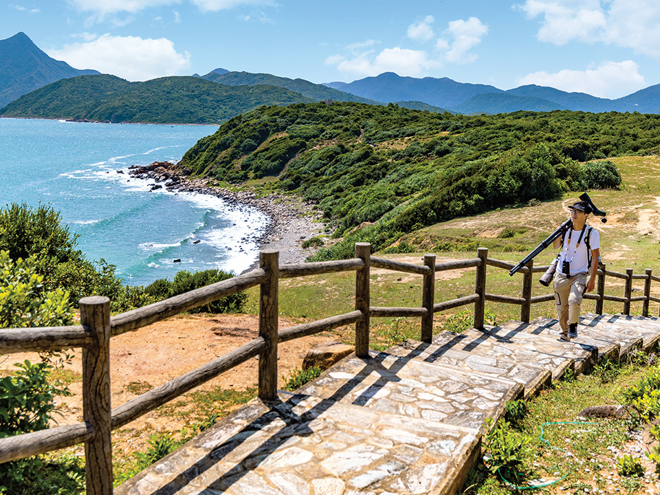
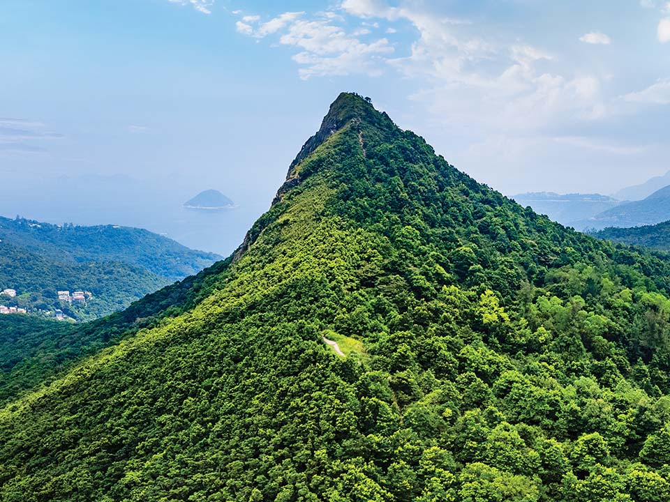
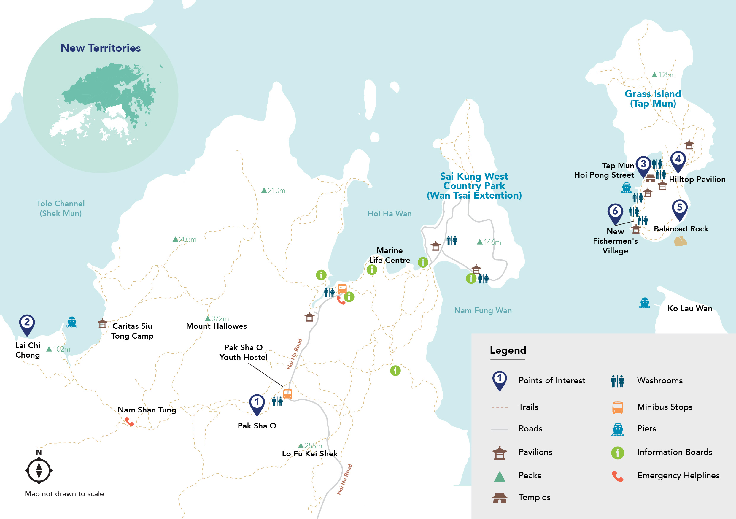
Nestled in the northeastern New Territories, the mountainous Sai Kung West Country Park and nearby islands around Tolo Channel offer wonderful outdoor experiences, thanks to great hiking trails and reliable kaito ferry services. They are part of the Hong Kong UNESCO Global Geopark’s internationally significant geological sites and landscapes, as well as protected environmental sites.
The 3,000-hectare country park and islands are also home to picturesque rolling hills, plateaus, and many old rural settlements bordered by feng shui woods. To explore the beautiful nature and the rich culture and history of the area, start with a hike from the Hakka village of Pak Sha O to Lai Chi Chong, a geosite famous for spectacular rock formations — and Instagrammable photo opportunities. Then, hop on a kaito to Tap Mun (Grass Island), home to a peaceful fishing village with seafood restaurants that offer a taste of its fine culinary culture.

Refuel
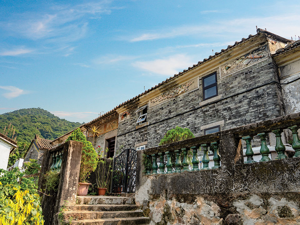
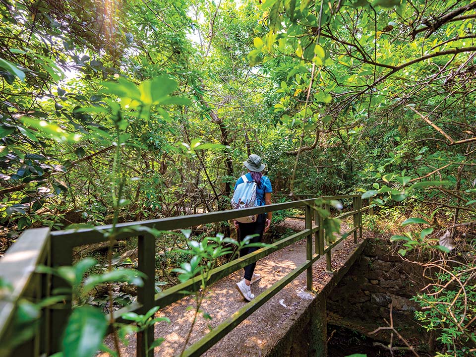
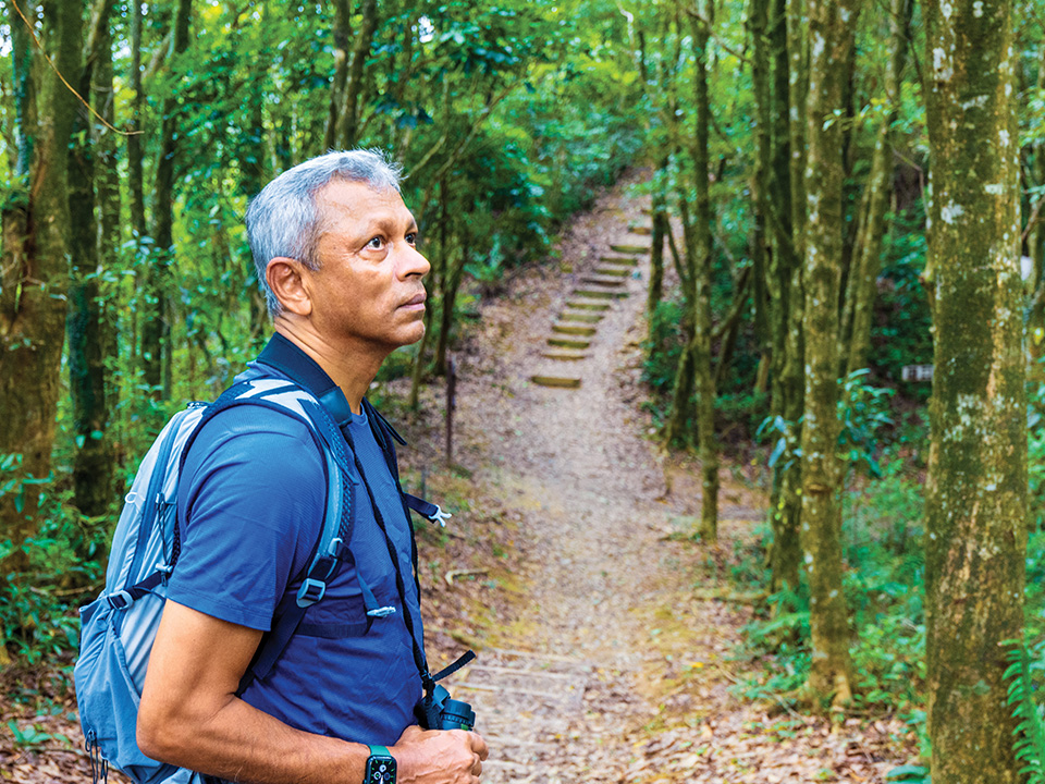
Situated in a densely wooded valley, Pak Sha O is a popular starting point for exploring the Sai Kung West Country Park on foot. It’s home to one of Hong Kong’s best-preserved 19th-century Hakka villages, where some of the houses, such as the former Ho Residence and Ho Ancestral Hall, are listed as Grade 1 historic buildings. While much of the village may seem uninhabited, a few houses along the trail to Lai Chi Chong are still in use, so be mindful not to make too much noise or cause disturbances. Walking around the tranquil area can be a relaxing experience: immerse yourself in the lush greenery and listen to the soothing music of nature — think birdsong and the calming sounds of water from a nearby stream. You may even see herds of cows chilling out by the trail.
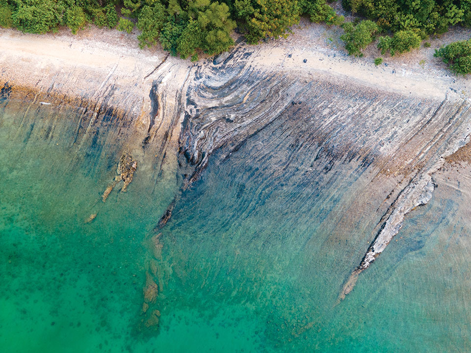
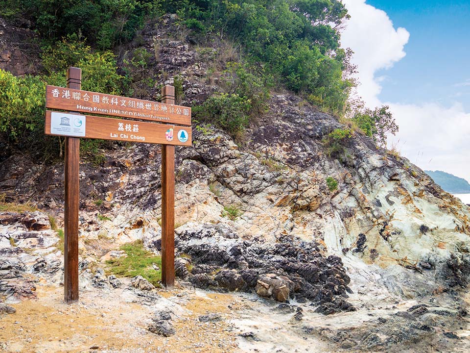
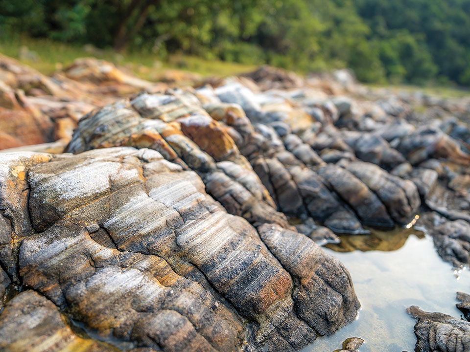
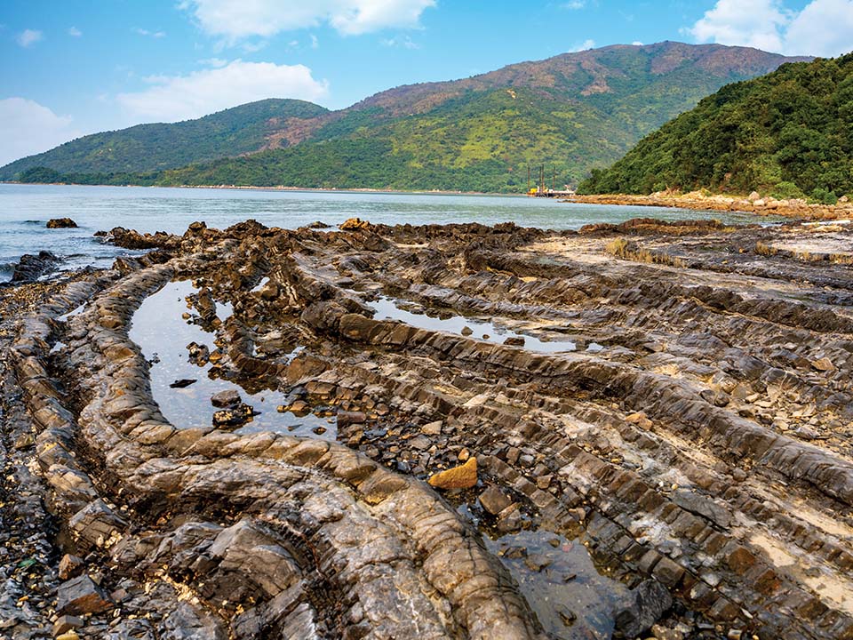
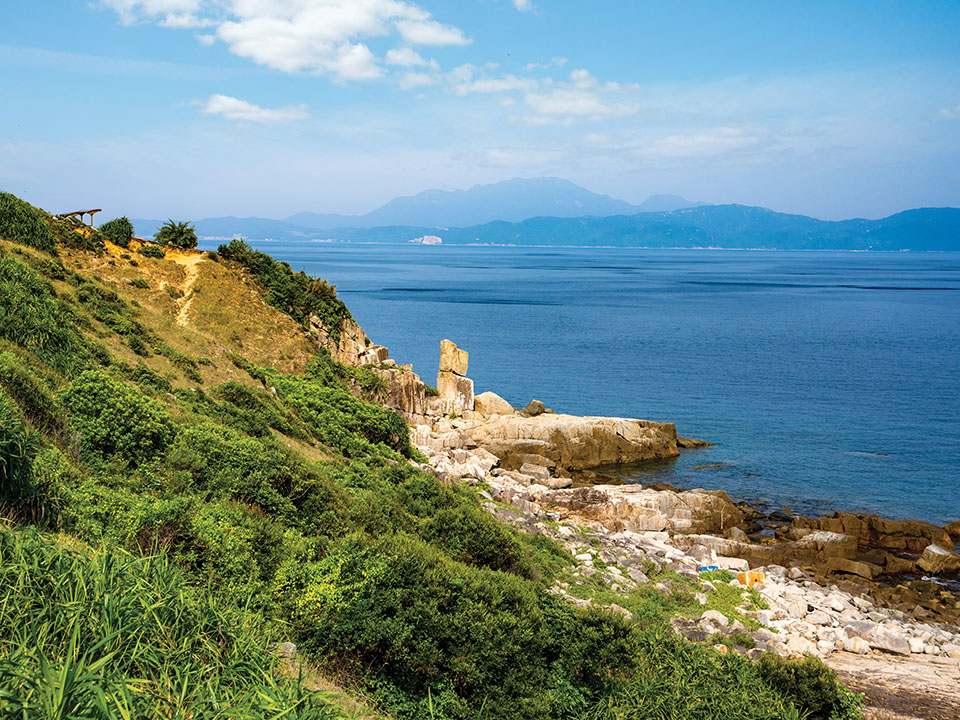
In just over an hour, you’ll arrive at one of the city’s most significant geosites, Lai Chi Chong. Here, you’ll find various rock types, including the rare volcaniclastic sedimentary rock, formed around 146 million years ago from falling volcanic ash that was mixed with silt and other organic deposits in a lake. Starting from the ‘Hong Kong UNESCO Global Geopark’ sign, the one-kilometre circular walk along the coast feels like a visit to a ‘geological cake shop’. There are marble cake-like tuffites, mini-faults (horizontally rolled-up layers of rock) that resemble mille-feuilles, and at the midpoint, a boulder field that looks like a platter of dark chocolate truffles. The walk also features rocks patterned with quartz veins, folded siltstone sedimentary rocks and, at the end, a pebble beach. When you walk near the water’s edge, you may even spot cute little crabs scurrying around between the rocks.
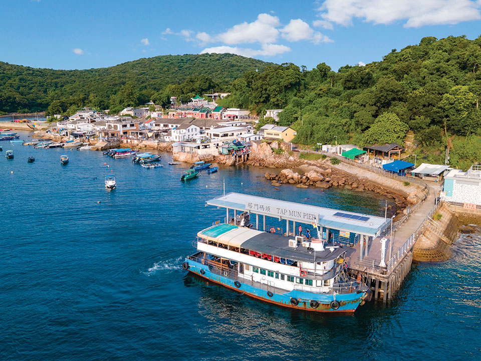
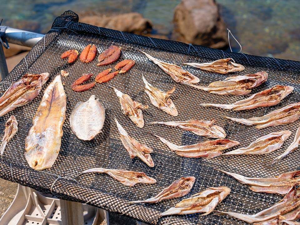
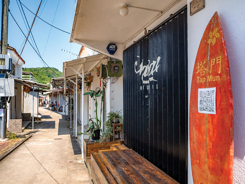


A circular kaito ferry service links Lai Chi Chong with several villages around Tolo Channel. If you are up for a scenic hike and some fresh seafood, catch the ferry to Tap Mun. If you come here on a weekday, you may find it hard to believe that this tranquil island was once home to a thriving community of 5,000 fisherfolk. After disembarking at the pier, you will reach Hoi Pong Street (meaning ‘seaside street’), the island’s ‘commercial centre’, if you could call it that. The first sight that greets you is the assorted seafood hung by the waterfront to sun dry, which is then sold at shops and stalls. The villagers will happily tell you recipes for preparing sun-dried seafood, but you can also enjoy fresh seafood dishes at the restaurants here — fried rice with sea urchin is a must!
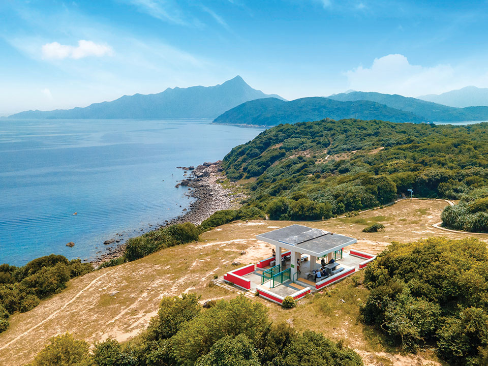
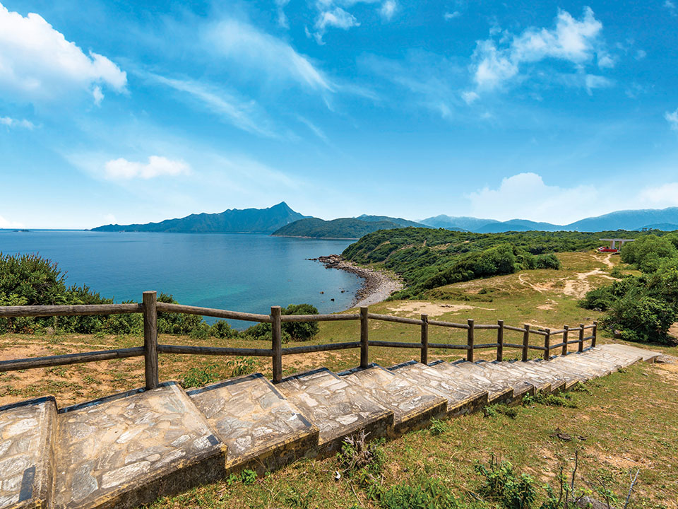
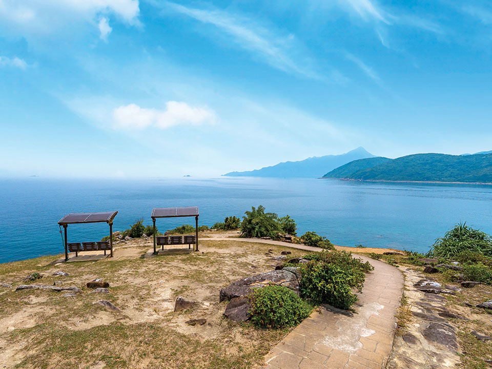
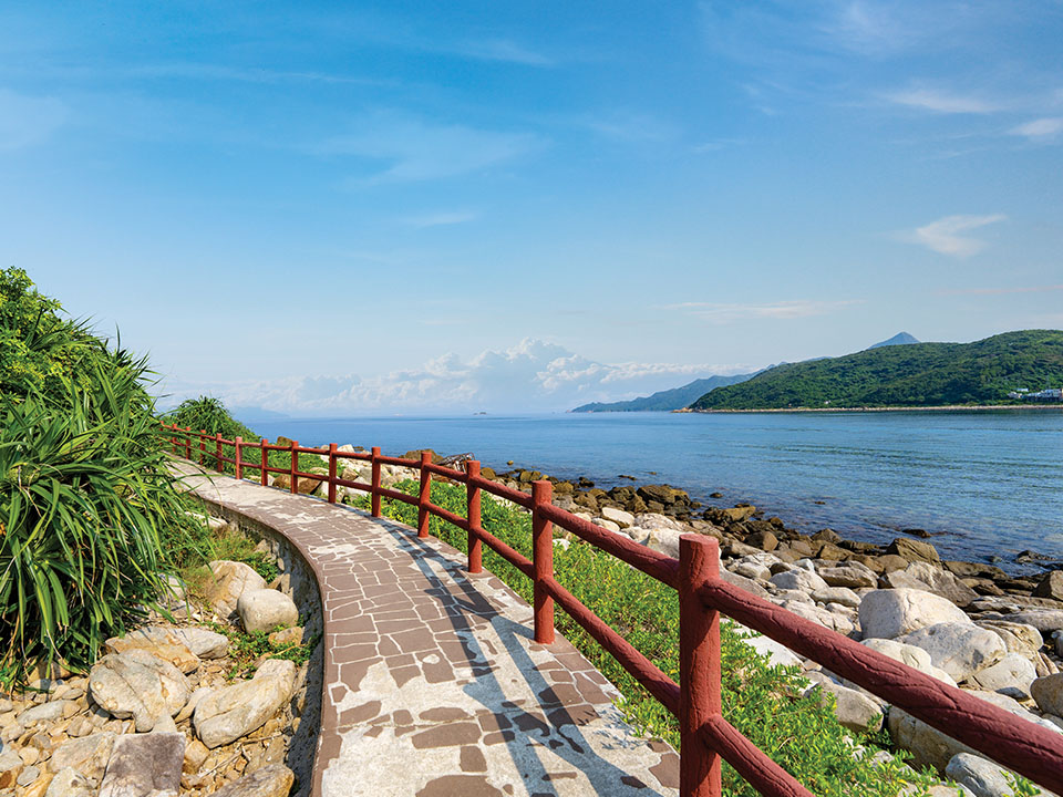
Head up the steps beside the 400-year-old Tin Hau Temple and continue on the trail for about 200 metres to reach the best vantage point on the island — Tap Mun Sitting-out Area, which comprises the Hilltop Pavilion and an expansive meadow. Here, you can enjoy an unobstructed view of Mirs Bay and, on a clear day, as far as Dapeng Peninsula in Chinese Mainland. Take your time to rest your feet; it’s relaxing to enjoy the cool sea breeze while watching boats sail by. When you’re ready, slowly make your way down to Pebble Beach, or head uphill to take the 200-step challenge up to Lung King (‘dragon view’) Pavilion.
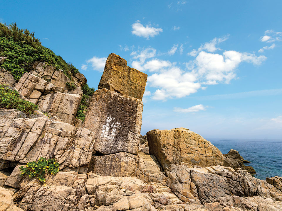
Follow the trail south for about 500 metres and you will see the Balanced Rock — two stacked rectangular rocks of about six metres in height, which form a slightly tilted tower beside the rugged coastline, surrounded by smaller stacked formations and rocks. Take a break on the well-maintained sheltered benches up the hill, as you muse over this special place while listening to the sea waves crashing on the shore.
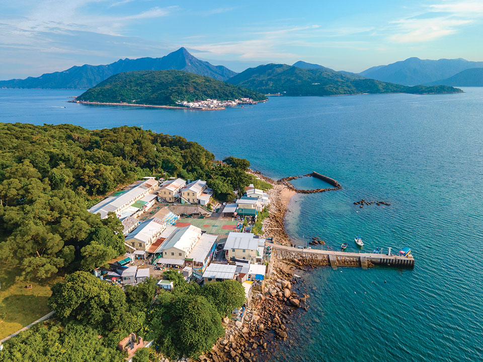
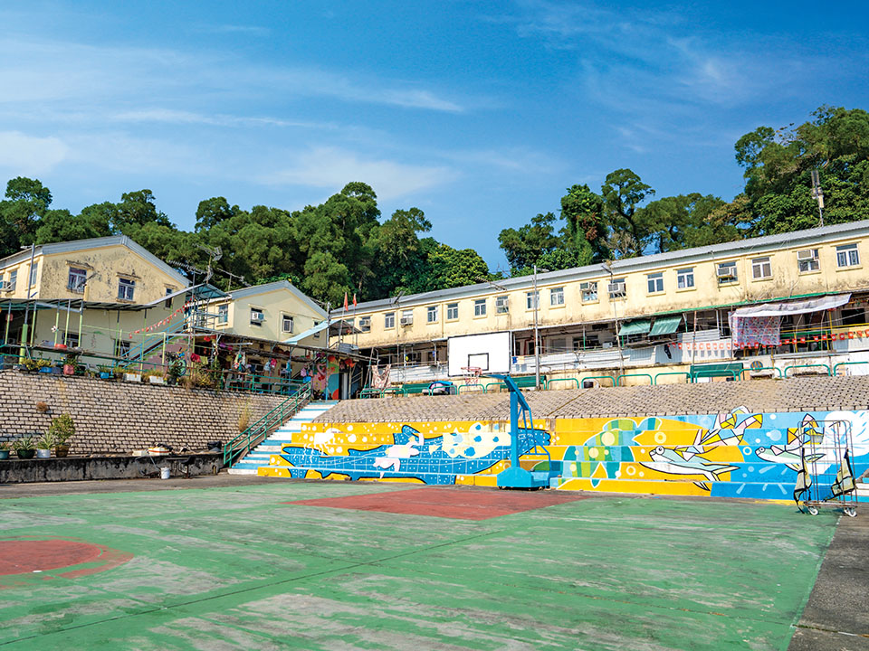
The trail will soon lead you to the southern end of the island, where the route makes a U-turn towards the east. This is a very scenic walk as a good part of it curves right along the waterfront. In about 30 minutes, you will reach New Fishermen’s Village, where a little pier stretches out into the sea, right beside a colourful public playground. It’s a good spot for sweeping vistas across the water of the Wan Tsai peninsula to the north of Sai Kung West Country Park.
Further along you will reach Yung Shue Village, where some villagers sell soft drinks and snacks outside their homes. There are also tables and chairs set up with lovely sea views so you can take a rest if you need. From here, it’s only about a 15-minute walk back to the main pier.
Situated in a densely wooded valley, Pak Sha O is a popular starting point for exploring the Sai Kung West Country Park on foot. It’s home to one of Hong Kong’s best-preserved 19th-century Hakka villages, where some of the houses, such as the former Ho Residence and Ho Ancestral Hall, are listed as Grade 1 historic buildings. While much of the village may seem uninhabited, a few houses along the trail to Lai Chi Chong are still in use, so be mindful not to make too much noise or cause disturbances. Walking around the tranquil area can be a relaxing experience: immerse yourself in the lush greenery and listen to the soothing music of nature — think birdsong and the calming sounds of water from a nearby stream. You may even see herds of cows chilling out by the trail.
In just over an hour, you’ll arrive at one of the city’s most significant geosites, Lai Chi Chong. Here, you’ll find various rock types, including the rare volcaniclastic sedimentary rock, formed around 146 million years ago from falling volcanic ash that was mixed with silt and other organic deposits in a lake. Starting from the ‘Hong Kong UNESCO Global Geopark’ sign, the one-kilometre circular walk along the coast feels like a visit to a ‘geological cake shop’. There are marble cake-like tuffites, mini-faults (horizontally rolled-up layers of rock) that resemble mille-feuilles, and at the midpoint, a boulder field that looks like a platter of dark chocolate truffles. The walk also features rocks patterned with quartz veins, folded siltstone sedimentary rocks and, at the end, a pebble beach. When you walk near the water’s edge, you may even spot cute little crabs scurrying around between the rocks.
A circular kaito ferry service links Lai Chi Chong with several villages around Tolo Channel. If you are up for a scenic hike and some fresh seafood, catch the ferry to Tap Mun. If you come here on a weekday, you may find it hard to believe that this tranquil island was once home to a thriving community of 5,000 fisherfolk. After disembarking at the pier, you will reach Hoi Pong Street (meaning ‘seaside street’), the island’s ‘commercial centre’, if you could call it that. The first sight that greets you is the assorted seafood hung by the waterfront to sun dry, which is then sold at shops and stalls. The villagers will happily tell you recipes for preparing sun-dried seafood, but you can also enjoy fresh seafood dishes at the restaurants here — fried rice with sea urchin is a must!
Head up the steps beside the 400-year-old Tin Hau Temple and continue on the trail for about 200 metres to reach the best vantage point on the island — Tap Mun Sitting-out Area, which comprises the Hilltop Pavilion and an expansive meadow. Here, you can enjoy an unobstructed view of Mirs Bay and, on a clear day, as far as Dapeng Peninsula in Chinese Mainland. Take your time to rest your feet; it’s relaxing to enjoy the cool sea breeze while watching boats sail by. When you’re ready, slowly make your way down to Pebble Beach, or head uphill to take the 200-step challenge up to Lung King (‘dragon view’) Pavilion.
Follow the trail south for about 500 metres and you will see the Balanced Rock — two stacked rectangular rocks of about six metres in height, which form a slightly tilted tower beside the rugged coastline, surrounded by smaller stacked formations and rocks. Take a break on the well-maintained sheltered benches up the hill, as you muse over this special place while listening to the sea waves crashing on the shore.
The trail will soon lead you to the southern end of the island, where the route makes a U-turn towards the east. This is a very scenic walk as a good part of it curves right along the waterfront. In about 30 minutes, you will reach New Fishermen’s Village, where a little pier stretches out into the sea, right beside a colourful public playground. It’s a good spot for sweeping vistas across the water of the Wan Tsai peninsula to the north of Sai Kung West Country Park.
Further along you will reach Yung Shue Village, where some villagers sell soft drinks and snacks outside their homes. There are also tables and chairs set up with lovely sea views so you can take a rest if you need. From here, it’s only about a 15-minute walk back to the main pier.
Transport
Getting to Pak Sha O
Leaving from Tap Mun
Alternatively, you can catch the kaito ferry to Ma Liu Shui Public Pier, and walk for about 15 minutes to MTR University Station. This service runs twice — morning and afternoon — on weekdays, and three times on Saturdays, Sundays and public holidays. Check the Transport Department schedule for details.